Download
1 / 29
290 likes | 296 Vues
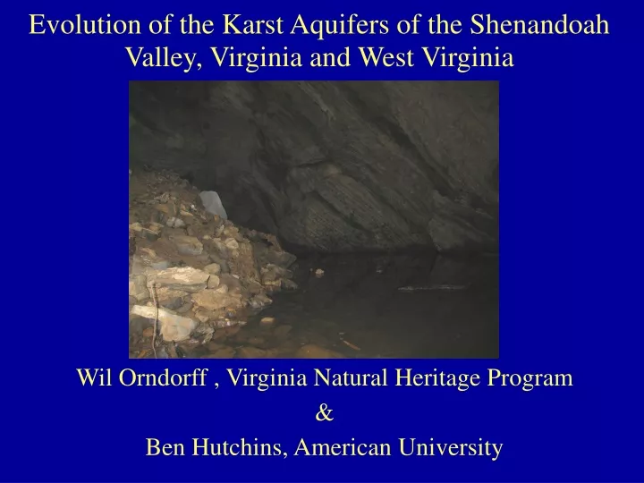
Wil Orndorff , Virginia Natural Heritage Program & Ben Hutchins, American University. Evolution of the Karst Aquifers of the Shenandoah Valley, Virginia and West Virginia. Shenandoah Valley Geomorphology. Shenandoah Valley Carbonates (Virginia).

E N D
Wil Orndorff , Virginia Natural Heritage Program & Ben Hutchins, American University Evolution of the Karst Aquifers of the Shenandoah Valley, Virginia and West Virginia
Shenandoah Valley Geomorphology Shenandoah Valley Carbonates (Virginia) • A broad valley underlain by Cambro-ordovician carbonates and some shale • Numerous small, well-decorated caves • Caves most common near incised, base level streams • Large springs at a variety of elevations • Surface streams are dominantly “spring runs”
Dye tracing patterns • Traces near base level streams • Low dilution • Convergent flow • Short travel times • Most traces “inland” of large springs* • High dilution • Divergent flow • Long travel times * - immediately inboard of and adjacent to large springs, flows are frequently convergent, with little dilution and short travel times.
Conceptual Structure Large spring Block Interior (remnant phreatic aquifers) Block Interior Transition zone with caves Incised Base level stream cave stream Small springs Block Interior
Madison Cave Isopod (Antrolana lira) • Centimeter long, free-swimming stygobitic crustacean • Endemic to Phreatic waters in the carbonate aquifer of the Great Valley (Shenandoah Valley and extended) • Monotypic genus (only freshwater, North American Cirolanid isopod known from north of Texas) • Most closely related to marine isopods
Discovered in a deep lake in a cave near Grottoes, VA in1958
Known distribution of Antrolana lira as of July, 2007 • Important New Sites • Lexington, VA –1999. 1st site outside Potomac watershed • Charles Town, WV – 2000. 1st in WV. • Leetown, WV – 2005. 1st in Opequon watershed. • Changes in recovery plan and/or legal status could result from this new data. Leetown(3)
Locations sampled for Antrolana lira in Virginia.
The high tech stuff… • Recovery plan called for genetic analysis to determine number of genetically unique populations • Research started in 2005 by Ben Hutchins at American University (incl. Dan Fong)
Visual Diagram of Continuous Versus Fragmented Habitat. A: Sampling locations provide access to continuous subterranean habitat. B: The same locations provide access to fragmented habitat.
Estimate Phylogeny of Antrolana lira unique haplotypes Method 1: Maximum Parsimony and Neighbor-Joining Method 2: Maximum Likelihood. GTR + G + I model of nucleotide substitution
Results consistent with conceptual model of dissected aquifer • Geographically largest northern clade corresponds to a large remnant “block”, bounded by the insoluble Martinsburg Formation to the West, the Shenandoah River to the East and South, and the Potomac River to the North. • Animals within this block are not significantly different genetically
Important Questions • When did incision occur? • Pre-pleistocene based on • Paleontology (presence of Pleistocene fossils in airfilled caves in the Shenandoah Valley) • Infill of incised valleys by braided stream deposits (Pleistocene? Peri-glacial?) • Time estimates from genetics based on mutation rate assumptions suggest millions of years • Why are rivers barriers? • Is base level below the bottom of most conduits? Probably not. • Has sedimentation plugged most conduit near and beneath base level streams on carbonate?
Time of last gene flow within groups Mutation rates (Hutchins, 2007) - 0.55%/my, Lefebure et al. (2006b), isopod Stenasellus - 1.25%/my Ketmaier ,et al. (2003),stygobitic isopod genus Stenasellus. - 2%/my Knowlton et al.(1993), snapping shrimp
Consider the Yucatan Perhaps the Shenandoah Valley was at a much lower elevation during the early Cenozoic, in contact with marine water and colonized by marine invertebrates. Late Miocene uplift fragmented and destroyed habitat. A. Lira is the “living fossil” of those times.
Science Question 1 - What is the inter-relationship of flow between groundwater and stream flow in the Shenandoah Valley? (groundwater flows into streams and streams flow back to the groundwater) • Generally, spring discharge supports base flow of perennial valley floor streams. • Spring runs may travel a short distance underground between springs and base level creeks and rivers. • Locally, some major allogenic streams (from off of the karst) discharge to the aquifer. A good example are the headwaters of the North River. • Allogenic recharge from the western slopes of the Blue Ridge in Warren, Page, Rockingham and Augusta counties is a major contributor to base flow of South Fork Shenandoah • Rates and directions of flow between surface and groundwater vary with • Hydrography of a specific recharge event • “Water levels” immediately preceding a rainfall event
Allogenic recharge from the mountains increases both the area draining to karst and, in some cases, the precipitation per area.
SQ 2 - What are the current levels of groundwater pollution in the Valley? (How much of the problem is caused by natural causes, septic failures, farming, urban runoff, etc. and how can these be remediated and prevented?) • Low levels of herbicides and pesticides are present. • Nitrate values are locally very high, and generally significant. • Estrogens introduced via poultry and livestock litter. • Bacteria are commonly present. • Sedimentation is observed in some wells and springs. • Sources for herbicides and pesticides, nitrates, and bacteria are probably dominantly agricultural. • Sedimentation can result from poor agricultural methods or from poor stormwater management. • Remediation and prevention require education of the public, regulation, and enforcement.
SQ 3 - Can groundwater budgets be defined by local area? SQ 4 - If #3 is not possible, can underground “watersheds” be defined for karst areas? (e.g. as in Kentucky) • Two questions are interconnected. • Local areas have to be defined by bedrock geology and fluvial geomorphology, not by political boundaries. • Kentucky is a bad analog. • Karst systems there are dominantly vadose, convergent collection networks; not in close contact with phreatic aquifer • Kentucky karst occurs in essentially flat lying limestone beds with very few faults; Shenandoah Valley is folded strata with numerous faults • Shenandoah Valley has a relatively shallow karst water table and very few cave streams. • Dye trace studies in Shenandoah basin have shown gw basin boundaries to be dynamic and vary with aquifer water levels; most movement is phreatic (beneath water table)
SQ7 - What is the interrelationship between soil quality and water retention and water quality? • This effects both quality and quantity, and can be a double edged sword. High soil moisture retention capacity, while reducing runoff, can also reduce recharge by holding the water in the soil and increasing the amount lost to evapotranspiration. • Better questions are: • What are the aquifer recharge mechanisms? • What is there geographic distribution pattern? • How can we maximize recharge and mimimize contamination?
DCR Natural Heritage Karst Research/Policy Recommendations • Characterize surface and groundwater subsystems of entire Shenandoah basin* • Develop a comprehensive database of significant perennial springs and acquire baseline data. • Establish watershed wide monitoring network for “index” springs and wells. • Pursue regulation of groundwater withdrawals, perhaps via designation of a Groundwater Management Area under the VA GW Protection Act. * - Policy makers in Northern Shenandoah Valley must acknowledge that they depend on the entire watershed for their water supplies.