Geometric Modeling and Computer Graphics GROUP
200 likes | 352 Vues
Geometric Modeling and Computer Graphics GROUP. DISI Department of Computer and Information Science University of Genova http://www.disi.unige.it/research/Geometric_modeling/. People. Faculties: Leila De Floriani Paola Magillo Enrico Puppo PhD students: Emanuele Danovaro

Geometric Modeling and Computer Graphics GROUP
E N D
Presentation Transcript
Geometric Modeling and Computer Graphics GROUP DISI Department of Computer and Information Science University of Genova http://www.disi.unige.it/research/Geometric_modeling/
People • Faculties: • Leila De Floriani • Paola Magillo • Enrico Puppo • PhD students: • Emanuele Danovaro • Franco Morando • Laura Papaleo • Post-doc • Mesmoudi Mohammed Mostefa (MINGLE training network)
Research Activity • Fields of activity • Geometric and solid modeling • Computational geometry • Reference applications • visualization • geographic data processing • computer aided design • computer vision • virtual reality
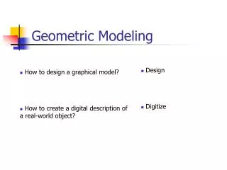
Current Research Modeling and computational issues concerning representation and manipulation of spatial objects • Multi-resolution Geometric Modeling • For surfaces, two- and three-dimensional scalar fields • For applications in Geographic Information Systems, virtual reality, volume data visualization • Emphasis: geometric algorithms and data structures • Shape Reconstruction • Non-manifold Geometric Modeling
Current Projects Projects funded by the European Community • MINGLE: Multiresolution in Geometric Modeling (2000-2003) • ARROV: Augmented Reality for Remotely Operated Vehicles (2001-2003) Projects funded by MIUR: • SPA.DA.: Representation and Processing of Spatial Data in Geographic Information Systems (2001-2002) • Cultural Heritage: Advanced methods for acquisition and rendering (1999-2002)
MINGLE(Multi-resolution in Geometric Modeling) • European training network for young researchers • Parners • SINTEF Applied Mathematics, Norway (coordinator) • Tel Aviv University (TAU), Israel • Munich University of Technology (TUM), Germany • Israel Institute of Technology (TECHNION), Israel • Max Planck Institute (MPII), Germany • Laboratoire de Modelisation et Calcul (UJF), France • University of Cambridge Computer Laboratory (UCAM-CLAB), UK • Department of Computer Science, University of Genova (DISI), Italy
ARROV Augmented Reality for Remotely Operated Vehicles based on 3D acoustical and optical sensors for underwater inspection and survey Goal:developing a novel integrated sensorial system, based on both optical and acoustical data to provide the ROV pilot with an augmented representation of the scene: • 3D reconstruction from range data • Texture from optical data • Synthetic primitives from image processing Target: ROVs operating in underwater environments and man-made installations
SPA.DA. Representation and Processing of Spatial Data in Geographic Information Systems Aim of the Project • Efficient and intelligent access and manipulation of spatial data in a GIS characterized by • use of multi-resolution in data manipulation • different levels of abstraction in spatial reasoning Partners DISI, University of Genova Dept. of Computer Science, Univ. of Milano Dept. of Electric Engineering, Univ. of L'Aquila Dept. of Science and Technology, Univ. of Verona Dept. of Systems and Information, Univ. of Firenze
Cultural Heritage: Advanced methods for acquisition and rendering • Aim: develop a system for the interactive navigation and exploration of an archeological site • multimedial data bases • advanced methods for acquisition and rendering • interface for the tourist and for the expert • case study: the Roman Theatre of Aosta • Partners: • Universities: Bologna, Genova • CNR Institutes: Roma, Torino • Industries: CM-Sistemi (Roma), EIDOCOM (Milano)
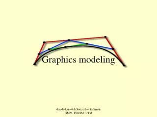
Multi-resolution Geometric Models • Modeling spatial objects through simplicial meshes • Objective: • Dealing with models of reduced size whose accuracy satisfies some user-specified requirements • Examples: • Transmission of a geometric model: send a coarse representation first, then add details when needed: progressive mesh transmission • Real-time rendering: on-line retrieval of a model whose size and accuracy best fit application requirements: selective refinement
Progressive Transmission 1740 triangles 100% error 2156 triangles 25% error 5459 triangles 6% error 69451 triangles 0% error
Application in Free-Form Surface Rendering 1.6% error 21663 triangles 6% error 5459 triangles 1.6% error inside box 5101 triangles (2741 in box)
Application in Terrain Rendering Error=2.45% 1999 triangles Error=0.05% inside box 2001 triangles (1179 in box) Error=0.05% 28995 triangles
Application in Volume Data Visualization Error=0 in box 35,605 tetrahedra 9,404 iso. faces Error=0.0 163,831 tetrahedra 16,272 iso. faces Error=0.0 on isosurface 80,493 tetrahedra 16,272 iso. faces
The Multi-Tessellation (MT) • A unified framework for multi-resolution geometric modeling based on simplicial meshes • Efficient data structures and algorithms for representing and accessing MTs • general-purpose data structures • compact data structures • algorithms for selective refinement • Applications • terrain modeling • free-form surfaces and solids • volume data modeling and visualization
A software library based on the MT • Supports the design of applications exploiting multi-resolution on geometric objects • Fully parametric on: • the dimensions of the mesh and of the embedding space • attributes associated with mesh vertices and cells • criteria to extract meshes at variable resolution • Any simplification code can be plugged-in. • Ready-to-use MT constructors: • for terrains from either scattered points, DEM grids, or TINs • for free-form surfaces from generic triangle meshes
Multi-resolution Geometric Modeling • Training Activity in MINGLE • Terrain modeling (SPA.DA.) • Surface modeling for virtual reality applications (Cultural Heritage Project) • Modeling of volume data for visualization • cooperation with Visual Computing Group, National Research Council, Pisa • cooperation with Department of Computer Science, University of Maryland, USA
Shape Reconstruction Methods for building a 3D mesh from sample points: • Method based on -sculpturing for 3D point clouds • New method based on fuzzy geometry for controlling data uncertainty • Mosaicing from multiple views (cooperation with University of Verona) • Reconstruction from acoustic images (ARROV)
Non-Manifold Geometric Modeling • A mathematical framework for describing non-manifold meshes in three and higher dimensions as assembly of simpler quasi-manifold components • Topological data structures for non-manifold meshes in three (and higher) dimensions • Objective: multi-resolution models for meshes with a non-manifold domain for CAD applications