Download
1 / 33
330 likes | 347 Vues
Explore the fascinating landforms of desert environments, where running water and wind are the primary agents of geomorphological change. Learn about the characteristic desert surfaces, the significance of running water, fluvial erosion and deposition, aeolian erosion and transportation, and the formation of desert sand dunes.

E N D
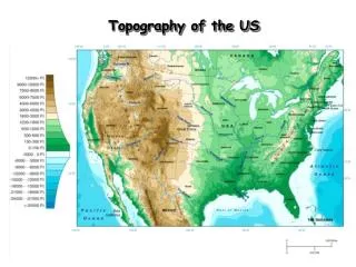
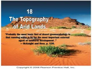
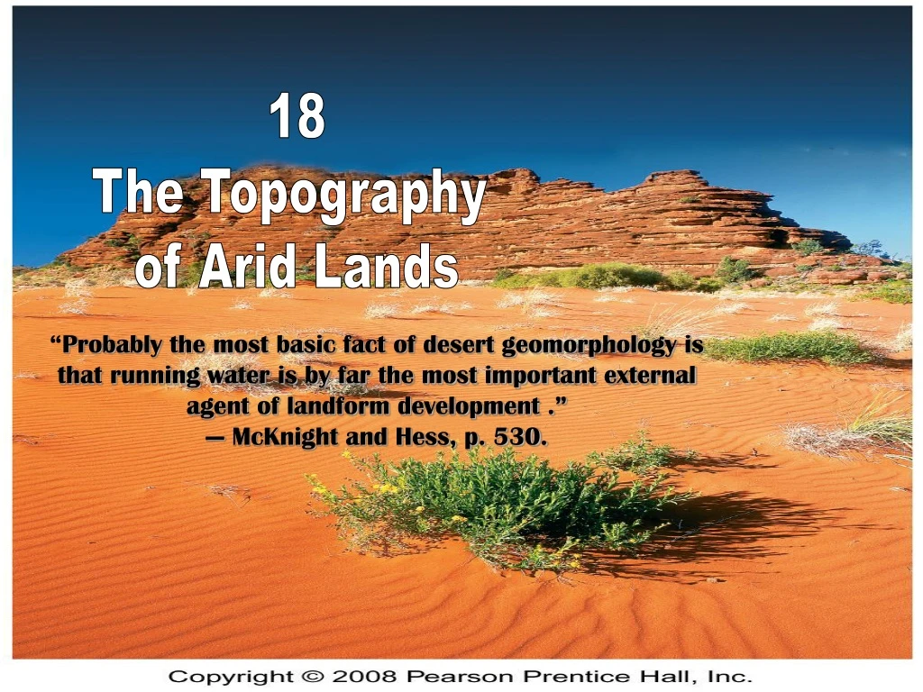
18 The Topography of Arid Lands “Probably the most basic fact of desert geomorphology is that running water is by far the most important external agent of landform development .” — McKnight and Hess, p. 530.
A Specialized Environment Running Water in Waterless Regions Characteristic Desert Surfaces—Ergs, Regs, and Hamadas The Work of the Wind Two Characteristic Desert Landform Assemblages in U.S. Deserts The Topography of Arid Lands
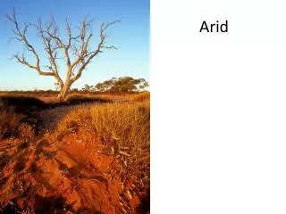
Special Conditions in Deserts Mechanical weathering dominates, e.g. salt wedging Soil and regolith are thin, leading to rocky terrain (below) -Fig. 18-1 A Specialized Environment
Special Conditions in Deserts (continued) Impermeable surfaces predominate e.g. caprocks (bedrock) and hardpans (hardened soil). So the little rain that falls, ends up as run-off. Never gets into groundwater, were plants can draw it up later. Sand & Wind – but not all deserts have sand or have landforms shaped mainly by wind. See pg 529-530. Rainfall – occurs as intense convective thunderstorms which leads to brief flooding, and fluvial deposition. Interior drainage that does not lead to the sea, Fig. 18-3. Also, see pg 530, #9. Lack of continuous vegetation cover, Fig 18-4, pg 531. - Fig. 18-2
Significance of Running Water Aeolian (wind) processes is less significant Sparse vegetation leads to overland flow erosion, and hence large volumes of sediment moved within a short time. Surface Water in Deserts Exotic Streams: fed by sources outside the desert. E.g. the Nile travels 2,000 miles thru the Sahara, without additional tributaries! Pg 531-532. (But its entire length with tributaries, is actually 4,000!). Fig. 18-5 Running Water in Waterless Regions
Ephemeral Streams Desert Lakes Playas (dry lake beds – see next slide), or Salinas, pg 546-548 Playa lakes tend to be temporary. Permanent playa lakes are mostly salty e.g. Great Salt Lake, UT. Fig. 18-6 and 18-7
Fluvial Erosion in Arid Lands Differential Erosion (common in sedimentary layers) Differential hardness of rock layers (see next slide) Fig. 18-1 Hard rock Soft rock
Fig. 18-9. The effects of differential erosion on the Red Cliffs near Gateway in Western Colorado.
Residual Erosional Surfaces They form Inselbergs (“island mountains”) Particularly a type called Bornhardts (resistant rocks that are round). This is how Uluru (Ayers Rock), in Australia was formed.
Fig. 18-11. The development of a bornhardt. • Fig. 18-10. Kata Tjuta (the Oglas) in the desert of central Australia.
Desert Stream Channels or Wadi They’re called “Wadi” in Arabic. E.g. the Wadi of Egypt. Fig. 18-13. Mojave Desert, near Baker, CA.
Fluvial Deposition in Arid Lands These depositional features are more obvious than erosional features, and they occur in ephemeral stream channels Piedmont zone. This is any zone at the foot of a mountain range where you find: Talus accumulations and alluvial fans Fig. 18-14. Idealized cross section of a desert piedmont zone.
Erg—A Sea of Sand ‘Erg’ – Arabic for sand Found in the deserts of Arabia, the Sahara and Namibia. The Arabian desert is the sandiest of all deserts; and even then, only a third of it is covered in sand. Moreover, most of that sand is not ‘true erg’. “Relict ergs” (covered with vegetation) are found in Western Nebraska. The “Sand Hills” on Hwy 2. Fig. 18-15 Characteristic Desert Surfaces—Ergs, Regs, and Hamadas
Reg—Stony Desert ‘Reg’ – Arabic for “stone” Desert pavement Called ‘gibber plains’ in Australia Hamada—Barren Bedrock ‘Hamada’ – Arabic for “rock” Comprises of exposed bedrock or cemented sedimentary material (these are large expanses of bedrock, as opposed to stones scattered all over in a “Reg”). Is the picture a Reg or a Hamada? Fig. 18-16
Aeolian Erosion Abrasion – wearing away of rock by airborne sand and dust particles Deflation – shifting of loose particles Fig. 18-17 and 18-18 The Work of Wind Sand-blasted rock, or ventifact Wind deflation
Aeolian Transportation Animation (Wind Transportation of Sediment) Suspension, saltation, traction and Creep (just like water movement). Fig. 18-19
Aeolian Deposition Animation (Desert Sand Dunes) Desert Sand Dunes Vegetation and Dune Stabilization Dune migration Fig. 18-20
Types of Sand Dunes (see next slides) Barchan Transverse Seif Fig. 18-21
Barchan in Namibia (also found in the Desert Dome of the Henry Doorly Zoo) - Fig. 18-22
Seif dunes in Simpson Desert of central Australia - Fig. 18-23
Loess Another aeolian feature that can be outside of deserts It is wind-blown silt; fine texture, no horizontal layering Fig. 18-25
Major loess deposits of the world. Fig. 18-26
Fig. 18-27 Two Characteristic Desert Landform Assemblages in U.S. Deserts • Basin-and-Range Terrain • Mesa-and-Scarp Terrain
Basin-and-Range Terrain Ranges Fig. 18-28
Piedmont Zone Alluvial fan Fig. 18-29
Basin Playa (dry lake bed) Fig. 18-30
Basin Salt pan Fig. 18-33. Death Valley, CA
Mesa-and-Scarp Terrain Horizontal layers of differential rock ‘Mesa’ is Spanish for ‘table’ Slopes have multiple scarps. ‘Scarp’ is short for ‘escarpment’ Due to differential weathering: the resistant rocks become ‘scarps’ and softer rock become gentler inclined slopes. Fig. 18-35
Residual landforms Flat-topped summits in horizontal sedimentary strata Hard cap rock; if they are bounded on one or more sides by a prominent escarpment, they’re called plateaus. Plateaus are “tablelands” (bigger than Mesas) Buttes are just eroded remnants of mesas Pinnacles are the smallest remnants Fig. 18-36
Badlands Innumerable ravines and gullies (see photos). Steep slopes. Fig. 18-38.
Arches and Natural Bridges Combination of weathering and fluvial erosion. See video link, below Arches,Figure 18-39 http://www.nps.gov/arch/photosmultimedia/index.htm