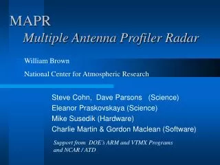
MAPR Multiple Antenna Profiler Radar
MAPR Multiple Antenna Profiler Radar. William Brown National Center for Atmospheric Research. Steve Cohn, Dave Parsons (Science) Eleanor Praskovskaya (Science) Mike Susedik (Hardware) Charlie Martin & Gordon Maclean (Software). Support from DOE’s ARM and VTMX Programs and NCAR / ATD.

MAPR Multiple Antenna Profiler Radar
E N D
Presentation Transcript
MAPRMultiple Antenna Profiler Radar William Brown National Center for Atmospheric Research Steve Cohn, Dave Parsons (Science) Eleanor Praskovskaya (Science) Mike Susedik (Hardware) Charlie Martin & Gordon Maclean (Software) Support from DOE’s ARM and VTMX Programs and NCAR / ATD
MAPR compared with conventional DBS profilers • Advantages • MAPR can make a much faster wind measurement • MAPR provides continuous measurements • MAPR does not need mechanical phase switches • Disadvantages • MAPR requires 4 antennas and receivers • Data analysis more sophisticated • Less sensitivity so more powerful transmitter required
MAPR - Specs • Transmitter Peak Power: 500W (soon to be upgraded to 4kW) • Duty Cycle: 10 - 15% • Receivers: 4 x Radian (soon to be replaced by PIRAQ) • Antenna: standard Radian 4 panel, 64 element array (split in 4 for receiving) • Beam Width: 8 deg (HWHM) • Resolution: 60, 105, 210 m (depending on SNR) • Typical range: 2 - 5 km (clear-air) • Typical time resolution: 1 minute (15 sec in high SNR, 10 minutes in low SNR) • Data: netCDF (raw & spectra) or consensus wind files • Real-time wind analysis produces plots on the Web
MAPR MAPR with clutter screen NOAA BAO 300m tower
MAPR wind measurements () Anemometer measurements (line) BAO tower (300m) Clear-air echoes Good agreement between MAPR and Anemometer wind measurements About 80% of measure-ments agree to 2m/s
Cold Front • MAPR and tower observations • Note the brief updraft (red) in clear-air ahead of the front • MAPR can make continuous and rapid 3D wind measurements
Cold Front • Note the strong downdraft, followed by a strong updraft at the leading edge of the front. • The frontal passage at the surface was weak. • The periodic up and down motions, which follow, suggests gravity waves.
Nauru99 MAPR operated for 1 month at sea for DOE/ARM’s Tropical Western Pacific campaign, Nauru99
Nauru99 MAPR Observations of squalls (rain & clear-air) Note the wind gusts (orange/red wind barbs) and updrafts (yellow/red) in clear-air around squalls
Turbulence Measurement MAPR can estimate turbulent intensity Doppler spectral width is related to velocity variance measured by a sonic anemometer
Overall goals for MAPR • Rapid measurement of the 3-D wind • Estimates of turbulent intensity • Rapid Deployment • Detection of three-dimensional winds and heat flux from applying spaced antenna techniques to radio acoustic sounding system (RASS) • Incorporation of multiple wavelengths and FDI processing to detect and monitor the evolution of fine-scale refractivity layers