Download
1 / 5
50 likes | 70 Vues
Learn how the Egyptian Meteorological Authority ensures high quality data from their upper air stations, utilizing GPS sounding systems and wind finding technology. Discover the challenges faced and the improvements made in reporting procedures.

E N D
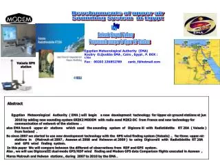
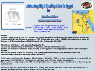
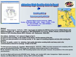
obtaning High Quality data in Egypt by Zeinab Sayed Fahmy Programming manger in Upper Air Stations Egyptian Meteorological Authority (EMA) Koubry ELQuobba EMA , Cairo , Egypt , P. BOX : 11784 Tel: +201119776589 , Fax :+202 26849857 , zanb_f@hotmail.com fig(1) Abstract Egyptian Meteorological Authority ( EMA ) has 6 upper air stations for GPS Sounding System SR2K2 Modemwith Radiosonde M2K2_DC , 6 Upper Air stations of RDF Radiotidolite wind finding RT20A ( Vaisala ) and three Upper Air Stations of GPS Sounding System MW31 (Vaisala) with Radiosonde RS92-SGP . this stations distributed for 6 places in Egypt as fig (1) . we used it in last according to the weather of the places and the seasons of the year . So there are many procedure to do during running of the upper air sounding programs and also after running the program . We must do quality control for obtaining high quality data before sending buffer and temp code to the communications network for exchange of data on the GTS . The Managements System Of Egyptian Meteorological Authority ( EMA ) has been assessed and complying with Iso goal for the following activities ( Exchange and distribute meteorological data for observations) . So we decided to stop using of the RDF Sounding System since two years because the problems of the wind speeds and directions . we will use DigicoraIII dual-mode GPS/RDF wind finding and modem GPS data Comparison flights executed in Asswan, and Marsa Matrouh stations during 2007 to 2012 by the EMA .
Upper Air Stations In Marsa Matroh with RDF Wind Finding Radiotheodolite Sounding System :- In Egypt their are two kinds of Jet Stream Polar and Subtropical Jet Stream passes in winter and autumn this effects to upper winds are very strong which leads to the balloon elevations at about 12 km altitude remains below 20 degree and some time the radius of balloon trajectory is about 130 km far from ground station at 16 km altitude So Radiotheodolite wind finding is not suited for Egypt situations where the balloon elevations. remain about 20°, At low balloon elevations, the measurement errors with Radiotheodolites increase rapidly with decreasing elevation even with larger tracking aerials It is extremely difficult to satisfy the accuracy requirements in this Part with a Radiotheodolite if upper winds are consistently very strong, Radiotheodolite wind observations are smoothed over thicker layers than indicated in these calculations at all heights apart from 5 km.
Comarison between RDF/GPS wind finding • By comparison of wind observations between the two systems RDF and GPS at ( Dec to feb 2008 ) GPS and ( Feb to Abr 2007 ) RDF by using dual-mode GPS/RDF Vaisalasystemin the Matoh upper air station (62306) with software digcora III and 500 g meteorological balloon we found that :- • Higher level of PTU measurement performance for both GPS and RDF systems . • Excellent upper-air wind data availability with code correlating GPS technology • Reliable narrowband digital transmission for GPS versions . • Continuously available, highly accurate wind data with code correlating GPS than RDF systems . • upper wind observations of GPS system is giving accurate informations at higher altitude than RDF system .
Quality of Temp message and Climat Application To IMPROVEMENTS IN REPORTING PROCEDURES When we used RDF sounding system the upper winds are reported using the TEMP code and buffer code The TEMP AND CLIMATE report should be checked against the detailed upper-wind measurement and the reported messages should be edited to eliminate unacceptable fitting errors before issue if we used old version of digicoraiii But with new version of digicora iii it was eliminates unacceptable fitting errors then we loose many information's of wind data at high altitude which it is important for numerical weather forecasts . So Upper winds data are normally input into numerical weather forecasts as layer averages, the thickness of the layers depending on the scales of atmospheric motion relevant to the forecast. Thus, it is important that the variation in winds between standard levels is accurately represented in upper-wind reports , in addition to ensuring that accurate winds are reported at the standard levels. The upper-wind reports should contain enough information's to define the vertical wind shear across the boundaries between the various layers in the mass fields. For this reason we decided to stop using of the RDF sounding system because the problems of the wind speeds and wind directions which we found .
Upper Air Stations In Asswan with GPS/RDF Wind Finding Asswan station in Egypt it is one of The Upper-air Network (GUAN) which consists of stations selected from the Global Observing System of the World Weather Watch. Criteria for choice of sites included homogeneity, a history of high quality observations . The data collected by the network of GUAN stations are transmitted on the GTS in the form of upper-air reports (TEMP and CLIMAT TEMP). International centers perform quality control on the data, prepare data products for users, and archive it for future users. Data Of GUAN for Asswan Station ( 62414 ) :- Range time WMO STATION OBS LVLS 00Z 12Z AVGPRS >100 >50 >10 TEMPS DPDS WINDS ( upper air station) (8/2007 ) 62414 ASSWAN, EGYPT 30 1780 30 0 52.9 27 27 0 1075 630 1157 ( Air RDF) (8/2008) 62414 ASSWAN, EGYPT 28 2097 28 0 26.2 27 26 0 1129 693 1410 ( vaisala RDF) (11-4/ 2009) 62414 ASSWAN, EGYPT 179 16893 179 0 23.3 171 166 4 8215 5071 11446 ( vaisala RDF&GPS) (1-6/2012) 62414 ASSWAN, EGYPT 177 17862 177 0 36.1 162 145 6 8552 5896 12434 ( modem GPS ) By using different soundingsystems Air RDF ,Vaisala RDF / GPS and Modem GPS from Guan data and all system we used 500 g of Metrological balloon which burst at latitude less than 30 km and fill with Hydrogen gas then We found that:- 1- by using Vaisala RDF sounding system and compare with Air RDF soundingsystem we found that number of significant levels for temperature ,dew point and wind in Air system is less than in Vaisala system . 2- by using Vaisala GPS sounding system and compare with modem GPS sounding systemwe found that the number of significant levels for temperature ,dew point and wind in Vaisala system is less than modem system . So Egypt continue to use modem GPS soundingsystems for 6 stations because easy to use, good quality and low price.