Download
1 / 45
450 likes | 497 Vues
Introduction to the Geology and Geography of Iceland. The Petrology of Iceland. Sig. Steinthorsson 19 Sept. 2007. Main points of the talk. Petrology and tectonic setting Three magma series in Iceland Magma series and tectonic setting Volcanic systems and the plate boundary Silicic rocks

E N D
Introduction to the Geology and Geography of Iceland The Petrology of Iceland Sig. Steinthorsson 19 Sept. 2007
Main points of the talk • Petrology and tectonic setting • Three magma series in Iceland • Magma series and tectonic setting • Volcanic systems and the plate boundary • Silicic rocks • The Palagonite formation • Petrology and isostatic rebound • Alteration
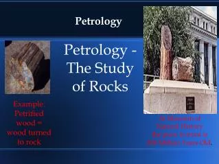
Classification of igneous rocks • Igneous rocks are classified according to chemical composition and rate/pressure of crystallization. Thus basaltic magma can form gabbro, dolerite, basalt or hyaloclastite, and silicic magma can form granite, granophyre, rhyolite or obsidian.
Icelandic petrological specialities • Unusual abundance of silicic rocks for an oceanic environment • Unusually varied range of “volcanic environments” — subaerial dry, subaerial wet, subglacial, submarine • Unusual circumstance of coinciding mantle plume and spreading centre
Global igneous activity • Three main magma series belong each to its own tectonic setting: • Tholeiitic series: Oceanic rift zones • Calc-alkaline series: Subduction zones • Alkalic series: Intraplate volcanism, off-rift islands
Tectonic setting • Iceland’s tectonic setting is rather unique in its both being a hot spot (i.e. “sitting on” a mantle plume) and at a spreading centre (divergent plate boundary)
Crustal formation at five different locations, based on olivine compositions (Sobolev et al. 2007) • Potential temperatures (Tp) and contributions of three mantle components in the melt forming the basaltic crust (green). • Blue: Upwelling peridotite mantle; • Red: recycled oceanic crust (eclogite); • Yellow: reacton zones formig hybrid pyroxenite; • Pink: refractory restite after eclogite melting. • Xpx: amount of pyroxenite-derived melt in the mixture with peridotite-derived melt • Xrc: amount of recycled oceanic crust in the peridotitic mantle.
Messengers from depth • Melt inclusions in crystals can originate as deep down in the Earth’s mantle as 100 km. The groundmass (the magma carrying the crystal) undergoes all sorts of changes en route to the surface, but the melt inclusions may stay intact, thus being tantamount to a 100 km deep drill hole
Evolution of volcanic belts • Due to the westwards drift of the N-Atlantic plate system relative to the mantle plume, the spreading centre has been relocated eastwards a number of times during the last 16 m.yrs. This gives rise to a variety of volcano-tectonic environments.
Volcanic systems • The surface expression of the plate boundary is en-echlon array of fissure swarms at angles with the plate boundary. Volcanic production is greatest at the junction between fissure swarm and the plate boundary beneath. The rift zones are characterized by sub-alkalic rock, the off-rift zones by alkalic rocks.
Relationship of volcanic systems to the underlying plate boundary • Below 3 km depth seismic epicentres define a “mathematical plane” separating the American and Eurasian plates. The surface expression, however, is en echelon swarms of volcanic and tectonic fissures. Volcanic centres develop at the intersection between the two.
Basaltic rocks in Iceland • To distinguish between alkalic and subalkalic rocks.
Distribution of magma types in Iceland’s volcanic zones (Jakobsson 1979).
Hawaii-chain Initiation of volcanism through old crust (Loihi mildly alkalic basalt) Tholeiitic shield building stage Mildly alkalic caldera-filling stage (Haleakala in Maui) Million year period of erosion Highly alkalic post-erosional stage (Diamond Head) Iceland Propagating rift (Vestmannaeyjar) with mildly alkalic magmas Tholeiitic rift zones Three million year period of erosion Mildly alkalic post-erosional stage (Snæfellsnes) Comparation between magmatic evolution of Hawaii and Iceland
Central volcanoes in Iceland (C) • Central volcanoes are characterized by (a) presence of evolved rocks, (b) high-temperature geothermal system, and (c) repeated eruptions from the same vent or vents. Many develop a caldera over a magma chamber which in the rift zones is at about 3 km depth. Evolved magmas form in the roots of central volcanoes.
Variation along the rift zone • The volume of volcanics (A) as well as the composition of the basalt (B) varies along the rift zone. This has been attributed to a bimodal mantle: plume beneath Iceland and “normal oceanic mantle” below the mid-ocean ridges.
Plate boundary in N-Iceland • The Northern Rift Zone is occupied by five volcanic centres, three of which have developed a caldera. The Krafla Fires 1974-84 proved an eye-opener for earth scientists in Iceland
The Askja caldera • Looking north, with table mountain Herdubreid in the backgrouond, the 1875-Askja lake occupies the 10,000 years old Askja caldera
The Krafla fissure swarm • Looking along the Krafla fissure swarm from the North, the caldera itself can be seen in the central ground. Hills sticking up through the lava fields are palagonite.
Volcanic centres in and around Iceland • The map shows volcanic centres, active and extinct, in Iceland and on the adjacent sea floor. Some people argue that the first “continental crust” on Earth came about in processes such as now are operative in forming silicic rocks in Iceland.
Robert Bunsen’s idea • German chemist Robert Bunsen (1851) was first to notice the scarcity of intermediate rocks in Iceland. His idea that two types of magma reside beneath Iceland, basaltic and silicic, has been vindicated in recent years.
Silicic rocks in IcelandA brief history of ideas • Bunsen 1851 — Two primary magmas, basaltic and silicic • Holmes 1918 — A raft of Greenland crust beneath Iceland • Moorbath & Walker 1965 — Sr-isotopes show that basaltic and silicic rocks are consanguinous • Muehlenbachs et al. 1973 — O-isotopes indicate role of hydrated basalt in rhyolite formation • Sigmarsson et al. 1992 — Th-isotopes “prove” formation of Hekla’s dacite by crustal anatexis • Sigmarsson 2006 — Zircons in siliceous rocks in East-Iceland indicate involvement of continental material
Formation of silicic magma by remelting of hydrated basalt • Silicic rocks in the rift zones are restricted to volcanic centers where shallow magma chambers (top at 3 km depth) cause the remelting of the hydrated basalt above to form rhyolitic magma. The picture is based on research at the Krafla center in N-Iceland (Jonasson, 1994).
Grimsvötn, a natural calorimeter • The Grimsvötn caldera beneath the Vatnajökull ice shield is underlain by a magma chamber from which heat is carried upwards by conduction and circulating water to melt the overlying ice. Silicic rocks in Iceland are thought to form by the interaction of such magma chambers with the overlying altered rocks.
Geological map • Three main formations, each with characteristic rocks, are the Tertiary (blue), Pleistocene (greenish & brown), and Holocene (purple). Silicic rocks are yellow.
Fissure eruption • Fissure eruptions are characteristic for Iceland, and in the Tertiary, when the land was relatively flat (not having been eroded by glaciers) voluminous lava flows covered large areas.
Tertiary landscape in NW-Iceland • These Tertiary lava successions are deeply eroded by the Pleistocene glaciers. The flat plateau topping the hills is at about 800-1000 m elevation.
Tertiary basalt succession • In East and West Iceland mapping has revealed that up to 10,000 years separate adjacent lava flows. The red sediments between the flows then represent a geological history amounting to that of the entire Holocene.
Surtsey eruption 1964-67 • The lengthy Surtsey eruption offered scientists an opportunity to carry out many experiments in volcanology and geology. After the eruption, a drill hole down to the sea floor below (at 130 m depth) showed that loose volcanic glass (tuff) is swiftly turned into hard rock (palagonite) by interaction with hot water.
Table mountain Herdubreid • Herdubreid, a table mountain north of Askja, is typical for this type of subglacial volcanoes. At the time of its formation, the surface of the glacier may have been 200-300 m above the top of the mountain.
How table mountains form in subglacial eruptions • Table mountains and other palagonite hills in Iceland are now known to have formed in subaquatic volcanic eruptions. This sequence of events was slightly modified in the Gjalp-eruption 1996.
Palagonite tuff • This palagonite tuff, with bombs of basalt, was deposited in water beneath the Pleistocene glacier. It is typical for such formations.
Palagonite in thin section • Palagonite is an important rock type in Iceland. This rock is indurated volcanic glass, sideromelane and tachylite. The transformation of tuff into palagonite is penecontemporaneous with the eruption producing the tuff, taking place at temperatures between 80 and 160°C
Jarlhettur palagonite ridge • Fissure eruptions beneath the Pleistocene glacier produced palagonite ridges such as Jarlhettur in Langjökull, just north of Gullfoss
Effects of isostatic rebound • Very voluminous eruptions took place in Iceland at the Pleistocene/Holocene transition, presumably due to the isostatic rebound following the sudden melting of the glaciers. Lava shields - olivine tholeiite and picrite - are restricted to this time in geological history.
Alteration of the basalt succession • Alteration increases with depth (temp-erature) as reflected by zeolite zones
Alteration around volcanic centres and in geothermal areas • A similar sequence of minerals as found in E-Iceland is seen around intrusions at the roots of central volcanoes, and in geothermal drill holes. The highest temperatures are only about 350°C
To explain Palmason’s kinematic model • Bödvarsson & Walker (1964) suggested, in view of the recently-proposed sea-floor spreading model, a mechanism for crustal formation in E-Iceland, explaining the increasing dip towards the rift zone. Palmason took their scenario further with his kinematic model (next).
Kinematic model • To reach deeper in the crust, one must resort to geophysical methods, experimental petrology, and theoretical modelling. Palmason’s kinematic model explains the dip of the volcanic succession towards the rift zones, the sub-horizontal zeolite zones, and the seismic structure of the crust.