Download
1 / 31
460 likes | 1.43k Vues
URBAN ROAD DESIGN Chapter 2- Urban Road Network Planning. School of Civil Engineering. 4 March 2013. Preface.

E N D
URBAN ROAD DESIGN Chapter 2- Urban Road Network Planning • School of Civil Engineering 4 March 2013
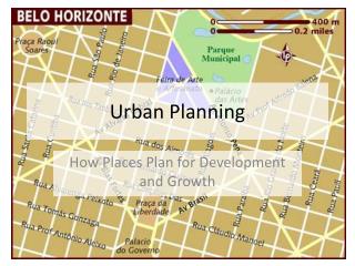
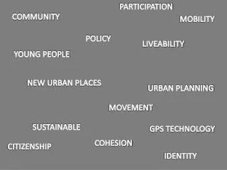
Preface • Urban planning (urban, city, and town planning) is a technical and political process concerned with the control of the use of land and design of the urban environment, including transportation networks, to guide and ensure the orderly development of settlements and communities. It concerns itself with research and analysis, strategic thinking, urban design, public consultation, policy recommendations, implementation and management.
Preface • Real urban planning is a relatively new concept. It gained popularity beginning in the mid-to-late 19th century, when it became obvious that there should be some kind of plan or larger goals for the growth of big cities like New York and Philadelphia. Before this time, cities very often grew as they had need, and the surrounding land was just swallowed up. London, Paris, Tokyo - none of these world cities had much urban planning, and even now, the addresses and streets in their older sections can be confusing even to natives. • Nowadays, urban planning takes all aspects of a city into consideration. It includes plans for safety, aesthetics and common sense placement of everything from houses to factories. Parents wouldn't want their children's playground next to the water treatment plant, for instance, and urban planning helps eliminate such problems. Goals for attractive architecture for city buildings are put into place and pleasing green spaces are planned. Good urban planning gets schools into the neighborhoods where they are needed most, places hospitals in centralized locations, allows for growth and plans roads accordingly.
Preface • Perhaps good urban planning is most evident in good roads planning in a city. Anticipating growth and traffic needs for a big city is crucial. Urban planners must consider how future growth will affect traffic flow and try to eliminate trouble spots before they become a problem. Even placing sewer systems and drainage systems is a necessary element of urban planning, albeit a less glamorous one. Urban planners must consider geography, the water table and numerous other elements of a city's landscape in order to properly plan for this necessity. • Because so many disciplines make up the larger concept of urban planning, a group of urban planners may have widely divergent degrees: civil engineering, architecture, botany, landscape design, electrical engineering, business administration, and so on. Urban planners who are good at what they do are highly sought after by municipal governments. When efficient urban planning is used, cities are more attractive and serve their citizens to the best of their potential.
Outlines • Functions of Urban Road Network • Shape Forms • Key Technical Indexes • Urban Road Network Planning Procedure
1. Functions of Urban Road Network • Traffic function • Public space • Disaster prevention and relief • City structure
2. Shape Forms • Urban road network is formed by the combination of history, geography, nature, and scale of the city. • Basic shape forms: Square shape Radiating and circular shape Free shape Hybrid type
2. Shape Forms - Square shape • Suitable for small and medium-sized flat city • Regular arrangement, be helpful for building layout • Intersections are too many, resulting in an un- convenient diagonal traffic.
2. Shape Forms–Radiating and circular shape • Applicable for big and super-big city • Subareas are connected with the center closely. • The traffic in the center is heavy.
2. Shape Forms - Free shape • Applicable for rolling terrain • Merged with the terrain and nature • Cause disorder traffic and abnormal intersections
城市道路网结构形式 • 方格网式 • 放射环式 • 自由式 • 混合式
3. Key Technical Indexes • Density of road network • Density of road area • Road area per person
大中城市道路网密度指标表 小城市道路网密度指标表
3. Key Technical Indexes • 道路面积密度是城市各类、各级道路占地面积与城市用地总面积之比值。其中道路用地总面积包括:交通广场、停车场及其它道路交通设施用地。《城市道路规划设计规范》规定一般以8%~15%较为适宜。对于人口在200万以上的大城市,宜为15%~20%。 • 城市人口人均道路占有率宜为7~15平方米/人。其中,道路面积宜为6~13.5平方米/人,广场面积宜为0 .2~0.5平方米/人,公共停车场面积宜为0.8~1平方米/人。
3. Key Technical Indexes • Nonlinear factor
4、 Urban Road Network Planning Procedure • 一、城市道路网规划设计的一般方法 • 1)现状调查,资料准备 • a、城市地形图 • b、城市用地布局和交通规划初步方案 • c、城市道路交通现状调查资料 • d、城市发展社会经济资料 • e、城市道路交通现状存在的问题 • 2)道路系统初步方案设计 • 3)对干道主要控制点、横断面形式、干道竖向布置等具体问题提出设计方案。 • 4)修改道路系统规划方案 • 5)绘制道路系统规划图 • 6)编制道路系统规划方案说明 • 二、城市道路系统规划的评价
General process of urban road network planning • Investigation of current traffic and preparation of planning data; • Preliminary planning and modifying of road system; • Plotting plan of road system; (plane plan, standard cross plan, and vertical plan) • Describe the explanation. • Evaluation and modification process
西客站片区内慢行道与外部慢行道统一规划示例西客站片区内慢行道与外部慢行道统一规划示例
Homework • 1. Read a paper and prepare a literature review; • 2. Search the papers about Bus only lane and Bicycle only lane, prepare a presentation.