Download
1 / 17
330 likes | 1.12k Vues
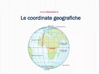
CARTE GEOGRAFICHE. Sono la riproduzione: APPROSSIMATA ( mai fedele) RIDOTTA (in scala) SIMBOLICA ( fa uso di una legenda dei simboli) della superficie terrestre. IL PLANISFERO DI MERCATORE. Scala superiore a 1:30.000.000.

E N D
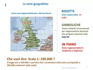
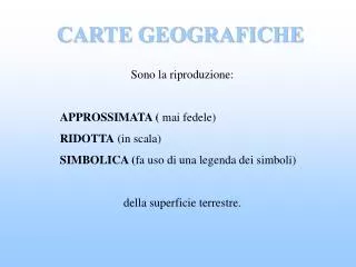
CARTE GEOGRAFICHE Sono la riproduzione: APPROSSIMATA ( mai fedele) RIDOTTA (in scala) SIMBOLICA (fa uso di una legenda dei simboli) della superficie terrestre.
IL PLANISFERO DI MERCATORE Scala superiore a 1:30.000.000 Le proiezioni cilindriche si basano sul principio di un cilindro avvolto intorno ad un globo
IL PLANISFERO DI MOLLWEIDE Le proiezioni coniche si basano sul principio di un cono che poggia su una sfera
CARTE GEOGRAFICHE Scala da 1:1.000.000 a 1:30.000.000
CARTE COROGRAFICHE Scala da 1:100.000 a 1: 1.000.000
CARTE TOPOGRAFICHE Scala da 1:10.000 a 1:100.000
LE PIANTE Scala da 1:10 a 1:10.000
CARTE TEMATICHE Sono destinate a impieghi particolari, nella ricerca scientifica, nella pianificazione territoriale, nell'amministrazione ecc. Possono prendere in considerazione un singolo fenomeno
CARTA MUTA Serve per inserire i dati e trasformarla in tematica
METACARTA È una specie di carta tematica, riguardante un fenomeno specifico, costruita in modo particolare; usa forme geometriche che variano a seconda della dimensione del fenomeno.
FOTOGRAFIA AEREA E IMMAGINI DA SATELLITE Attraverso le tecniche del telerilevamento, che consente di misurare a distanza la superficie terrestre, si possono ottenere immagini anche di zone inaccessibili.