Download
1 / 18
180 likes | 356 Vues
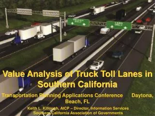
Applications of Oblique Aerial Imagery in Transportation Planning. Who is “We”?. TMIP – Transportation Model Improvement Program. Subdivision of TTI – Texas Transportation Institute Working with FED DOT on Consultant basis We decided: GO BIG OR STAY HOME……. Where this info can be used.

E N D
Applications of Oblique Aerial Imagery in Transportation Planning
Who is “We”? • TMIP – Transportation Model Improvement Program. • Subdivision of TTI – Texas Transportation Institute • Working with FED DOT on Consultant basis • We decided: GO BIG OR STAY HOME……
Where this info can be used • TRB – Transportation Research Board • AMPO – Association of Metropolitan Planning Organizations • GIS-T – GIS for Transportation • FED DOT Resource Website • State Sales • Local MPO’s or Equivalent • County Sales
Better, Stronger, Faster: how Oblique Aerial Imagery is changing the Face of Transportation Planning
Planning Organization vs. DOT • Planning organizations work on a regional level. They deal with larger issues, transportation studies, evacuations, air quality, light pollution and all types of mass-transit. • DOT’s are your day-to-day operations. Pavement conditions, snow plowing/routing, paint conditions…
Method • 58 MPO’s were Represented by our 140 existing counties • Of the 58, 43 have coverage over 50% of their represented population • Of the 58, 34 have coverage over 50% of their represented land area • Of the 58, 26 have 100% of both • Of the 58, 17 use Pictometry
28 MPO’s Interviewed • Transportation Planners • Transportation Modelers • GIS Professionals • ALSO: 9 of the above were interviewed from; Mass. Highway / Conservation / Recreation Departments and the City of Rockville, MD.
Benefits of Oblique Imagery • Save Labor, Time, Money • Reduces Travel Expense • Reduces or Eliminates Field Visits • Increased Accuracy (data verification & collection) • Requires Less “Educated Interpretation” • Excellent Tool for Public Process through Increased Problem Recognition/Solution
Current Uses • Allocation of Floor Space • Clearly Seeing View not avail from Ground • Collection of Data • Improve Data Integrity • Identify Vertical Code Violations • ROM Planning • Infrastructure Inventory • Identify Centroid Connectors – TAZ Zones
Estimate Walk to Transit • Land Use Classification • Dignitary Safety / Even Planning • Emergency Preparedness • Pedestrian Safety • Emergency Response • Crash Reporting / Analysis • Snow Removal Planning • Search and Rescue / Fire Control • Public Meeting Communications • Addressing Complaints Expediently
Odd, every day things; Dam dismantling plan, Roadway Projects, Involvement Program, Develop a Training Tool…
Current Barriers to Implementation • Storage Space • Implementation to hundreds of users • Strong Perception that it is Cost Prohibitive • Lack of Cross Agency Communications or Interest. • Lack of Competition • Proof of Value is Still Being Evaluated
Future Uses • Barrier / Retaining Wall Inventory • Slope Identification • Change Analysis
Change Analysis: Example of Oblique imagery In Change Analysis (Before / After) Viewed from four different Directions