Download

1 / 31
310 likes | 491 Vues
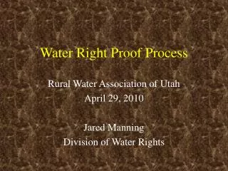
Water Rights Training for Proof Professionals. July 16, 2008 Salt Lake City. Purpose of this Training. Discuss fundamental water rights concepts Explain tools available on our website Help proof professionals understand what is required on proofs

E N D
Water Rights Training for Proof Professionals July 16, 2008 Salt Lake City
Purpose of this Training • Discuss fundamental water rights concepts • Explain tools available on our website • Help proof professionals understand what is required on proofs • Improve the proof process for proof professionals and water rights staff
Water Rights History • Prior Appropriation Doctrine – first in time is first in right (practiced since pioneer times) • Water rights were administered by courts and ecclesiastical leaders (stake presidents) • 1896 – Utah statehood • 1897 – the legislature established the State Engineer’s Office to administer water rights • 1903 – First comprehensive water rights statutes were enacted
Water Rights Statute • Defines a process for appropriating water • Establishes a way to define historical, pre-statutory water rights (diligence claims) • Gives the State Engineer the authority to administer water rights • Defines a process for adjudicating water rights
Appropriations Process • File an application with the State Engineer • The application is advertised in the newspaper • The application may be protested • A hearing may be held • An Order of the State Engineer is issued • The decision can be appealed • Proof must be filed showing the works have been constructed and the water put to beneficial use • Extensions of time can be requested to extend the time for submitting Proof of Beneficial Use
Change Application Process • Same basic process as an Application to Appropriate • A water right may first need to be segregated from its parent water right • Since most sub-basins are closed or restricted to new appropriations, changes are very common
Exchange Application Process • Same basic process as an Application to Appropriate • Usually based on a contract (for example, WBWCD) • The certificate is conditioned upon maintaining a valid contract
Adjudication Process • Initiated by Petition of Water Users or Court Order • Hydrographic Survey Maps are prepared for the entire area by our office • A Water Users Claims is prepared for every water right in the area • A Proposed Determination is published and submitted as a recommendation to the court • The Proposed Determination can be protested • A Decree is issued by the court
Standard Diversion Values • Irrigation – 3 to 6 acre-feet per acre • Domestic – 0.45 acre-foot per dwelling for full-time use; 0.25 acre-foot per dwelling for part-time or recreational use • Stock watering – 0.028 acre-foot per equivalent livestock unit (elu); round up to the nearest elu
Other Standard Values • Depletion – Alfalfa is the default crophttp://waterrights.utah.gov/techinfo/consumpt/default.asp • Other Common Uses – Tables 510-1 and 510-2http://www.rules.utah.gov/publicat/code/r309/r309-510.htm • Sheep, goat, swine, moose, elk – 0.0056 acre-foot • Ostrich, emu – 0.0036 acre-foot • Llama – 0.0022 acre-foot • Deer, antelope, bighorn sheep, mt. goat – 0.0014 acre-foot • Chicken, turkey, chukar, sage hen, pheasant – 0.00084 acre-foot • Mink, fox (caged) – 0.00005 acre-foot
Statutory Proof Requirements (U.C. 73-3-16) • Description, location, nature, and extent of the diverting and carrying works • Point(s) of diversion\return and description of water source(s) • Quantity of water • Method of applying water to beneficial use • Detailed measurements • Place of use • Must conform to rules and standards established by the State Engineer
Proof Processing Procedures • 4 requirements for complete proofs • Ownership records current • Signed and stamped by the proof professional • Signed by the owner • Notarized • Corrections that “materially affect the water right” need to be stamped, signed by applicant and professional, and notarized • Obvious corrections can be made by Water Rights Staff
Showing Beneficial Use • Primary purpose of the proof • Development must be complete (no planned or future uses) • “Natural vegetation” is not usually considered to be irrigation • Full-time domestic use needs to be a permanent or semi-permanent structure (not a temporary trailer)
Options When Beneficial Use is not Complete • File an extension • Let the water right lapse and file a new application • Prove up on the part of the water right that has been completed; segregate off the other portion (file an extension on the segregated portion), or let the undeveloped portion lapse • Do not submit proof on something that has not been developed, even if it is almost done
Mapping Standards (R655-5) • Surveyed locations shall be within a one-foot positional tolerance • Maps must include the following: a north arrow, a scale in both written and graphic form, a legend, and a title block. • All information must be legible. The line quality must be distinct. The boundary of the irrigated area must be delineated. Shading or hatching may be used to show irrigated acreage. • Surveys must be tied to a section or a quarter section corner and the map must indicate the basis of bearing. The survey method must be specified on the map. Any public roads adjacent to or near the property surveyed should be shown on the map. If within a legally platted subdivision, the subdivision name and lot/block designations of the subject parcels shall also be shown.
Mapping Standards (continued) • The title block must include: the water right number, application number, date of the survey, name of the applicant, name, seal, and license number of the proof professional, and the section, township, and range where the parcel is located. • Maps must be submitted on standard drafting medium that is durable and reproducible. All information shown on the map must be in black permanent drafting ink or other media of equivalent durability and opacity. • The preferred map sizes are 8 ½" x 11" or 8 ½" x 14". Maps of small parcels shall be drawn to the largest scale practical. The smallest scale allowable on small maps is 1"=300' (1:3600). Maps shall not be folded. Margins should be at least 1 ¼" on the top and ½" on the sides and bottom. • Larger maps shall be 24" x 36". Larger maps shall be rolled for mailing or transport. If mailed, a protective mailing tube or box shall be used.
Appurtenance • One of the purposes for submitting proof is to establish water right appurtenance to land • Appurtenance must be shown on the map for all uses including stock watering • All county parcel numbers with appurtenant water rights should be specified and shown on the map
Supplemental Water Rights • Definition: Water rights that are used together for a common beneficial use • Water rights are NOT NECESSARILY supplemental just because • They have the same owner, or • The water rights are commingled • When water rights are supplemental, each water right can potentially provide the entire flow during a given year (the classic case is when a surface right and a well are used on the same land)
Sole Supply • Definition: A quantification of a water right’s beneficial use representing the maximum use of water when used alone and separate from any and all supplemental water rights • Water rights are not necessarily limited by sole supply when used supplementally • Sole supply must be defined for a water right before a certificate can be issued • If the sole supply is less than the total acreage, all other acreage must be accounted for
NOT Supplemental (Same Owner, Different Place of Use) SUPPLEMENTAL GROUP NO. 28088WATER RIGHT(S): 29-3442IRRIGATION: 8.74 acresSOLE SUPPLY: 8.74 acres SUPPLEMENTAL GROUP NO. 28089WATER RIGHT(S): 29-3443IRRIGATION: 5.13 acresSOLE SUPPLY: 5.13 acres
NOT Supplemental (Com-mingled, Different Place of Use) SUPPLEMENTAL GROUP NO. 27160WATER RIGHT(S): 29-2644IRRIGATION: 12.72 acresSOLE SUPPLY: 12.72 acres SUPPLEMENTAL GROUP NO. 27161WATER RIGHT(S): 29-2645IRRIGATION: 9.86 acresSOLE SUPPLY: 9.86 acres
Supplemental Water Rights SUPPLEMENTAL GROUP NO. 26110WATER RIGHT(S): 29-1474, 29-1575IRRIGATION: 156.0 acresSOLE SUPPLY: 29-1474 80.0 acres 29-1575 76.0 acres
When Should Water Rights be Shown as Supplemental? • When water rights are used on the same land and have the same owners, these water rights should generally be shown as supplemental, except as outlined below • Exception: a proof cannot change the place of use (alter the appurtenance) of a water right that is not the subject of the proof • Exception: the water right owner may want to show distinct places of use for water rights for future conveyance purposes or other reasons
Water “Stacking” • Definition: “Stacking” occurs when the place of use has more water rights than can be used • Water rights generally cannot be certificated if they are being stacked on top of existing water rights; this is especially true when the existing water rights are actively being used • Land needs to be checked for existing water rights during the proof process
Amendatory Changes • Required when the proof does not reflect the application • Must go through the administrative process (advertising, protest, etc.) • Possible exceptions (subject to the State Engineer’s discretion): • The point of diversion is within 660 feet of the approved point of diversion • The place of use is within an adjacent forty • Areas where no advertising is required on small applications
Flow Measurements • Each source needs a measurement • Flow must support the total volume • High water marks and other “theoretical” measurements are not acceptable • A reasonable effort must be made to ensure that flow measurements are as accurate as possible
OSE Conditions • Measuring devices • Statute requires all water right holders in Utah to meter their diversions • We have not enforced the requirement for domestic, irrigation, and stock water users to show a meter in the proof process except when a meter was required to satisfy concerns of protestants • Proofs on water uses for “other” uses greater than 1 acre-foot should show metered diversion records • Land removed from production • Multi-source language
Miscellaneous Points of Diversion • Point of diversion for dams located on the natural channel: “the point where the longitudinal axis of the dam crosses the center of the stream bed” [73-3-2(d)(iii)] • Point of rediversion: • “The point where released storage water is taken from the [natural] stream” [73-3-2(d)(iv)] • Also applies to inter-basin transfers of water • Usually does not apply to water “rediverted” from a canal or other man-made channel • Point of return: usually applies when the water use is fairly non-consumptive such as hydro-electric power generation or other industrial uses
What Separates an Excellent Proof from an Acceptable Proof? • Photographs showing beneficial use • High quality maps • Wells clearly identified by Well Identification Number (WIN) • No typos, errors, or ambiguities
Upcoming Additions to the Division’s Proof Program • Administrative Rules for proofs (including updating the map standards) • Online, interactive proof form • Online proof professionals database • Periodic training for proof professionals • Two new employees in Salt Lake City to help with the processing of proofs