Vector Data Input
This chapter explores various sources of existing GIS data, including federal, state, and local agencies, as well as private companies. It examines the importance of accurate base maps, layers, and geospatial standards. Key components include metadata, accuracy standards, and methods for data acquisition, such as remotely sensed data and digital mapping techniques. The chapter highlights the significance of frameworks like the TIGER system and discusses challenges related to data quality. Essential resources, such as the US Geological Survey and state public data systems, are also addressed.

Vector Data Input
E N D
Presentation Transcript
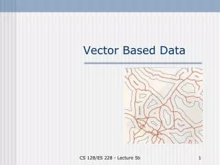
Vector Data Input Chapter 4
Data • Buy or make - sources • Base map - layers • Standards – accuracy • Metadata • As bad as the worst component
Existing GIS Data • Federal Government • Internet • State Agencies • Regional and local • Framework data • geodetic control, orthoimagery, elevation, transportation, hydrography, governmental information, cadastral.
Existing GIS Data • US Public Data • US Geological Survey • US Bureau of the Census • State Public Data • Regional Public Data (Central TX) • Metropolitan Public Data (Austin) • GIS Data from Private Companies
US Geological Survey • National mapping and remotely sensed • Thematic data clearinghouse • Digital Line Graphs created from USGS quadrangles. • 1:24,000; 1:100,000; 1:2,000,000 • Hypsography (contour lines and spot elevations); hydrography, boundaries, transportation, PLSS data. • Land Use Land Cover (LULC) - Anderson
US Bureau of Census • TIGER – Topologically Integrated Geographic Encoding and Referencing • Each census. • Address geocoding • Legal and statistical (zip, census block) to link to census data • Roads, railroads, streams, water bodies, power lines and pipelines.
Statewide Public Data • See Appendix C of text • Texas Natural Resources Information System (TNRIS) • Texas Wetland Information Network (WetNet) • Texas Natural Resource Conservation Commission • Texas Parks and Wildlife Department • Texas Environmental Awareness Network
Regional and Local Public Data • University of Texas at Austin • College of Architecture • Community and Regional Planning • Austin and Central Texas
GIS Data fromPrivate Companies • ESRI • Geographic Data Technology • Library/Resources
Metadata • Information about information • Federal Standards • Software to assist • Federal Geographic Data Committee • Example: Texas Parks & Wildlife
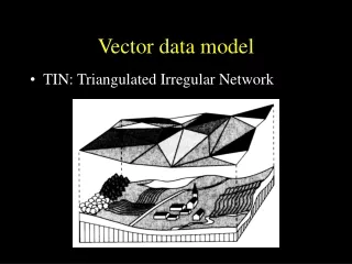
Conversion of Existing Data • Direct translation • Arc/Info interchange files (.e00) • MGE and Microstation (.dgn) • AutoCAD (.dxf, .dwg) • shapefiles • Neutral format • Spatial Data Transfer Standard (SDTS) • Topological Vector Profile (TVP) • International Steering Committee for Global Mapping (ISCGM)
Remotely Sensed Data • Digital orthophotos (DOQs) • Satellite images
GPS Data • Library/Resources • Selective Availability • Differential correction • 3-5 meter
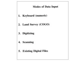
Digitizing • 0.001 inch accuracy • Snap tolerances • arcsnap • nodestrap • Intersect arcs • Duplicate arcs • On-screen or heads up digitizing
Scanning • Raster!!! • Coffee stains - notes • Colors • Digital Raster Graph (DRG) • Vectorization of raster files • Commercial maps
Geometric Transformation • Converting a digital map or an image from one coordinate system to another using a set of control points and transformation equations. • Different methods. • We won’t cover directly. • Root Mean Square Error (RMS)