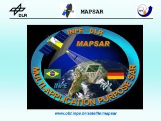
www.obt.inpe.br/satelite/mapsar
www.obt.inpe.br/satelite/mapsar. MAPSAR: a New L-Band Spaceborne Light SAR Mission for Assessment and Monitoring of Terrestrial Natural Resources. National Institute for Space Research - INPE - Brazil German Aerospace Center - DLR - Germany

www.obt.inpe.br/satelite/mapsar
E N D
Presentation Transcript
MAPSAR: a New L-Band Spaceborne Light SAR Mission for Assessment and Monitoring of Terrestrial Natural Resources National Institute for Space Research - INPE - Brazil German Aerospace Center - DLR - Germany Institute of Lightweight Structures - TU Munich - Germany
Contents • Motivation • Background • Satellite Concept • Sensor Concept and Performance • Compliance with User Requirements • Current Status
WORKSHARE PRINCIPLES INPE PMM Systems Engineering Satellite AIT (assembly, integration and test) SIVAM Airborne Simulation in Brazil DLR SAR Sensor Orbit Analysis ESAR Airborne Simulation in Europe TUM Reflector Antenna
MOTIVATION • To verify the feasibility of a satellite on the 500 kg class mission with a Light SAR payload. • To fulfill the requirements for German and Brazilian users for assessment and monitoring of Terrestrial Natural Resources, considering the following themes: • Agriculture • Cartography • Disaster Management • Forestry • Geology • Geomorphology • Hydrology • Oceanography • Urban studies • Defense/Intelligence
BACKGROUND • 20 years cooperation between INPE and DLR. • Late 90’s: mission proposal from DLR to INPE for Amazon Region observation based on a Light SAR sensor. • July 2001: joint project establishment for system evaluation. • October 2001: users workshop at DLR. • April 2002: users workshop at INPE. • July 2002: Consolidation of user requirements. • December 2002: Pre-phase A conclusion. • December 2003: Phase A study was established (2004-2005 period).
MAPSAR Workshop April 15, 2002 Summary: . Hosted by INPE, . 83 registered workshop attendees, . 28 agencies (mainly Brazilian governmental level), . 09 0ral presentations (invited-speakers), 01 Plenary Session, . Main Application Fields: Agriculture Cartography Intelligence Disaster Management Forestry Geology Hydrology Oceans Urban Studies
MAPSAR Application User Requirements Black - Brazilian User Requirements / Blue - German User Requirements
System Constraints • Satellite constraints related to: • mass • power generation • geometric envelope • data rate • Imposed the following limitations: • single band • reflector antenna • max 55 km swath
MAPSAR Final Application User Requirements User/MAPSAR parameters Frequency L Polarization single,dual and quad. pol. Incidence Interval 20°- 45° Spatial Resolution 3-20 meters Swath 20 km - 55 km Orbit Inclination sun-synchronous Coverage global Look Direction ascending/descending and left/right looking Revisit weekly Access to data near real time Additional Requirement InSAR and Stereoscopy
Mission Baseline • Strong oriented to an operational application system serving “public good” , not excluding scientific and commercial aspects. • Thematic Mapping and Monitoring purposes. • Mission continuation (series of satellites).
Satellite Concept Modularity Independent AIT for Payload and Platform modules Objectives: Cost reduction Shorter schedule High reliability
MMP performance • ACDH: • Pointing accuracy: < 0.05o (3 σ) • Drift: < 0.001o/s • Attitude determination: < 0.005o (3 σ) • Off pointing of: 30o in 120 seconds • Payload Capability: • Mass: up to 280 kg • Volume: compatible with class of launchers • Power supply: 175 W average • 900 W peak
MMP Development Status • Power Supply, Structure, TT&C and Propulsion subsystems contracted in December 2001. • PDR (Preliminary Design Review) in May 2003. • CDR (Critical Design Review) performed in 2004. • ACDH (Attitude Control and Data Handling) to be contracted. • Total development at the end of 2007.
Payload Module • - Limitations imposed by the MMP performance • Mass • Power • ACDH • Envelope • - Functional Block Diagram • - Proposed Configuration
MAPSAR Mass Budget MMP 250 kg MAPSAR total 520.1 kg
Proposed Antenna Concept Antenna Trade-Off Result: Elliptical parabolic main reflector 7,5 m length (azimuth) 5 m width (range) Cassegrain type subreflector 67 cm length (azimuth) 93 cm width (elevation) Distance to main reflector: 2,8 m. Feed type: horn antenna Technology Example: HALCA (MUSES-B), the first astronomical satellite dedicated to Very-Long Baseline Interferometry (VLBI), was launched from Kagoshima Space Center on February 12, 1997. Operating frequency 1.6-1.73 GHz Reflector diameter 8 m
Design Goals • Reflector aperture 5 m x 7.5 m, elliptical. • Shape accuracy 5 mm RMS (TBD). • Low mass < 2 kg/m2. • High design flexibility for the range of requirements (incl. launch and space environment). • Easy integration of enabling technologies (reflecting surface, deployment and shape control etc.)
Access Region / Field of View Off-nadir angle 620 km Incidence angle 20° 48,1° Nadir 204 km 395 km Current swath is selected by rolling the whole satellite
Radar Modes MAPSAR operates three different resolution modes (3m, 10m, 20m) in three different polarization modes: Single (SPM), Dual (DPM), Quad (QPM). Overview of important modes:
Radar Beam Specification Radar Beam specification (Medium/Low Resolution) SPM, DPM low/medium res. (20/10 m): 31- 55 km swath SPM high res (3m): 5 - 38 km swath QPM low res. (20 m): 28 – 43.4 km swath QPM medium res. (10 m): 22 – 23.3 km swath
Conclusions • Pre-phase A study has been completed. • Preliminary feasibility was demonstrated for reflector antenna concept. • High interaction with users to define the mission. • Degree of innovation: 500 kg class SAR satellite, reflector antenna, sensor performance. • Applications will take advantage of high resolution L-band SAR with enhanced capabilities (polarimetry, stereoscopy, interferometry), particularly suitable for the Amazon region and Boreal forest. • Critical items: antenna deployment mechanism, solid state high power amplifier. • Cost estimate 90 MUS$ including launcher. • Estimated time to deployment 6 years (2008-2009).
Phase A Activities (2004-2005) • Refinement of the mission requirements and establishment of a function tree of the complete system. • Exploration of alternative system concepts against mission needs. • Investigation of the feasibility of selected orbit with respect to revisit time, stereoscopic and interferometric capabilities. • Investigation of the feasibility of SAR sensor performance and technology evaluation (core radar definition, equipment specification, industrial feasibility). • MMP bus system/subsystems/equipment (MMP performance and configuration, equipment specification, industrial feasibility). • Interfaces between MMP and the SAR payload (systems segments). • Ground system conception and technology. • Airborne simulation campaign (development of MAPSAR user-oriented value added products).
SIPAM SAR ProgramMAPSAR Simulation Flights: Feb-May 2005 EMB-145 / R-99B
SAR - Banda L λ= 23,9 cm (1.27 GHz) SAR - Banda X λ= 3,1 cm (9.68 GHz)
SIVAM R-99 Mapping Modes Quad L + Single X Dual L + Single X InSAR + Single L Quad L Single L + Single X InSAR + Quad L
SIVAM R-99 SAR: resolution and swaths Quad L + X (3m) – 10km Quad L + X (6m) – 20km Quad L + X (18m) – 60km Dual L + X (3m) – 20km Dual L + X (6m) – 40km Dual L + X (18m) – 120km Quad L (3m) – 10km Quad L (6m) – 20km Quad L (18m) – 60km L + X (3m) – 20km L + X (6m) – 40km L + X (18m) – 120km
SIVAM SAR R-99: resolution and incidence Quad L (3m) – 36º - 83º Quad L (6m) – 36º - 83º Quad L (18m) – 36º - 84º L + X (3m) – 36º - 83º L + X (6m) – 36º - 83º L + X (18m) – 45º - 84º Quad L + X (3m) – 36º - 80º Quad L + X (6m) – 36º - 80º Quad L + X (18m) – 45º - 80º Dual L + X (3m) – 36º - 83º Dual L + X (6m) – 36º - 83º Dual L + X (18m) – 45º - 84º
SIVAM SAR Quad-Pol (L-HH) Serra do Tepequem – Roraima ( spatial resolution = 6m)
SIVAM SAR Quad-Pol (L-VV) L-VV Serra do Tepequem – Roraima ( spatial resolution = 6m)
SIVAM SAR Quad-Pol (L-VH) L-VH Serra do Tepequem – Roraima ( spatial resolution = 6m)
MAPSAR Simulation (SIPAM SAR Application Program) • Goals • to test MAPSAR sensor configuration and establish a proof of concept to meet users need. • to strengthen the capabilities of end-users (“critical mass”) for the effective usage of MAPSAR data for resource assessment, management and environmental monitoring, particularly in the Amazon Region. • to encourage the utilization of new information derived from MAPSAR (multipolarized L-band images) by relying heavily on Airborne R-99 as a data source for research, application and training projects. • to provide demonstration MAPSAR value-added products for applications (preparing users for the advent of MAPSAR).
MAPSAR Simulation (SIVAM R-99 campaign) • Proposed strategy : • To simulate MAPSAR far range images (beams7-10) with SIVAM A1.Quad L+X near range mode (incidence: 40 – 48 degrees). • Balanced agenda of applications. • Strong participation of INPE and potential end-users in the proposals (government, university and industry).
MAPSAR Simulation (SIPAM SAR Application Program) • Test Sites: • Agriculture: Barreiras (BA) – EMBRAPA, INPE, UnB, UFRJ, CPRM • Coastal Zone Studies: Bragança (PA) – UFPa, M.P.E. Goeldi, INPE • Disaster Management: Terminal Coari/Manaus (AM) – PETROBRAS • Forestry: Tapajós (PA) – INPE, DSG, DLR • Geology: Carajás (PA)/Curaçá (BA) – INPE, Unicamp, CVRD, CPRM • Hydrology/Forestry: Lago Grande (PA): UVIC (Canadá), UFPa, INPE • Hydrology/Forestry: Igarapé Açu (AM) – INPE, INPA, JPL
News from the last DLR meeting (Nov 2004) • Travelling waves tubes technology may replace solid state high power amplifiers for the radar sensor (space qualified from SAR-LUPE). • a new configuration for the PMM and payload interface will be proposed by INPE taking into account the reflector antenna deployment mechanism. • a demonstrator for thereflector antenna performance is under developement at the Technical University of Munich. • two MAPSAR orbit configurations are under investigation: 7 days repetition cycle for interferometry and 39 days (or 41 days) orbit for stereoscopic applications. • A paper with the current status of MAPSAR project will be presented in Goiânia (BRSS-2005).