Download
1 / 9
90 likes | 104 Vues
A government-private sector partnership between the U.S. Geological Survey (USGS) and SPOT Image Corporation to enhance the management, preservation, and distribution of SPOT satellite data. This agreement aims to ensure timely access to satellite data for monitoring natural resources and the environment. The partnership involves data exchange, preservation, processing, promotion, consultation, and occasional joint facility use.

E N D
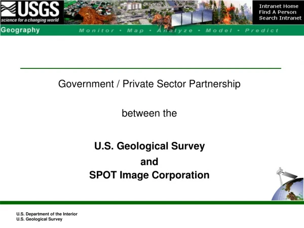
Government / Private Sector Partnership between the U.S. Geological Survey and SPOT Image Corporation U.S. Department of the Interior U.S. Geological Survey
USGS / SPOT Image Corporation Partnership Discussions • SICORP and EDC met on Thursday, April 23, 1998 • SICORP was represented by: • Dan Carayannis, VP Sales and Marketing • Neal Carney, VP Finance and Administration • Gary Kuchel, Federal Sales Manager • EDC was represented by: • Tom Holm and John Boyd. • Basis for the discussion: • Transfer SPOT satellite data to the NSLRSDA to EDC
MEMORANDUM OF AGREEMENTBETWEEN THEU.S. GEOLOGICAL SURVEYANDSPOT IMAGE CORPORATIONFORCOOPERATION IN THE MANAGEMENT, PRESERVATION,AND DISTRIBUTION OF SPOT SATELLITE DATA Signed on September 9, 1998
USGS / SPOT Image Corporation Partnership • Purpose of the MOA • The EROS Data Center and the SPOT Image Corporation (SICORP), recognizing their mutual interests in long-term management, preservation, and distribution of SPOT satellite data (a unique and historic land-surface record), hereby agree to cooperate, under this Memorandum of Agreement (MOA), in such manner that each may benefit from the other's strengths and in order that programs/operations of both institutions may be enhanced.
USGS / SPOT Image Corporation Partnership • Cooperation Objectives: Specifically directed toward enhancing efforts of both organizations to: • Ensure the long-term management and preservation of SPOT satellite data; and • Assist the broadest spectrum of users in obtaining timely access to SPOT data for monitoring global, regional, and local changes in natural resources and the environment. • To serve the interests of both organizations, SPOT satellite data, as a permanent land-surface record, must be maintained, be accessible, and be reproducible in a timely fashion.
USGS / SPOT Image Corporation Partnership • SCOPE: • Exchange of metadata and browse images of 1986-98 U.S. SPOT data on standard digital media; • Preservation of SPOT 1-3 U.S. data currently on HDDT; • Processing of SPOT 1-3 U.S. data to produce and distribute, within the U.S. Government and its Affiliated Users, system-corrected products; • Promotion of the wider application of historical SPOT data; • Exploring the possibility of a downlink at EDC of SPOT data for the continental U.S., including consideration of SPOT-4 Vegetation sensor data reception; • Consultation between EDC and SICORP experts on technical topics related to remote sensing, image processing, and data management; • Occasional joint use of facilities, hardware, and software.
What are the terms of the USGS / SICORP Partnership? • Transfer the entire SPOT Image Corporation HDT archive to EDC • U.S. lower 48 coverage only • Acquisitions from 1986 to Summer 1998 +/- • Approximately 600,000 scenes (Pan -10 meter and Multispectral - 20 meter) • Approximately 6,000 HDTs • USGS pays shipment (Transfer began in late 1999) • Commitment to purchase the archive (HDTs) required by SICORP • Payment schedule flexible, e.g., payment over 3 years +/- (without penalty/interest) • USGS will keep the SICORP royalty with no additional payments to SICORP, until the up-front commitment is paid • USGAU pays COFUR + Royalty
What can the USGS do with the SPOT satellite data? • USGS/EDC can distribute SPOT satellite data to select users • Distribution will be to U.S. Government and its Affiliated Users (USGAU) • SICORP will evaluate the risk of opening the distribution to all users • Again, USGS will pay a royalty • Our COFUR plus the Royalty should equal an end product price of $600 • USGS will pay a royalty with a low of $250 and a high of $400 • Royalty will equal COFUR, for example: $300 COFUR means $300 Royalty = $600 end product price
USGS/SPOT Archive Transfer – Status • HDTs to be migrated: 6,000 • Number migrated: 6,000 (100%) • Completion date: January 7, 2002 • 750,000 scenes (1986 – 1998): 400TB • Data Access • Integrated Metadata & Browse into Earth Explorer & DORRAN • Issues/Challenges/Lessons • Sunset clause, sunset clause, sunset clause! • SPOT Image Corporation has sold distribution rights – Impact ? • Sunset date - public access • New data (1999, 2000, 2001, 200?)