Download
1 / 14
180 likes | 418 Vues
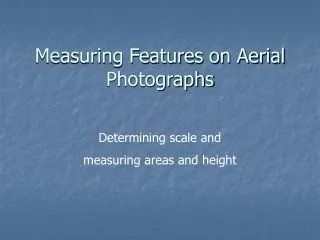
Measuring Features on Aerial Photographs. Determining scale and measuring areas and height. Determining photo scale. Compare with maps Compare with known features on the ground Calculate using flying height and focal length Estimate based on experience. Some variables.

E N D
Measuring Features on Aerial Photographs Determining scale and measuring areas and height
Determining photo scale • Compare with maps • Compare with known features on the ground • Calculate using flying height and focal length • Estimate based on experience
Some variables • PS = Photo scale (unitless) • RF = Representative fraction • PD = Photo distance • GD = Ground distance • MD = Map distance • F = focal length • H = Height of camera above ground • PSR = Photo scale reciprocal (unitless) • MSR = Map scale reciprocal (unitless) Notes: • Units must be the same • Photo scale is variable if photo is tilted or terrain is not flat
Compare with maps of known scale • RF = 1 / [MD*MSR)/PD)] • Best if: • two lines are measured on the photo • intersecting close to right angles • near the principal point • as long as possible • terminating at points with the same elevation
Compare with known features • PS = PD / GD • Identify features with know dimensions such as a football field • Identify features that can be easily measured • Best to use the same conditions that you would use if comparing with map distance
Calculate using H and f • PS = f / H • Scale applies to an imaginary plane on the ground at a distance H from the camera • At low altitudes a small error in H or focal length results in a significant error for PS
Estimate based on experience • With experience photo interpreters can estimate the scale based on the size of features in the photo
Directly measuring area • Planimeter digital or analog) • Digitizing tablet • On screen digitizing
Measuring height • Single photo • Shadow length • Measure extent of displacement • Stereo photos • Measure parallax
Shadow length • Object height = shadow length * Tan (sun angle) • The length of a shadow is directly related to the features height • Need to know the solar elevation angle • Determine from solar tables • Calculate from shadow length cast from an object of known height Figure from Remote Sensing Core Curriculum Introduction to Photo Interpretation and Photogrammetry by John Estes and Jeff Hemphill
Extent of displacement • Height = (D * H) / R • D = displacement length of object • R = photo distance from nadir to top of object • H = Flying height • Best with large photo scales
Measure parallax • Based on the difference in parallax (radial displacement) between the top and bottom of an object • More accurate than single photo methods • Can be used even if the foot of the tree isn’t visible (use reference with same elevation) • Requires more skill and special tool (parallax bar or parallax wedge • Requires stereo photos with minimum tilt
Parallax equations • h = (H * dP) / (PR + dP) • h = height of object • H = Flying height • PR = Stereoscopic parallax of the reference plane PR = PP1PP2 - f1f2 • dP = Difference in stereoscopic parallax between the top and bottom of the object dP = f1f2 – t1t2