Download
1 / 51
520 likes | 557 Vues
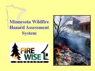
Evaluate and reduce wildfire risks using fuel reduction activities in the Home Ignition Zone. Utilize GIS systems for hazard assessment and implement fire prevention measures, following a structured hazard assessment process with scoring criteria. -

E N D
Bad Situation 911 Call: Small fire in the woods near a house Fire in the woods! FIRE!
The Home Ignitability Zone • It’s what happens in the home ignitability zone that’s important • If it’s connected to the structure, it’s part of the structure • Little things matter in defending against firebrands
Home Ignition Zone 100 feet
Luck (defn.): the events or circumstances that operate for or against an individual
Hazard Assessment Process • Select the areas to be evaluated • Select the hazard components to be considered • Score the hazard components • Compile the hazard ranking in a usable format (database) • Develop future actions / projects
GIS Systems • Satellite-based imagery • Fuel hazard types
GIS Systems Look at fuels close to buildings • Identify the degree of defensible space between the building outline and the surrounding trees
GIS Systems Using the data created in phase 1 & the power of either ArcView or EPIC • Run an analysis with an Hazard Fuel layer to locate the highest risk areas
Hazard Assessment Form Starting with the highest risk areas, do a site visit and check for: • Subdivision Design • Site Hazards • Structural Hazards
Rating Factors • Vegetation • Structure • Location
1. ACCESS • IF 1 primary & one secondary access 3 • IF 1 access road in & out 5
2. PRIMARY ROAD WIDTH • At least 20 feet wide 1 • Less than 20 feet wide 3
3. SECONDARY ROAD CHARACTERISTICS • Structure on main access road 0 • Road ends in a cul-de-sac • Cul-de-sac diameter more than 100 feet 1 • Cul-de-sac diameter less than 100 feet 2 • Dead end road less than 200 feet 3 • Dead end road more than 200 feet 5
4. STREET SIGNS • Present (> 4” and reflectorized) 1 • Missing (< 4” or non-reflectorized) 3
5. DRIVEWAY LENGTH • Less than 150 feet long 0 • Greater than 150 feet with minimum 3 45 foot outside radius turnaround • Less than 150 feet with small 5 or no turnaround
6. DRIVEWAY WIDTH • More than 12 feet wide 0 • Less than 12 feet 5 • No obstructing branches (up to 14 feet) 0 • Obstructing overhead branches 5 • Inadequate surface for heavy vehicles add5
7. DRIVEWAY SLOPE • Level or driveway length less than 30 feet 0 • Steep driveway (over 10%) 5
8. GATED / LOCKED • No 0 • Yes 2
9. ADDRESS • Not visible from road 2
10. FUEL TYPES • Deciduous, hardwoods 1
10. FUEL TYPES • Mixed (Hardwoods and Conifers) 5
10. FUEL TYPES • Conifer (Pine, spruce, red-cedar) 10
11. DEFENSIBLE SPACE • Good thinning out 70 feet from buildings 1
11. DEFENSIBLE SPACE • Only 30 foot around buildings treated 5
11. DEFENSIBLE SPACE • No defensible space treatment 10
12. LADDER FUELS • Underbrush and low branches present 5 • No branches within 6 feet of the ground 0
13. TYPE OF GROUND COVER • Sand, gravel 0 • Grasses up to 6 inches tall 2 • Grasses 6-12 inches tall 5 • Marsh or grasses > 12 inches tall 6 • Shrubs with leaves 3 • Shrubs with needles 4 • Moderate to heavy slash 7 MAJORITY OF TYPE COVERAGE WITHIN 30 FEET OF STRUCTURES
14. SLOPE OF PROPERTY • Flat (0-5%) 0 • Moderate (6-20%) 2 • Steep (over 20%) 4
15. FIREWOOD STORAGE • 0 to 20 feet from structure 5 • 20 feet from structure & <25’ from edge 3 • 20 feet from structure & >25’ from edge 1 • No outside stored firewood 0
16. OUTBUILDINGS • None, or more than 25 ft away 0 • Within 25 feet of home 3
17. POWERLINES • Underground or clear of trees 0 • Trees too close, can fall on lines 3
18. WATER SOURCE • Hydrant within 1000 ft of structure 0 • No hydrant, draft source within 1000 ft 1 • Water source -- < 20 minute round trip 4 > 20 minute round trip 6
19. ROOFING MATERIALS • Metal, tile or fiberglass (good condition) 0 • Asphalt shingles / rolled roofing 3 • Wood shingles 6 • Flat roof add 1
20. SOFFITS & ATTIC VENTS • Enclosed with metal screens 0 • Enclosed with plastic screens 2 • Unscreened vents 4
21. WINDOWS • Small (<5x5) 0 • Large 2
22. FOUNDATION • Open 5 • Enclosed with wood sheeting 3 • Enclosed with fireproof sheeting 0
23. EXTERIOR WALL MATERIALS • Brick / stone / metal 0
23. EXTERIOR WALL MATERIALS • Vinyl / wood 4
24. DECKS AND OVERHANGS • No deck, no open overhang or attached fence 0 • Non-combustible siding AND deck 1 • Combustible siding OR deck 4 • Combustible siding AND deck 10
Home Wildfire Risk Calculation • Subdivision Design (A) 11 • Site Hazards (B) 59 • Structural Hazards (C) 18 • TOTAL 88