Download
1 / 71
740 likes | 1.16k Vues
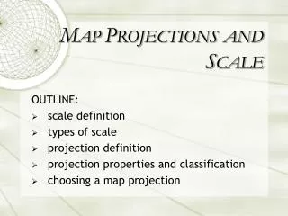
M AP P ROJECTIONS AND S CALE. OUTLINE: scale definition types of scale projection definition projection properties and classification choosing a map projection. P ROJECTIONS. T HE G LOBE. Advantages: most accurate map latitude and longitude lines Disadvantages expensive to make

E N D
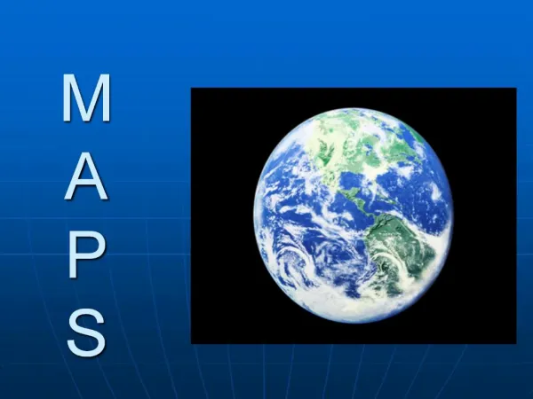
MAP PROJECTIONSAND SCALE OUTLINE: scale definition types of scale projection definition projection properties and classification choosing a map projection
THE GLOBE Advantages: • most accurate map • latitude and longitude lines Disadvantages • expensive to make • cumbersome to handle and store • difficult to measure • not fully visible at one
Flat Map Curved Earth PROJECTIONS • process of transforming earth’s spherical surface to a flat map while maintaining spatial relationships.
PROJECTIONS • projection process involves stretching and distortion
PROJECTIONS • no matter how the earth is divided up, it can not be unrolled or unfolded to lie flat (undevelopable shape).
PROJECTION PROCESS • most projections are combinations of the following characteristics: • characteristic of earth features that are maintained • shape of the projection plane (developable shape) • aspect of the projection plane • points or lines of tangency or secancy • location of the false ‘illumination source’
PROJECTION PROPERTIES • properties in which distortion is minimized when producing a map Area • equal area or equivalent • area sizes are correct everywhere on map • shapes greatly distorted
PROJECTION PROPERTIES Distance • equidistant • distance is correct in all directions from a point i.e. equidistant projection centered on Winnipeg would show the correct distance to any other location on the map, from Winnipeg only • distorting area and/or direction
PROJECTION PROPERTIES Equidistant
PROJECTION PROPERTIES Direction • azimuthal • compass bearing is maintained in all directions only from a point • shapes, distances and areas are badly distorted
PROJECTION PROPERTIES Shape • conformal • shape maintains its shape across the map • distorting area • latitude and longitude cross at right angles • used for navigation
Equal-Area projection Mercator projection PROJECTION PROPERTIES Tissot’s Indicatrix • convenient way of showing distortion • size and shape of the indicatrix will vary from one part of the map to another
Mercator: PROJECTIONS • made by projecting a globe onto a surface – developable surface • distortion is least where developable surface touches the earth • accomplished by use of geometry and mathematics
PROJECTION CLASSIFICATION • Tangent case – shape just touches the earth along a single line or at point. • Secant case – shape intersects or cuts through earth as two circles.
PROJECTION CLASSIFICATION Conical • globe sits under a cone, touching along pre-selected line of latitude • projection developed by cutting cone lengthwise and unrolling
PROJECTION CLASSIFICATION normal case: • parallels – concentric circular arcs, meridians – straight equally spaced lines
Lambert conformal conic projection Albers equal-area conic projection PROJECTION CLASSIFICATION
PROJECTION CLASSIFICATION Conical Distortion
PROJECTION CLASSIFICATION Conical Polyconic – envelopes globe with an infinite number of cones, each with its own standard parallel
PROJECTION CLASSIFICATION Cylindrical • projected onto a cylinder which is also cut lengthwise and unrolled
PROJECTION CLASSIFICATION Cylindrical • evenly spaced network of straight, horizontal parallels and straight vertical meridians (grid like)
parallels become further apart and poles can not be seen PROJECTION CLASSIFICATION Cylindrical Distortion • projection of the entire world, significant distortion occurs at the higher latitudes
Mercator Projection True size PROJECTION CLASSIFICATION Cylindrical Distortion • sizes of Greenland vs. Africa
PROJECTION CLASSIFICATION Cylindrical • straight line between any two points follows a single direction called a rhumb line • useful in construction of navigational charts
PROJECTION CLASSIFICATION Planar/Azimuthal • portion of earth’s surface is transformed from a perspective point to a flat surface
Light rays PROJECTION CLASSIFICATION Planar/Azimuthal • perspective point/light source
PROJECTION CLASSIFICATION Planar/Azimuthal • true direction only between center and other locations • most often used to map polar regions
NORMAL TRANSVERSE OBLIQUE PROJECTION CLASSIFICATION
Planar Conic Cylindrical CANADA PROJECTED
Pseudocylindrical PROJECTION CLASSIFICATION Pseudo map projections • pseudoconic and pseudocylindrical projections - have curved meridians instead of straight ones
PROJECTION CLASSIFICATION Pseudo map projections • modified projections - changes have been made to reduce the pattern of distortion or add more standard parallels • modified to reduce the distortion in the size of areas
Goode’s Projection PROJECTION CLASSIFICATION Pseudo map projections • individual or unique projections – can not be easily related to one of the three developable geometric forms
CHOOSING PROJECTION • depends on: • purpose for which the data is to be used • property in which distortion is minimized • extent and location of area
CHOOSING PROJECTION steps: • size of area of interest • small area has little distortion, any projection. • latitude of area of interest • low-latitudes – cylindrical • mid-latitudes – conical • polar latitudes - planar
CHOOSING PROJECTION • shape of area of interest: • E-W extent: conic or cylindrical • N-S extent: cylindrical • square or circular: planar • purpose: • navigation – planar or cylindrical • world distributions – cylindrical • specific locations - planar
COMMON PROJECTIONS Albers Equal-Area Conic • equal area, secant conical projection (two standard parallels) • resembles earth graticule
COMMON PROJECTIONS Mercator • cylindrical, conformal projection • angular relationships are preserved • parallels and meridians appear as straight lines • parallels are farther apart with increased distance from equator
COMMON PROJECTIONS Mercator • change in N-S scale exactly offset change in E-W direction (shapes preserved) • scale is true at equator or at two standard parallels equidistant from equator • all rhumb lines appear as straight lines, while great circle arcs are not (except equator and meridians) • used primarily for navigation and large scale maps
COMMON PROJECTIONS Transverse Mercator • cylindrical, conformal projection • similar to Mercator except the axis of projection cylinder is rotated 90o from polar axis • scale is true along central meridian or along two straight lines equidistant from and parallel to central meridian • used to portray areas with larger N-S than E-W extent.
COMMON PROJECTIONS Lambert Conformal Conic • conformal, secant conical projection with two standard parallels • possesses true shape of small areas with area distortion • concentric parallels (increasing intervals) and equally-spaced straight meridians
COMMON PROJECTIONS Mollweide • pseudocylindrical, equal-area projection • N-S scale is decreased in high latitudes, increased in low latitudes; opposite in E-W direction • parallels are straight, spaced closer together from equator
COMMON PROJECTIONS Polar Stereographic • directions are true from center point • conformal projection: over a small area, angles in the map are the same as the corresponding angles on Earth's surface • meridians are straight and radiating; parallels are concentric circles • shows only one hemisphere
COMMON PROJECTIONS Polar Stereographic • preserves circles - all great and small circles are shown as concentric arcs or straight lines • scale true only where the central parallel and meridian cross • used in polar aspect for topographic maps of polar regions, regions that are circular in shape
COMMON PROJECTIONS Eckert IV Equal Area • pseudocylindrical and equal-area • scale is true along the parallel at 40:30 North and South