Download
1 / 16
170 likes | 847 Vues
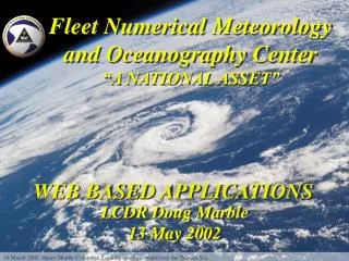
Fleet Numerical Meteorology and Oceanography Center “A NATIONAL ASSET”. WEB BASED APPLICATIONS. LCDR Doug Marble 13 May 2002. 10 March 2002 -Space Shuttle Columbia. Looking southwestward over the Tasman Sea. Web Based Applications. SIPRNET Satellite Focus Testbed

E N D
Fleet Numerical Meteorology and Oceanography Center “A NATIONAL ASSET” WEB BASED APPLICATIONS LCDR Doug Marble 13 May 2002 10 March 2002 -Space Shuttle Columbia. Looking southwestward over the Tasman Sea.
Web Based Applications • SIPRNET Satellite Focus Testbed • TCWeb – NIPRNET operational, SIPRNET next • User customizable gifs – MyWxMap • Operational on SIPRNET and NIPRNET • Less bandwidth - gifs versus grids • “Infinitely” customizable areas and products • Web enabled Search and Rescue – WebSAR • 30 minute turnaround reduced to ~60 seconds • User friendly interface, cleaner graphics • Uses highest resolution data available in search region • Web enabled VLSTRACK • Simplify use • Automate data reformat and ingest • Navy METOC Portal • Web Developers Collaboration Site
Web Enabling Applications • What makes web enabling a good idea? • Broad customer base • Currently difficult user interface • Need to manually reformat or ingest data • Requires software download/install (thick client) • Bandwidth limitations or possible loss of service not safety/mission critical • What shouldn’t be web enabled? • Applications that are the converse of all of the above… Yes Meteograms GDIGS WWM OPARS TAWS MMOS TAPPS WindP/StrikeP DPS Forecast Soundings STARS METCAST JMV? No ATCF CEEMS
30 Jan 2002, 0740Z, SeaWiFS true color SIPRNET Satellite Focus Testbed • Joint NRL-FNMOC presentation of developmental satellite products • In response to user request, region specific • Arabian Sea, Afghanistan, Persian Gulf • Philippines next? • INSAT dust enhancement loops, SeaWIFS true color/dust enhancement, feature tracking winds • New products – low cloud over snow, low clouds at night, convective cloud top heights,
SIPRNET Satellite Focus Testbed • MODIS dust enhancement over the Northern Arabian Sea, true color over land. Dust over the ocean appears as shades of pink. Dry lakebeds over land (often representing sources of dust) are also indicated in pink. • Horizontal resolution of the data is 500m.
Tropical Cyclone Web Page (TCWeb) • Satellite data fusion page • Multi-sensor images • Transitioned to FNMOC Ops from NRL Development. based on user demand. • SIPRNET next
Tropical Cyclone Web Page (TCWeb) • Multi sensor , data and imagery fusion • Aids JTWC and NHC forecasters and analysts in determining more accurate storm positions and intensities • Available to the public u.l. - SSMI IR/ GMS5 IR u.r. –SSMI VIS/ GMS5 VIS l.l. - SSMI 85 GHz/ GMS5 VIS l.r. - SSMI Composite/ GMS-5 VIS
My Weather Map (MyWxMap) • Public charts –replacement for WxMap capability • iPAQ Charts – PDA/Palm sized charts • WxCommunities – user specific tailored product list, testing initial capability • Equipment configuration: • - 2 web servers • - 2 queen nodes • - 30 worker nodes (N) • - 10 workers (S) • - SGI (N) IBM (S) PCs - Linux 6.2 operating system currently, but essentially hardware and o/s independent
My Weather Map (MyWxMap) 1. My areas /Add View 3. Select products, levels, and taus 2. Select Region 4. Display what is/isn’t available
My Weather Map (MyWxMap) Forecast tau Previous model runs 5. The end result All other charts in that region
Web Enabled Search and Rescue (Web-SAR) Future development plans Online feedback form Model details Pull down menus Help links Available to authorized DoD and Government users 30 minute request turn-around-time reduced to less than 60 seconds
Web Enabled Search and Rescue (Web-SAR) • Text, Image or Combined output. • Initial point marked, wind and current barbs • Model used is identified in output. • Program uses highest resolution ocean and met model forecast data (COAMPS, NOGAPS or WW3/TOPS) available in SAR area.
Web enabled VLSTRACK • Early developmental Stage • Primitive web interface • Text/grid output so far
Navy METOC Portal Non-authenticated user, general public: http://www.metnet.navy.mil/malmquist/portal_beta/index_anon_new.html Authenticated user, non-customized: http://www.metnet.navy.mil/malmquist/portal_beta/index_aviation_new.html Authenticated user, customized: http://www.metnet.navy.mil/malmquist/portal_beta/index_custom_new.html
Web Developers Collaboration Site • Resources • Document exchange • Mailing List • Mailing list archive • Web CVS Archive • FNMOC TAG Project page • TFW documents and links • JMCDM link • DISA XML Registry link • Training modules • Account Admin • Coding Standards • References • News https://www.metnet.navy.mil/webdev/
Future Web-enabling work… • Meteograms on demand – clickable map • GDIGS - Global Digital Imagery Generation System, web-based, user definable geo-regions, retrieves latest imagery from DB • WWM - Web Weather Messenger, ODD-N feed • OPARS - Optimum Path Aircraft Routing Service • TAWS – Tactical Airborne Weapons Systems • MMOS – Mobile METOC support • TAPPS – Tropical Applications • Forecast Soundings • STARS – Possible OTSR tool • WindP/StrikeP – damaging wind/strike probability • Bulk File Transfer (replace FNMOC DPS) • METCAST Client – no need for software install • Add selected JMV functionality to MyWxMap • Web Services model for internal data management and application interoperability (XML)