Download
1 / 35
350 likes | 441 Vues
Delve into the complexities of city living by exploring physicality, abstraction, and analysis through spatial mapping and recording. This graduate studio design project challenges you to perceive the city's solid and void spaces, societal structures, and environmental contexts. Utilize computer simulations, mixed media, and data analysis to uncover the intricate layers that shape urban environments. Understand the city beyond its surface and discover the interconnected web of elements that define it. Expand your perspective on urban life through this immersive exploration.

E N D
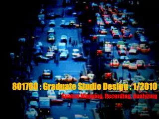
801760 : Graduate Studio Design : 1/2010 Spatial Mapping, Recording, Analyzing
Positing yourself to the city and architecture first: • - what is the city? • - Generic or constructed or both? • Accidentally happen? Or there is a duration and process? • Have you seen the city as multi-layers or meaning? • Have you seen the city as a still object or flexible entity?
how many layers you have perceived? • - physicality, boundary, route, edge, height…. • People who live in? do you think they are part of condition how we perceive the city? If so, what do we need to think of…. • Or a part of abstraction, mentality, activities, class system, prejudice, gender, social life, career… ? • How we can capture all of these aspects?
Mixed Media : Computer Graphic : Specific Program like Space Syntax
People : how to observe them : Staler : Non-Participated Observer
From Observing to Recording : Route : Connection in the space
What do we have after we map a physicality and we record data of abstraction? - Prediction, Assumption, Speculation
Different Data tell us different story : Closed Space and Open Space : Route and Road : some related conditions
Different Data tell us different story : Closed Space and Open Space : Route and Road : some related conditions
Different Data tell us different story : Closed Space and Open Space : Route and Road : some related conditions
Different Data tell us different story : Geometrical Data (Physicality), Topological Data (Movement and Connection in Space),Social Data (Abstraction), Semantic Data (Analysis)