KB Skipper Class # 2
KB Skipper Class # 2 Today’s class: It’s a motor, not an engine Charts and Navigation aids Trip planning Hull Speed Hull Speed = 1.34 * SqRt (LWL) LWL = length at water line Charlotte 21.75 = 6.25 knots Rascal 21.75 = 6.25 knots

KB Skipper Class # 2
E N D
Presentation Transcript
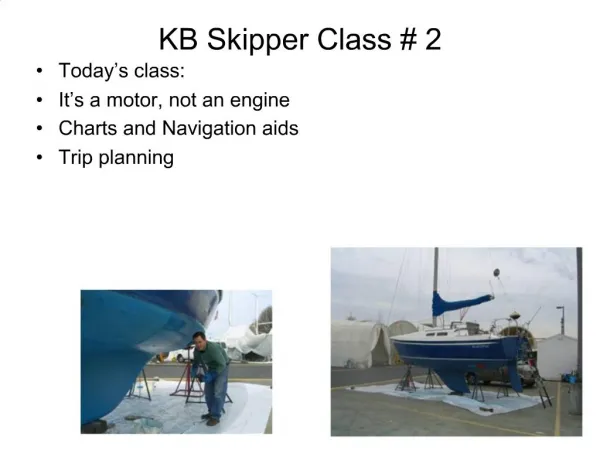
KB Skipper Class # 2 • Today’s class: • It’s a motor, not an engine • Charts and Navigation aids • Trip planning
Hull Speed Hull Speed = 1.34 * SqRt (LWL) LWL = length at water line Charlotte 21.75 = 6.25 knots Rascal 21.75 = 6.25 knots Platypus 22.0 = 6.29 knots Perspicacious 22.25 = 6.32 knots Passport 40 Sloop, lwl 33.5 = 7.76 knots Jeanneau 52 sloop lwl 41.67 = 8.65 knots 850 ft Freighter = 37 knots *
Wave of Translation The velocity of a wave is equal to its wavelength times its frequency. With frequency constant, increase the wavelength and you increase the velocity.
How long would it take a container ship to go from barely visible (Edmonds) to right on top of you (Shilshole)? 1.34 * Sq Rt (LWL) 12 Nautical Miles / 37 knots = .32 hours = 20 minutes1.34 * SqRt ( 850)1.34 * 28.3 = 37 knots 18 knots = 40 minutes ZIM Djibouti
Ferries are Fast 30 minutes from dock to dock. 17 Knots mid channel MV Tacoma 100-yard moving security zone
Electrolysis Corrosion in marine environments occurs when two (or more) dissimilar metals are brought into electrical contact under water.
Sacrificial Zinc Anode Mount on propeller shaft
Prop Shaft Zinc Anode • Electrical contact is essential – • Metal to metal.
Outboard Motor Zinc • zinc
Inboard Engines • Sacrificial zinc needed in cooling system. • Salt water acts as electrolyte
Damn outboard motors …… Sweet inboard engines
Changing the Shear Pin Exercise: Using outboard motors in the shop, have everyone change out a sheer pin. Go over various engine systems.
All buoys float Red buoys have even numbers.
Can Nun Flat Top Pointed Top Red on right, when you return from the sea
Day Marks Red = triangleGreen = square
NOAA Chart #1 Our #3 Buoy looks like this
Phase Characteristics of lighted buoys • Fixed • Flashing • Quick Flashing • Alternating
Tortilla Flats Run aground here
Eagle Harbor- all lit up! • Decatur Reef R “2” fl R 6s • Blakely Rock fl 4 s 16ft 5M • Tyee Shoal Fl (2+1) R 6s 15ft 5 MHORN (bl 15s) • R N “2” • Fl G 6s 30 ft 4M “1” • Fl G 2.5s 15ft 5 M “3” 1Bell • Fl R 4s 15ft 4M “4” • Fl G 4s “5”
Equally spaced0 to 90 degrees60 Minutes to each degree60 seconds to each minuteEach minute is one nautical mile 5400 Nautical miles from equator to the pole
Meridians are about 60 NM apart at the equator, 0 at the poles
Port Madison Latitude: 47° 41′ 57.23″ NLongitude: 122° 31′ 47.25″ W The WAC Latitude: 47° 38′ 55.18″ NLongitude: 122° 17′ 55.08″ W
Charts • Feet or meters or fathoms • Chart number • Mean Lower Low Water – depth references • Compass Rose • Special areas – traffic lanes, restricted areas • Scale: 1:8,0000 is large • 1:40,000 better • 1:8000 harbor chart
Lake Washington ship Canal Burlington Northern Bridge Clearance 43 feet (13.11 m) at high tide (mean high water of an approximate 10-foot/3.05-m tide)Ballard Bridge Clearance 44 feet (13.72 m) at center span at mean regulated lake level. Closed weekdays 7 - 9 a.m. and 4 - 6 p.m.,Fremont Bridge Clearance 30 feet (9.14 m) at center span at mean regulated lake level. Closed weekdays 7 - 9 a.m. and 4 - 6 p.m., University Bridge Clearance 42 feet 6 inches at center span at mean regulated lake level. Closed weekdays 7 - 9 a.m. and 4 - 6 p.m., Montlake Bridge Clearance 46 feet (14.02 m) at center span at mean regulated lake level. May - August, Closed weekdays 7 - 9 a.m. and 3:30 - 6:30 p.m. September - April, Closed weekdays 7 - 10 a.m. and 3:30 - 7 p.m.,
Exercise Morris Code Mo List all nav aids transiting ship canal from Puget Sound to Lake Union
Ballard Locks – 4 knot speed limit • Waiting for the locks • Fenders on both sides • 50 ft. lock lines ready • Tie to bulkhead or not • Practice the lasso • Do not get off the boat • Red light = no Green light = ready for boats to enter • Large boats first • Listen for announcement • Large Locks • If you are on the wall, how to handle the 50 ft lock lines • Do not tie across to a boat on the other side. • You will most likely be rafting up to a larger boat. • Small Locks • The attendant will tell you what number bollard to take. • Floating bollards – practice the lasso • In the locks • Fend off carefully – do not risk hands or feet to injury • Lake line secured first • Run line to cleat on boat you raft too then back – so you control the release • Cleat all lines • Watch sailboat mast locations. • Keep crew from rocking the boat. • Exiting the locks • Start engine before lock opens • Pay attention to lock attendant • Remove lake line last. • With current, boat must have way on her for rudder to bite. • If out of control, do not injure crew, boat will flush out of locks on her own. • Get out of the way of other boats coming out of the locks
Hiram M. Chittenden Locks LakeLineLast Locks 1Locks 1Locks 1Locks 1
Shilshole • Shilshole Marina • Pump out and Gas dock locations • Range markers for approaching channel in the dark. • Nun buoys and shallow water hazards in the area. • Get out of the channel before raising/lowering sails
Trip Planning Exercise: Drag out the charts, arrange on floor from Olympia to Gulf Islands and talk about destinations.