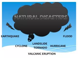
Monitor activity and earthquake
680 likes | 702 Vues
This tool allows you to estimate dip and strike, determine earthquake focal mechanisms, identify fault types, and recognize plate boundaries.

Monitor activity and earthquake
E N D
Presentation Transcript
You must be able to • Estimate the dip and strike of a plane on the stereonet • Determine the orientation of the two focal planes for an earthquake from the focal mechanism diagram • If you want to pick one focal plane as the fault plane, defend your pick on geological grounds • Determine the type of fault from the focal mechanism • Recognize plate boundaries from the pattern of focal mechanisms
Planes In Geology • Bedding of sedimentary rocks • Fault planes • Joints • Metamorphic foliation • If not a plane, then local tangent to curved surface
Measure in Field www.ougsnw.org.uk/.../ Dip%20and%20Strike.htm
Dip & Strike Strike: direction of horizontal line in plane Dip: angle from vertical of line perpendicular to strike
Planes in Geology • Dip and strike • Great circles, Poles (normal) • Sphere (3D) Circle (2D) • Plane to line • Line to point
Lower hemisphere • Great circle shows how plane cuts hemisphere • Straight line = vertical • Circle/semicircle = horizontal
Geologic Symbols http://dept.kent.edu/geology/edlab/structure/GeoMapSymbols.gif
Objectives Forces and deformation and plate motion Stereo net as required tool Fault types, stress orientation Earthquake focal mechanism (beach ball diagrams) Richter and Mercalli scales
Magnitude 8.0 NEAR COAST OF CENTRAL PERU Wednesday, August 15, 2007 at 23:40:57 UTC
Normal Fault (no tension) Figure 9.11
Reverse Fault Figure 9.11
Strike-Slip Fault Figure 9.11
P wave: faster, first arrival, pressure S wave: slower, shear or secondary arrival, does not travel in liquids
Frequency of Occurrence of Earthquakes Based on Observations since 1900
Why Are There So Many Magnitude Scales? The idea of a logarithmic earthquake magnitude scale was first developed by Charles Richter in the 1930's for measuring the size of earthquakes occurring in southern California using relatively high-frequency data from nearby seismograph stations. This magnitude scale was referred to as ML, with the L standing for local. This is what was to eventually become known as the Richter magnitude. As more seismograph stations were installed around the world, it became apparent that the method developed by Richter was strictly valid only for certain frequency and distance ranges. In order to take advantage of the growing number of globally distributed seismograph stations, new magnitude scales that are an extension of Richter's original idea were developed. These include body-wave magnitude, mb, and surface-wave magnitude, MS. Each is valid for a particular frequency range and type of seismic signal. In its range of validity each is equivalent to the Richter magnitude. Because of the limitations of all three magnitude scales, ML, mb, and MS, a new, more uniformly applicable extension of the magnitude scale, known as moment magnitude, or MW, was developed. In particular, for very large earthquakes moment magnitude gives the most reliable estimate of earthquake size. Because of the logarithmic basis of the scale, each whole number increase in magnitude represents a tenfold increase in measured amplitude; as an estimate of energy, each whole number step in the magnitude scale corresponds to the release of about 31 times more energy than the amount associated with the preceding whole number value.
Abbreviated description of the 12 levels of Modified Mercalli intensity. I. Not felt except by a very few under especially favorable conditions. II. Felt only by a few persons at rest, especially on upper floors of buildings. III. Felt quite noticeably by persons indoors, especially on upper floors of buildings. Many people do not recognize it as an earthquake. Standing motor cars may rock slightly. Vibrations similar to the passing of a truck. Duration estimated. IV. Felt indoors by many, outdoors by few during the day. At night, some awakened. Dishes, windows, doors disturbed; walls make cracking sound. Sensation like heavy truck striking building. Standing motor cars rocked noticeably. V. Felt by nearly everyone; many awakened. Some dishes, windows broken. Unstable objects overturned. Pendulum clocks may stop. VI. Felt by all, many frightened. Some heavy furniture moved; a few instances of fallen plaster. Damage slight. VII. Damage negligible in buildings of good design and construction; slight to moderate in well-built ordinary structures; considerable damage in poorly built or badly designed structures; some chimneys broken. VIII. Damage slight in specially designed structures; considerable damage in ordinary substantial buildings with partial collapse. Damage great in poorly built structures. Fall of chimneys, factory stacks, columns, monuments, walls. Heavy furniture overturned. IX. Damage considerable in specially designed structures; well-designed frame structures thrown out of plumb. Damage great in substantial buildings, with partial collapse. Buildings shifted off foundations. X. Some well-built wooden structures destroyed; most masonry and frame structures destroyed with foundations. Rails bent. XI. Few, if any (masonry) structures remain standing. Bridges destroyed. Rails bent greatly. XII. Damage total. Lines of sight and level are distorted. Objects thrown into the air. From USGS