GPS is not only TOMTOM
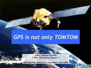
GPS is not only TOMTOM. Isaac Troyano Pujadas ( IFAE – Electronics Depart. ) IFAE Meeting, Bellaterra, November 13th 2008. Contents. History of GPS development. GPS Overview. Distance Calculation. Determining the Position. GPS Errors and Biases. GPS Applications. GPS Nowadays.

GPS is not only TOMTOM
E N D
Presentation Transcript
GPS is not only TOMTOM Isaac Troyano Pujadas ( IFAE – Electronics Depart. )IFAE Meeting, Bellaterra, November 13th 2008
Contents • History of GPS development. • GPS Overview. • Distance Calculation. • Determining the Position. • GPS Errors and Biases. • GPS Applications. • GPS Nowadays. • GPS – The Dark Side. • GPS Hacking. • Questions Introduction How does it work? GPS utilities
History of GPS development • In the early 1960s, several U.S. goverment organizations were interested in developing a satellite system for three-dimensional position determination with the following attributes: global coverage, continuous/all weather operation, ability to serve high-dynamic platforms, and high accuracy. • Three satellite systems were explored before the GPS program by differents military services: Transit, TIMATION and System 621B. • In 1969, the Office of the Secretary of Defense (OSD) established the Defense Navigation Satellite System (DNSS) program to consolidate the independent development efforts of each military service to form a single joint-use system. • The GPS program was approved in December 1973 and the first satellite was launched in 1978. • In February 1994, the Federal Aviation Agency (FAA) declared GPS ready for aviation use.
L1 Civil use L2 Military use GPS Overview • The system provides accurate, continuous, world-wide, three-dimensional position and velocity to users. • The satellite constellation consists of 24 satellites arranged in 6 orbital planes with 4 satellites per plane (with a worldwide ground control that monitors their health/status). • Two frequencies are used by the system, called L1 (1,575.42 MHz) and L2 (1,227.6 MHz). • GPS provides two separate service: • Standard Positioning Service (SPS). • Precise Positioning Service (PPS).
GPS Overview • GPS consists of three segments: • Space segment. • Control segment. • User segment.
GPS Overview • Space Segment Block IIIR satellite components. GPS orbital planes around the Earth.
GPS Overview • Control Segment Hawaii monitor station Control segment stations
GPS Overview • User Segment
GPS Overview • Markets and applications: • Land: • LBS (Location-Based Services). • AVLS (Automatic Vehicle Location Systems). • Aviation • ATC (Air Traffic Control). • Space guidance • Maritime
Distance Calculation Distance
Determining Position • 2-D Location X A Y R1 R2 TRACKING….. TRACKING….. B R3 AMBIGUITY PROBLEM Trilateration principle User GPS receiver
Determining Position • 3-D Location This links offers you the possibility to track all of GPS system satellites: http://science.nasa.gov/RealTime/JTrack/3D/JTrack3D.html
GPS Errors and Biases • The errors originating at the satellites include: • Ephemeris error. • Selective availability. • Clock error. • The errors originating at the receiver include: • Clock error. • Multipath error. • System noise. • Antenna phase center variations.
GPS Errors and Biases • Selective Availability • For national security reasons, the military sometimes degrades the C-code signal. This is called selective availability. • These errors are random. • Errors be as high as +100 meters. GPS after cancellation of Selective Availability (2001) GPS with Selective Availability (1997)
GPS Errors and Biases • Selective Availability
GPS Errors and Biases • WAAS (Wide Area Augmentation System) WAAS is a DGPS (Differential GPS) system that is a method to improve the positioning or timing performance of GPS using one or more reference stations at known locations, each equipped with at least one GPS receiver. The reference station(s) provides information to the end user via a data link that may include error corrections and integrity information. WAAS ground network. EGNOS ground network.
GPS Applications • There are lots of GPS applications that We may not know but are really • important in so many fields. These “not famous” applications are: • Utilities industry. • Forestry and natural resources. • Precision farming. • Civil engineering applications. • Monitoring structural deformations. • Open-pit mining. • Land and marine seismic surveying. • Airborne and seafloor mapping.
GPS Applications • Construction applications • Utility mapping • Forestry and precision farming
GPS Applications • GPS for monitoring structural deformations • GPS for marine and land seismic surveying. Akashi Bridge, Japan • GPS for airborne mapping.
GPS Applications • GPS for airborne mapping. LIDAR system mapping Classical aribone photogrammery
GPS Applications • GPS for airborne mapping.
GPS Nowadays - Lunar GPS - GPS Deployed in War Against Bird Flu - GPS Shoe - Track Blind People - New Quake Prediction Methods - Dynamic urban map
GPS – The Dark Side • U.S. Army GPS guided Weapons • Excalibur projectiles. • MOAB(Massive Ordnance Air Blast bomb).
GPS Hacking • GPS ‘Spoofing’
Questions …that I could answer…please…
The End Thanks for your time and attention