Download
1 / 30
310 likes | 337 Vues
This presentation discusses the importance of good governance and geodetic engineers in Disaster Risk Reduction and Management. It covers the role of Fundamental Spatial Datasets (FSD) in DRRM, emphasizing governance issues and advocating for institutionalization. The functions of FSD within the Spatial Data Infrastructure (SDI) framework are explored, highlighting the need for spatial consistency and precision. The preconditions for developing FSD, such as rule of law, participation, and accountability, are detailed, underscoring the significance of governance in building reliable geographic datasets for disaster management.

E N D
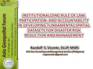
INSTITUTIONALIZING RULE OF LAW, PARTICIPATION, AND ACCOUNTABILITY IN DEVELOPING FUNDAMENTAL SPATIAL DATASETS FOR DISASTER RISK REDUCTION AND MANAGEMENT RSV Geo-Consulting and Management Services (Philippines) rsvgeomatics@gmail.com Randolf S. Vicente, DLUP, MSRS
Outline of Presentation • Background • Relevance of Fundamental Spatial Datasets (FSD) in Disaster Risk Reduction and Management (DRRM) • Importance of Good Governance in Developing FSDs • Underlying Good Governance Issues • Role of Geodetic Engineers in DRRM • The Advocacy for Institutionalization • Summary
Background The Asia-Pacific Region (UN Population Report, 2002 ) • The region shares 53 % of the world’s population; • About 20 % of land area experiences loss of life and impact to socio-economic processes; and • Nearly 70% of all lives are lost due to natural disasters.
Background Flood/Flash Flood Natural Disasters in Southeast Asia • Storm Surge Tsunami
Background Natural Disasters in Southeast Asia • Ground Rupture • Volcanic eruption • Landslides
What is Disaster Risk Reduction (DRR)? “The conceptual framework of elements considered with the possibilities to minimize vulnerabilities and disaster risks throughout a society, to avoid (prevention) or to limit (mitigation and preparedness) the adverse impacts of hazards, within the broad context of sustainable development”. Baas et. al. (2008)
Disaster Risk Reduction and Management (DRRM) A response system which includes the following activities: • Vulnerability and risk assessment; • Risk reduction and mitigation; • Pre-disaster preparation; • Emergency assistance and management; • Recovery and transition; and • Reconstruction and post-construction.
Paradigm Shift in DRRM From traditional relief to: • Preparedness and mitigation; • Integration of risk and vulnerability assessment and reduction in development planning; • Scaling up of community-based response and support systems; and • Expanding partnerships with private development stakeholders.
The Spatial Data Infrastructure (SDI) Concept • Technical and methodical enhancements of managing geographic information for a specific purpose; • Assembles geographic information descriptive of the arrangement and attributes of features and phenomena on the Earth;
The Spatial Data Infrastructure (SDI) Concept • Encompasses different building blocks such as: • Standards and interoperability • Metadata • Clearinghouse • Institutional framework • Fundamental (Core) spatial datasets • Capacity building
The Functions of FSD in Relation to SDI Development • Serves as the foundation for the integration of secondary or tertiary geographic data/information in SDI development. • Guarantees spatial consistency, precision, and reliability of geographic datasets.
Composition of FSD (Country-specific) • Geodetic Reference Frame • Basic Topography • Administrative Boundaries • Parcels or Cadastre • Elevation Models • Orthoimages • Road Networks • River Systems • Geographic Names • Others
The Importance of Good Governance in Building FSDs Definition of Good Govenance “It refers to the process of decision making and the procedure by which decisions are implemented or not implemented”. The United Nations Economic and Social Commission for Asia and the Pacific (UNESCAP)
Preconditions to Developing FSD viz Good Governance • Need for fair legal framework that are enforced impartially to fully protect human rights; legal-political regime restrains asserted by governments to promote social stability, order, and legal certainty of liberties. - Rule of law
Preconditions to Developing FSD viz Good Governance • Setting up of certain reasonable criteria in identifying and selecting stakeholders whether through direct involvement or representation of membership-based groups and associations. -Participation
Preconditions to Developing FSD viz Good Governance • Need for a mechanism to ensure that decisions and actions are made and taken, respectively, by individuals or officials who are in the best position to do so (e.g., appropriate job descriptions, duties and responsibilities) towards realizing set of objectives and needs of recipients. -Accountability
Preconditions to Developing FSD viz Good Governance • Appropriate system to ensure that processes and institutions, including the employees and officials, produce outputs or outcomes at their disposal while making the best use of allocated resources and made compliant with specified standards. -Effectiveness and Efficiency
Relevance of Good Governance in Building FSDs Other Spatial Datasets Fundamental Spatial Datasets Effectiveness and Efficiency Accountability Participation Rule of Law Good Governance
Governance-related Issues in FSD Build-up • Rule of Law - Lack of recognition and enforcement of professional regulatory laws e.g., Republic Act No. 8560, as amended, otherwise known as the “Philippine Geodetic Engineering Law of 1998”. • Participation- Limited involvement of Geodetic Engineers in FSD buildup.
Governance-related Issues in FSD Build-up • Accountability - No one is held accountable for unsound discretions, inactions, and errors committed by institutions and individual professionals mandated/tasked to build FSDs. • Effectiveness and Efficiency - The issues surrounding the first three (3) elements have compromised the timeliness of delivery and quality of outputs.
Geodetic Engineer: Definition and Scope of Practice • “A natural person who has been issued a Certificate of Registration by the Board of Geodetic Engineering and has taken Oath of Profession of Geodetic Engineers”. • The law also provides that: “The practice of geodetic engineering is a professional and organized act of gathering physical data on the surface of the earth with the use of precision instruments utilizing scientific and methodical procession of these data and presenting them on graphs, plans, maps, charts, or documents”. Philippines Republic Act No. 8560, as amended.
Statement of the International Federation of Surveyors (FIG) “The Contribution of the Surveying Profession to Disaster Risk Management”. • Ensuringgood governance • Undertaking capacity building activities Publication No. 38 (FIG Working Group 8.4, 2006)
Building FSDs for DRRM: Facts • Developing SDI is an interdisciplinary and multi-entity in nature; • Incorporates the active involvement of professionals in the field; • Mere training cannot substitute educational preparation; • Geodetic Engineers are governed by certain professional regulatory law and Code of Ethical Conduct; and • Violation of the Code results to the cancellation and revocation of license to practice profession.
The Advocacy Framework for Institutionalization Other Spatial Datasets Legal Authority Competency Fundamental Spatial Datasets Educational Background
The Advocacy • Develop the Project: “Institutionalizing Good Governance in Developing FSDs for DRRM: A Project Study for Capacity Enhancement”. • Aims to contribute to realizing an improved DRRM by way of: • Recognizing professional regulatory laws; • Rationalizing participation; • Adherence to accountability measures; and • Ensure effectiveness and efficiency.
The Advocacy • We intend to: • Cooperate in developing and implementing measures to reduce disaster losses, among others, pursuant to the ASEAN Agreement on Disaster Management and Emergency Response (AADMER); • Contribute to the enhancement of cooperation on DRRM (18th ASEAN Summit, Indonesia, 07 May 2011); and • Support the implementation of Hyogo Declaration and the Hyogo Framework for Action.
The ASEAN Charter* Article I (Purposes and Principles of the ASEAN) “To strengthen democracy, enhance good governance and the rule of law, and to promote and protect human rights and fundamental freedoms, with due regard to the rights and responsibilities of the member States of the ASEAN.” * - Signed in 20 November 2007; enforced in 15 December 2008
Summary • For an SDI to be reliable and dynamic, it must be referred to an FSD that is: • Dependable • Up-to-date • Consistent • Among other things, the above condition can be better achieved through: • Recognition and strict enforcement of professional regulatory laws • Appropriate participation mechanism • Implementing accountability measures • Ensuring effective and efficient work environment
SELECT AND DEPLOY THE APPROPRIATE PROFESSIONALS IN THE JOB! THANK YOU FOR LISTENING…