Download
1 / 14
140 likes | 245 Vues
Learn about bioregional planning, the goals of UNESCO-MAB Biosphere Reserve, community mapping, institutional collaboration, and public engagement. Discover the values and actions needed for successful implementation.

E N D
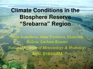
Implementing bioregional planning in the Southwest Nova Biosphere Reserve Dr. Bob Maher, Chairman of the Board Southwest Nova Biosphere Reserve Association (SNBRA), Senior Research Scientist AGRG, NSCC Middleton May 2007
Outline • What is Bioregional planning? • What are the goals of the UNESCO-MAB Biosphere Reserve? • Plan of Action: • Community mapping • Institutional collaboration • Public Engagement • Final comment
Bioregion A bioregion can be determined by use of climatology, physiography, animal and plant geography, natural history and other descriptive natural sciences. The final boundaries of a bioregion are best described by the people who have lived within it, through human recognition of the realities of living-in-place. • Berg & Dasmann 1977 Berg, P. and Dasmann, R. (1977) “Reinhabiting California, The Ecologist 7 (10): 399-401
Events in the Story of Bioregionalism • Tentative expression as intersection of concern for place, politics and ecology • Spread beyond community of origin • Coalescence and inspiration of a vocabulary • Attraction of an artistic, intellectual and literary vanguard • Articulation as unified theory informed by practice • Expression of proposed methods of applied practice • Regional and continental congresses/gatherings • Exploration of a broad intellectual history • Extension of definition to more firmly include a social/spiritual dimension • Connection/integration with other social change movements • “Discovery” by mainstream government institutions • Broadening into a body of teaching with balanced social and ecological dimension - Doug Aberley From Bioregionalism. Part 1, section 2; Interpreting bioregionalism: A story from many voices. pg 13
Values of Biosphere Reserve Concept • a conservation function - to contribute to the conservation of landscapes, ecosystems, species and genetic variation; • a development function - to foster economic and human development which is socio-culturally and ecologically sustainable; • a logistic function - to provide support for research, monitoring, education and information exchange related to local, national and global issues of conservation and development. Southwest Nova Biosphere Reserve www.snbra.ca
Community Mapping “Mapping our common ground” Community Mapping • create a sense of place • facilitates dialogue • transforms “reality” From Mapping our Common Ground; a community and green mapping resource guide. Part 1, pgs 1-2, Lee Bagrow. Editor Maeve Lydon
Mapping Food Matters A resource on place-based Food System Mapping Ground Works Learning Centre
Action Plan • Community Mapping Boundaries of Home: Mapping for Local Empowerment. Edited by Doug Akerley. The New Catalyst, Bioregional Series Chapter 5. How to map your bioregion: A Primer for Community Activists.
Specific Actions • community mapping workshop (s) • access to maps and technology • develop a network in southwest nova • create a ‘mapping’ culture • provide resources: NSCC/COGS $$, people
Institutional Collaboration • education • high school • community college • university • non Government organizations • MTRI • CARP • Bay of Fundy, MRC • TREPA
Institutional Collaboration • industry • tourism industry • resource-level industries (forestry, mining, fishing, agriculture) • government (quasi-government) • federal – Parks Canada • provincial – NSDEL, NSDNR • municipal – Annapolis Valley RDA (Annapolis & Digby counties)
Public Engagement It is not bureaucratic top-down approach
Public Engagement Who owns the map? “One thing I have learned as a professional geographer is that whoever has the maps in their hands controls the fate of the land. Cartographers have been at the forefront of turning land and nature into polygons of commodities”. Briony Penn From Islands in the Salish Sea, A Community Atlas. Foreword, pg 10.
Final Comment “Artistic community mapping is a collaboration between science, art and the community. These maps help us to understand and protect significant natural and cultural features. It’s almost as though its not the final product, the map, that saves the place; it’s the actual process of working together. The final art in a visual statement of the collaboration.” p.20 From Islands in the Salish Sea A Community Atlas edited by Sheila Harrington & Judi Stevenson