Download
1 / 6
60 likes | 230 Vues
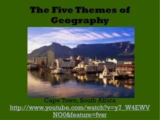
The Five Themes of Geography. By: Andrew Keller Period 1 2-10-11 Geography Mr. Jankowski. Describes where something is. World in spatial terms 3-How to analyze the spatial organization of people, places and environment

E N D
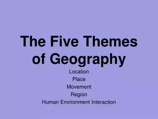
The Five Themes of Geography By: Andrew Keller Period 1 2-10-11 Geography Mr. Jankowski
Describes where something is. • World in spatial terms • 3-How to analyze the spatial organization of people, places and environment • I chose this picture because the mall is describing where Borders is located. • This could be tied in with the theme Place because Borders is a place. http://www.google.com/images?hl=en&safe=active&biw=1259&bih=599&tbs=isch%3A1&sa=1&q=pennsdale&aq=f&aqi=g1&aql=&oq= Location This is Borders located on the Lycoming Mall drive.
http://www.google.com/imgres?imgurl=http://www.nshr.com/photo_page/bridge1.jpg&imgrefurl=http://www.nshr.com/Photos%2520page.html&usg=__WNj6HAgSeBQBkgrghZqGkUVjvw0=&h=400&w=500&sz=185&hl=en&start=0&zoom=1&tbnid=iiVDntSNL7szjM:&tbnh=131&tbnw=164&ei=zRhTTeC0Gcq2tgeX5_H6Cg&prev=/images%3Fq%3Dmuncy%2Bpa%26hl%3Den%26biw%3D1596%26bih%3D692%26gbv%3D2%26tbs%3Disch:10%2C69&itbs=1&iact=hc&vpx=968&vpy=396&dur=297&hovh=201&hovw=251&tx=95&ty=145&oei=zRhTTeC0Gcq2tgeX5_H6Cg&esq=1&page=1&ndsp=32&ved=1t:429,r:29,s:0&biw=1596&bih=692http://www.google.com/imgres?imgurl=http://www.nshr.com/photo_page/bridge1.jpg&imgrefurl=http://www.nshr.com/Photos%2520page.html&usg=__WNj6HAgSeBQBkgrghZqGkUVjvw0=&h=400&w=500&sz=185&hl=en&start=0&zoom=1&tbnid=iiVDntSNL7szjM:&tbnh=131&tbnw=164&ei=zRhTTeC0Gcq2tgeX5_H6Cg&prev=/images%3Fq%3Dmuncy%2Bpa%26hl%3Den%26biw%3D1596%26bih%3D692%26gbv%3D2%26tbs%3Disch:10%2C69&itbs=1&iact=hc&vpx=968&vpy=396&dur=297&hovh=201&hovw=251&tx=95&ty=145&oei=zRhTTeC0Gcq2tgeX5_H6Cg&esq=1&page=1&ndsp=32&ved=1t:429,r:29,s:0&biw=1596&bih=692 • Describes what a location looks like. • Places and Regions • 4-The physical and human characteristics of places • I picked this picture because the bridge is in Muncy and Muncy descibes what the location of the bridge looks like. • Movement, Human Environment Interaction Place This is the railroad bridge in Muncy.
How people interact with the environment. • Human Systems • 14-How humans actions modify the physical environment • The farmer farms the crops that the land gives him, they benefit each other. • None http://www.google.com/imgres?imgurl=http://static.img4tw.com/i/bd08d562.jpg&imgrefurl=http://fullrshare.com/games/49021-farming-simulator-gold-edition-rip98-mb..html&usg=__pqxR6oNUiicarpK9N3Iu2WkBt80=&h=500&w=800&sz=339&hl=en&start=53&zoom=1&tbnid=FfuujfU-uM33hM:&tbnh=120&tbnw=167&ei=gBtTTbyHK8H58AbCgs3qCQ&prev=/images%3Fq%3Dfarming%26hl%3Den%26sa%3DG%26biw%3D1596%26bih%3D692%26gbv%3D2%26tbs%3Disch:1&itbs=1&iact=rc&dur=265&oei=MxpTTfm4Gs2_tgeDyb2ACw&esq=2&page=3&ndsp=35&ved=1t:429,r:9,s:53&tx=104&ty=83 Human Environment Interaction Farming is an example of Human Environment Interaction
How people, goods, and ideas move between places. • Environment and Society • 15-How physical systems affect human systems • The plane is moving goods from one place to another. • None http://www.google.com/imgres?imgurl=http://www.doctorswithoutborders.org/images/news/2008/Myanmar-Burma-Cyclone-Cargo-Plane-Aid-41976.jpg&imgrefurl=http://www.doctorswithoutborders.org/news/article.cfm%3Fid%3D2692&usg=__i24gLGi2GUtSgZbq1_WsdEEkYSY=&h=366&w=550&sz=78&hl=en&start=178&zoom=1&tbnid=eI8dmVSqNScFmM:&tbnh=122&tbnw=163&ei=xCNVTeWYNsqDtwfHtp3mDA&prev=/images%3Fq%3Dcargo%2Bplanes%26um%3D1%26hl%3Den%26sa%3DN%26biw%3D1579%26bih%3D692%26tbs%3Disch:10%2C3597&um=1&itbs=1&iact=hc&vpx=839&vpy=379&dur=3806&hovh=183&hovw=275&tx=155&ty=130&oei=hiJVTZ_cFYS5tgedydSkDQ&page=7&ndsp=32&ved=1t:429,r:28,s:178&biw=1579&bih=692 Movement This is a cargo plane being unloaded at Yangon airport.
http://www.google.com/imgres?imgurl=http://cmaner5.org/images/Maps/NortheastRegion.jpg&imgrefurl=http://cmaner5.org/regional-map.aspx&usg=__DbgmxzTvxqrNt3VvP5zrEyr3Y_I=&h=355&w=350&sz=27&hl=en&start=0&zoom=1&tbnid=PSCJkoKOegJNPM:&tbnh=165&tbnw=157&ei=PABTTaiEPNCftwet1dTtCg&prev=/images%3Fq%3Dnorth%2Beast%2Bregion%26hl%3Den%26biw%3D1596%26bih%3D692%26gbv%3D2%26tbs%3Disch:1&itbs=1&iact=hc&vpx=134&vpy=111&dur=188&hovh=226&hovw=223&tx=149&ty=135&oei=PABTTaiEPNCftwet1dTtCg&esq=1&page=1&ndsp=23&ved=1t:429,r:0,s:0http://www.google.com/imgres?imgurl=http://cmaner5.org/images/Maps/NortheastRegion.jpg&imgrefurl=http://cmaner5.org/regional-map.aspx&usg=__DbgmxzTvxqrNt3VvP5zrEyr3Y_I=&h=355&w=350&sz=27&hl=en&start=0&zoom=1&tbnid=PSCJkoKOegJNPM:&tbnh=165&tbnw=157&ei=PABTTaiEPNCftwet1dTtCg&prev=/images%3Fq%3Dnorth%2Beast%2Bregion%26hl%3Den%26biw%3D1596%26bih%3D692%26gbv%3D2%26tbs%3Disch:1&itbs=1&iact=hc&vpx=134&vpy=111&dur=188&hovh=226&hovw=223&tx=149&ty=135&oei=PABTTaiEPNCftwet1dTtCg&esq=1&page=1&ndsp=23&ved=1t:429,r:0,s:0 • An area that is defined by common characteristics. • Places and Regions • 5-How people create regions to interpret Earth’s complexity • The picture goes with the theme because the United States are split into different regions and the North East region is one of them. • None This is a picture of the North East region of the United States of America. Region