Download
1 / 13
130 likes | 146 Vues
This presentation by Menghua Wang explores the requirement, science, and benefit of weather and water information for improved decision-making. It also discusses the challenges and next steps in accurately remote sensing water properties and improving water resources forecasting capabilities.

E N D
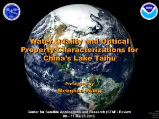
Water Quality and Optical Property Characterizations for China’s Lake Taihu Presented by Menghua Wang
Requirement, Science, and Benefit Requirement/Objective • Weather and Water • Serve society’s needs for weather and water information • Better, quicker, and more valuable weather and water information to support improved decisions • Increase lead time and accuracy for weather and water warnings and forecasts • Improve predictability of the onset, duration, and impact of hazardous and high-impact severe weather and water events • Increase coordination of weather and water information and services with integration of local, regional, and global observation systems • Ecosystems • Protect, restore and manage the use of coastal and ocean resources through ecosystem-based management • Healthy and productive coastal and marine ecosystems that benefit society • A well informed public that acts as a steward of coastal and marine ecosystems Science • How to provide accurate water optical, biological, and biogeochemical property data in coastal and inland regions from satellite measurements? Benefit • Improve water resources forecasting capabilities • Protect and monitor water resources • Understand the effect of environmental factors on human health and well-being
Challenges and Path Forward • Science Challenges • Accurate remote sensing of the water properties is still challenges for: (a) complex coastal and inland waters and (b) for absorbing aerosols. • Next Steps • Continue efforts for improving the remote sensing data products for coastal and inland waters. • Demonstrate various applications for using the improve data products. • Transition Path • We will implement research results into NOAA operational data processing, e.g., the NOAA SWIR project, which will be operation in this year.
Improved Water Optical Property Data in Coastal and Inland Regions • SWIR-based Atmospheric Correction Algorithm: the shortwave infrared (SWIR) atmospheric correction algorithm has been developed and demonstrated to provide improved ocean color products in coastal and inland waters. • Inland Lake Taihu: contains consistently highly turbid waters, and the derivation of MODIS lake property data requires using the SWIR method, due to significant water-leaving radiance contributions at the near-infrared (NIR) bands. • Standard Satellite Ocean Color Data Processing: often fails to produce any valid products in very turbid waters, e.g., in Lake Taihu, due to an incorrect assumption and/or computation of the NIR water contributions. • Quantitative Characterization of Aquatic Optical and Biological Property: for Lake Taihu is demonstrated using the SWIR-based algorithm from MODIS-Aqua measurements. • Research Results Demonstrate: an application of satellite-derived imagery for inland water quality monitoring, assessment, and management.
SWIR-based Ocean Color Products for Various Applications • Coastal Phytoplankton Bloom Study: Observations of Hurricane Katrina-induced phytoplankton bloom in the Gulf of Mexico (Shi and Wang, 2007; Liu et al., 2009). • Ecosystem Responses to Major Weather Event: Three-dimension observations from MODIS and CALIPSO for ocean responses to Cyclone Nargis in the Gulf of Martaban (Shi and Wang, 2008). • River Estuary, River Dynamics and River Plume: Satellite observations of flood-driven Mississippi River plume in the spring 2008 (Shi and Wang, 2009). • Stormwater Plume Detection: Stormwater plume detection in the southern California coastal ocean (Nezline et al., 2008). • Coastal and Inland-water Hazard Monitoring:Satellite-observed blue-green algae blooms in China’s Lake Taihu (Wang and Shi, 2008). • Environmental Responses to a Land Reclamation Project: Satellite-observed drastic changes in marine environment in response to the Saemangeum Reclamation Project in South Korea (Son and Wang, 2009). • Monitoring Green Macroalgae Blooms in Yellow Sea: Satellite observation and monitoring of green macroalgae blooms in the Yellow Sea during the spring and summer of 2008 (Shi and Wang, 2009).
Satellite (MODIS) Observed Blue-Green Algae (Microcystis) Bloom MODIS Images:True Color, Chlorophyll-a, andRadiance Quantitative Measurements The work was featured in the NASA 2008 Sensing Our Planet (http://nasadaacs.eos.nasa.gov/articles/2008/2008_algae.html)
Diffuse Attenuation Coefficient Kd(490):Water Turbidity and Water Quality
Significant NIR radiance nLw(859) contributions in Lake Taihu
Validation Results for MODIS-derived Water-leaving Radiance Spectra
Challenges and Path Forward • Science Challenges • Accurate remote sensing of the water properties is still challenges for: (a) complex coastal and inland waters and (b) for absorbing aerosols. • Next Steps • Continue efforts for improving the remote sensing data products for coastal and inland waters. • Demonstrate various applications for using the improve data products. • Transition Path • We will implement research results into NOAA operational data processing, e.g., the NOAA SWIR project, which will be operation in this year.