Download
1 / 16
160 likes | 284 Vues
This document outlines the comprehensive framework for addressing and mapping within West Virginia, utilizing the Statewide Addressing and Mapping System II (SAMS II) via ArcGIS Desktop. It details primary and secondary data layers, including sites, addressable and non-addressable locations, road centerlines, emergency service zones, and various geospatial features such as building footprints and historical sites. The report also discusses the functionalities of web-based tools for maintenance, validation, and data stewardship aimed at enhancing the accuracy and accessibility of address data.

E N D
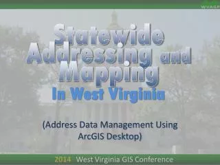
Statewide Addressing and Mapping In West Virginia (Address Data Management Using ArcGIS Desktop)
Primary Data Layers • Sites • Addressable • Non-addressable • Other • Road Centerlines
Secondary Data Layers • ESZ (Emergency Service Zones) • Site Drop Lines – (legacy) • used only to show the connection between site and street • or Address Point (address/driveway point) • Historical Sites • Alternate Streets • Adjacent Geographies • Building Footprints • Bldg_ID • Site_ID Type • Evac Zones • Fire Hydrants • Points of Interest • Basemaps (cloud based) • Aerial Imagery
Non-spatial Tables • OLD addresses (crosswalk table) • Site ID – Structure multi-address table • Municipal Zones • MSAG (Master Street Addressing Guide)
Geodatabase • ESZ (Emergency Service Zones) • Site Status (addressable) • Confirmed • Not Confirmed • Street Centerline • Named, ranged • Named, not ranged • Not Named • Site Drop Lines – (legacy) (LGIM uses address point) • used only to show the connection between site and street • Site with Old Address • Building Footprint • Bldg_ID • Site_ID Type
Geodatabase Domains • ESZ (Emergency Service Zones) • Valid Zones • Site • Confirmed/ Not Confirmed • Site Type • Street Centerline • Name / Alt Names • Road Type • Surface Type • Building Footprint • Bldg_ID • Site_ID Type
Editable Layers • Sites • Street Centerline • ESZ (Emergency Service Zones) • Site Drop Lines – (legacy) • Address Point • Building Footprint
Workflow • Site (New) • Site (Update) • Site Status (addressable) • Confirmed (field verified) • Not Confirmed • Street(New) • Plan • Field (GPS) • Street (Update) • Geometry • Attributes
Workflow –continued • Building Footprint • Aerial update • Temp (Sketch) • Plan (submitted) • Mass replacement • persistent ID through update? • Historical
Discussion! • Notes:
Statewide Addressing and Mapping In West Virginia (SAMS II)
SAMS II • DOES NOT REPLACE CAD SYSTEMS • Web-based Maintenance Tool • Web-based Public Validation Tool • Integrated Disconnected Maintenance
SAMS II • Web-based Maintenance Tool • Portal for Address Data Stewards • Provides address feature editing tools • Sites • Centerlines • Provides unified data model • Core Geometries (Features) • Core attributes
SAMS II • New Site Tools • Each address has a default address range value • may be altered for non-standard communities • Input by X,Y / Lat,Long/ Click on map • Suggested Address Number • Auto-populate fields, based upon selected road centerline • Needs a Left/Right designator • Web-based Public Validation Tool • Integrated Disconnected Maintenance • Feature Access Service? • Distributed GDB replica? • ArcGIS Mobile Compatible?
SAMS II - DEMO • Sneak peak at current development • SAMS II test server