Download
1 / 44
440 likes | 518 Vues
International Charter Space and Major Disasters. International Charter Brief Jim Dickerson MGIO 6/11/2009. Satellite Imagery Support. Disaster Occurs. Presidential Disaster Declaration. 2 weeks. Pre-disaster. FEMA handles requests ($$). USGS-EROS handles requests (no $).

E N D
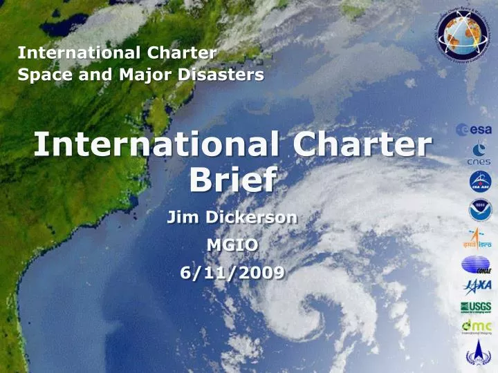
International Charter Space and Major Disasters International Charter Brief Jim Dickerson MGIO 6/11/2009
Satellite Imagery Support Disaster Occurs Presidential Disaster Declaration 2 weeks Pre-disaster FEMA handles requests ($$) USGS-EROS handles requests (no $) USGS-EROS handles requests (no $) USGS controlled satellites: LandSat ASTER MODIS USGS Archives LandSat ASTER MODIS NGA NextView – Ikonos GeoEye Worldview QuickBird Natl Guard EagleVision – SPOT NGA NextView Program – Ikonos GeoEye Worldview QuickBird COMSAT Intl Charter Prog. – RADARSAT (Canada) SPOT (France) JAXA (Japan) DMS (Britain) EO (Europe) . . .
Where the International Charter Fits in the Overall Scheme • There are some points in the disaster timeline where satellite support is available, but the access changes. • The International Charter is invoked when these assets are not sufficient for the desired end products. • This discussion does not include airborne imagery, just satellites.
Where the International Charter Fits in the Overall Scheme • Pre-Disaster • USGS has their own assets at no cost to end user. • USGS can task commercial satellites through NGA before presidential declaration. • Hands over to FEMA after presidential declaration. • Air Force collects SPOT data via EagleVision program. • Post-Declaration • NGA tasks classified sources via FEMA. • When JFO is set up, it has authority.
International Charter Space and Major Disasters History and Operations
Purpose • An International agreement among Space Agencies to support with space-based data and information relief efforts in the event of emergencies caused by major disasters. • Disaster response • Won't activate for war, drought • Multi-satellite data acquisition planning • Fast data turn-around – priority acquisition • Archive retrievals and spacecraft tasking • Data processing at pre-determined level • Space Agency contribution in image/data • Space Agency initiative for value-added-data fusion
Charter Member Agencies CSACanada ESADMC Europe CNSA China JAXA Japan CNESFrance NOAA USGS USA ISRO India CONAE Argentina
Charter Activation Cases (disaster types) As of April 30, 2009
Activation Distribution Floods and storms Costa Rica Peru Flood/ocean wave Storm/hurricane As of April 30, 2009
Activation Distribution Earthquakes, volcanic eruptions and landslides Earthquake Volcano Landslide As of April 30, 2009
Activation Distribution Oil spills, forest fires and other hazards Oil spill Fire Ice/snow hazard Other As of April 30, 2009
End User (EU) • The End User is not specifically defined. • The EU is the organization that is involved in the disaster. • The EU is the organization that will benefit from the International Charter data. • The EU doesn’t need to know a thing about satellites or imagery, but needs to know what end product is needed: • Flood extent polygons • Burn areas • Lava flow polygons • This is also referred to as the derived product
Lena river flood, Russia Flooded area extracted from RADARSAT and SPOT RADARSAT-1 S6 image May 24, 2001
May 19, 1999 June 15, 2002 Manitoba flood, Canada Flood mapping B B
Galicia oil spill, France Oil spill detection Prestige oil tanker spill disaster From Libération ScanSAR Narrow RADARSAT-1 image November 22, 2002
British Columbia Forest Fire, Canada Multi-spectral, multi-date images acquired over Okanagan Mountain August 29, 2003 August 30, 2003
Tsunami, Indonesia Banda Aceh, West area
Authorized User (AU) Interfaces • AU – End User • In the USA, the USGS has this position • End-User or representative requests support. • Provides disaster definition • Provides bounding box • Provides definition of end products • AU confirms disaster and appropriateness of request
Authorized User (AU) Interfaces • AU – On-Duty Operator (ODO) • AU calls the ODO and submits the User Request Form (URF) • ODO checks the identity of the calling AU • ODO confirms the reception of the URF and its completeness
Authorized User (AU) Interfaces • AU – Emergency on-Call Officer (ECO) • ECO calls the AU for information on the Disaster • Only the ECO initiates the call and obtains the AU input • Geographical location of the affected area • Type of disaster • Extent of disaster • Type of data processing/product (if applicable) • Target delivery time • Delivery medium and address • Any additional information
Authorized User (AU) Interfaces • AU – Project Manager (PM) • PM is selected by AU from a list of potential PM’s • Selectee agrees to take the job, become the PM for that disaster • PM contacts directly the ODO if required • PM obtains further information on the requirement • PM apprises the AU with regard to the data acquisition planning • PM solicits AU's appraisal of the Charter activation
International Charter 'Space and Major disasters' Project Manager Functions
Project Manager Role The Executive Secretariat designates the PM by taking into consideration the following criteria: • Geographical region of the disaster occurrence; • Disaster type; • Sensor(s) used to cover the disaster; • Availability of potential PMs among Parties/Partner Agencies; • Fair distribution of PMs among Parties/Partner Agencies; • Value-added processing proposal by a Party/PA according to the AU request. The PM receives the Dossier on the disaster from the ECO. The PM interacts with the AU on all the data and information requirements and with other parties for any required delivery of value-added products and information.
Project Manager knowledge The PM has experience base in the following areas: Remote sensing satellites, their supporting ground systems; Data delivery networks; Remote sensing data application, particularly in disaster management Civil Protection Agencies and their mandates; Remote sensing data value adding; Project management
Project Manager knowledge The PM has a good understanding of predefined Scenarios. The PM is completely familiar with the Charter 'Space and Major Disasters' and the level of data commitment of each Party/PA.
Project Manager (PM) Interfaces • PM and Authorized User (AU) • The PM contacts the AU to obtain further description of the disaster, special data and information needs • The PM provide updated information concerning data acquisition and special data or information product delivery.
Project Manager (PM) Interfaces • PM and Emergency On-Call Officer (ECO) • PM contacts the ECO concerning the reception of the dossier. The PM receives the Dossier of the disaster event from the ECO or downloads the elements from the ftp site. The PM populates this folder with the activation documents, maps, correspondence, etc. If deemed necessary for operations, raw images may transit in this folder for a short period of time.
Project Manager (PM) Interfaces • PM and Executive Secretariat (ES) • Prepares a preliminary report for the event based on the contacts with the requestor and the information and documents provided. Delivery of the preliminary report to the ES should be made within one month after activation of the Charter. • Suggests improvements, if any, in the implementation procedure of the predefined PM Scenario. • Writes up a final operation report - for delivery to the ES within three months of Charter activation - taking into account comments from participating bodies affected by the disaster.
Responsibility of the PM • PM acquires an in-depth knowledge of the disaster and the data requirements. • The PM ensures fast data, information and services delivery directly to the requestor or through the Civil Protection Agency concerned, or through such channels as those allowing quick turnaround. • The PM builds a preliminary report of the event based on the Dossier forwarded by the ECO • The PM builds a final report which contains the following information: • An small introduction with purpose and scope • A summary of the intervention: • Project details • Chronology of events • Available satellite data • The assessment of the Intervention: • Main project issues • Results of value-added processing if provided • User feedback • Conclusions on the project • Recommendations for improving Scenarios • In Appendixes: • General information – Map of the area • Media coverage of the disaster (national TV, radio, news agencies/papers, web sites, etc.) • User Request Form (URF) • Emergency Data Request Submission forms for the various satellites tasked • Copy of final value added products delivered
Responsibility of the PM • PM contacts space agencies directly. • PM can task resources (satellites) with high priority over paying customers. • PM needs to know who will act as Value Added Reseller (VAR). • USGS has no money for VAR. • USGS has limited capabilities as VAR. • PM insures the flow of data to VAR and End User. • PM has to enforce the license agreements of each agency.
Charter Operational Loop Emergency On-Call Officer (ECO) CSA RADARSAT-1 ESA ERS-2 and ENVISAT CNES SPOT-1, 2, 4 & 5 On-Duty Operator (ODO) NOAA-12, 14, 15, 16 & 17, POES and GOES NOAA ISRO IRS Project Manager (PM) Authorized User (AU) CONAE SAC-C JAXA ALOS USGS Landsat Disaster CNSA DMC CBERS DMC Constellation End User (EU) Value-Added Reseller (VAR)
Charter Operational Loop Project Manager (PM) Value-Added Reseller (VAR) CSA RADARSAT-1 ESA ERS-2 and ENVISAT CNES SPOT-1, 2, 4 & 5 NOAA-12, 14, 15, 16 & 17, POES and GOES NOAA ISRO IRS Authorized User (AU) CONAE SAC-C JAXA ALOS USGS Landsat DMC DMC Constellation Disaster CNSA CBERS End User (EU)
What’s the Catch? • The Intl. Charter is for response, not recovery. • There’s a time limit to how long it can be invoked. • The initial request should specify the response use. • Data from the Intl. Charter is no cost, but it is not free. • Someone pays, in most cases the individual space agencies for each satellite. • Charter has higher priority over paying customers. • There’s an obligation to have the means to use the data to create end products for the user.
What’s the Catch? • Sponsoring agencies are expected to pay for PM’s time. • In return for free data, the sponsoring agency is loaning a body to run the International Charter Program. • PM is not a full-time position, but a high-priority position. • The International Charter is the highest priority. • The level of effort of depends on local arrangements. • Once the appointment is made, it is for the duration of the charter activation.
What’s the Catch? • The Charter stops at providing the data. • The success of the Charter depends on having a Value Added Reseller (VAR) to process the data into derived products for the end user. • PM needs to know who will act as VAR. • USGS has no money for VAR. • USGS has limited capabilities as VAR. • USGS will provide technical and legal assistance. • Without a VAR, there’s no reason to activate the Charter. • An emergency is the wrong time to start looking for a VAR and learning procedures.
What’s the Catch? • Minnesota has no VAR defined. Likely candidates are: • AmericaView – Support organization for remote sensing • University of Minnesota is a participant • Other universities, such as St. Mary’s. • GISCorps – a volunteer group spinoff of URISA, may require $$ • Commercial vendors - $$$ • MN DNR • Some kind of MOU needs to be in place for this support.
What’s the Catch? • Data can’t be shared but derived products can be. • A derived product can be: • Imagery processed into classified types • Vector files created from data • Imagery used in a map or document • Most of the data is licensed. • Agencies will buy data, usually single user license, but can be upgraded. • Per each license, the data must be removed from use at the expiration of the license or deactivation of the charter.
What’s the Catch? • The IC is activated for emergencies/disasters only. • Emergency is whatever the state says it is, economic impacts, danger to people. • Only denied if well past date. • Won’t activate for war or drought • Will activate for disasters caused by war • Once Presidential Disaster Declaration is issued, FEMA handles requests for commercial imagery. • The IC program is still run by USGS. • Any support already initiated is continued (except commercial).
What’s the Catch? • Derived products need to have attribution to each satellite used. • Space needs to be reserved on maps for logos. • Naming convention can be used for data files.
Summary • To use the International Charter, an agreement needs to be formed with an organization capable of acting as a VAR. • MGIO is looking at the problem and welcomes any suggestions.
Satellite Imagery Support Disaster Occurs Presidential Disaster Declaration 2 weeks Pre-disaster FEMA handles requests ($$) USGS-EROS handles requests (no $) USGS-EROS handles requests (no $) USGS controlled satellites: LandSat ASTER MODIS USGS Archives LandSat ASTER MODIS NGA NextView – Ikonos GeoEye Worldview QuickBird Natl Guard EagleVision – SPOT NGA NextView Program – Ikonos GeoEye Worldview QuickBird COMSAT Intl Charter Prog. – RADARSAT (Canada) SPOT (France) JAXA (Japan) DMS (Britain) EO (Europe) . . .