The World into which Jesus Came
250 likes | 497 Vues
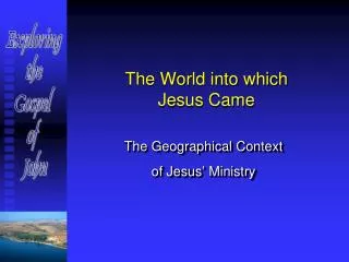
The World into which Jesus Came. The Geographical Context of Jesus’ Ministry. EAST. Sea of Galilee. Capernaum. Jordan Valley. Dead (Salt) Sea. Jericho. Sychar. Nazareth. Jerusalem. SOUTH. NORTH. FYI: Satellite Maps are East-oriented! East is at the top!. WEST.

The World into which Jesus Came
E N D
Presentation Transcript
The World into which Jesus Came The Geographical Context of Jesus’ Ministry
EAST Sea of Galilee Capernaum Jordan Valley Dead (Salt) Sea Jericho Sychar Nazareth Jerusalem SOUTH NORTH FYI:Satellite Maps are East-oriented! East is at the top! WEST
Texture of the Terrain The land of Israel is not flat! Elevations may vary from 1200 ft. below sea level (in the lower Jordan Valley) to 3000 ft. above sea level (on the Judean/Samaritan ridge.) • Horizontal: We note the distances and routes that determine walking times between points. • Vertical: We note the differences in elevations along travel routes and the difficulties these may present. • Jericho to Jerusalem – a 3500 ft. climb in just 15 miles! • Nazareth, situated 800 ft. above the Plain of Esdraelon • Capernaum, located 700 ft. below sea level on the Sea of Galilee
E GAULANITIS DECAPOLIS (city states) Philip PEREA Herod Antipas Sea of Galilee Dead (Salt) Sea Wilderness of Judea GALILEE PHOENICIA Herod Antipas Jerusalem SAMARIA Pilate (Prefect) JUDEA Caesarea Maritima IDUMIA Mediterranean Sea First Century A.D. Rulers of Palestine (after the death of Herod the Great in 4 B.C.)
E GAULANITIS DECAPOLIS (city sates) PEREA Sea of Galilee Dead (Salt) Sea GALILEE PHOENICIA Jerusalem SAMARIA JUDEA IDUMIA Caesarea Maritima Mediterranean Sea First Century A.D. Palestine political regions (Samaria was governed as part of Judea.)
Jordan Valley E Jericho to– Jerusalem 17 miles 3500’ascent Scythopolis - 374’ Jericho -1200’ Mt. Gilboa Wadi Faria 1640’ Hill Country of Samaria Jacob’s Well The Ridge Road 3084’ Bethel Jerusalem 3000’ 2300’ Hill Country of Samaria 2526’ 3000’ Hill Country of Judea The “International Highway” MESOPOTAMIA Antipatris 410’ Plain of Sharon EGYPT Contours of the Land
Jordan Valley E Sea of Galilee Jordan Valley Capernaum Tiberias Mt. Meron Mt. Tabor Valley of the Doves Mt. Gilboa Hill of Moreh UPPER GALILEE LOWER GALILEE Cana Nazareth Sepphoris Bet Haccarem Valley Plain of Esdraelon (Jezreel) Bet Netofa Valley Mt. Carmel The Galilee of Jesus’ day
The Black Sea The Caspian Sea Nineveh The Fertile Crescent MESOPOTAMIA The Great Sea Babylon Israel Memphis EGYPT Israel, “The Land Between,” lies on the “International Highway” that links the great civilizations of Egypt and Mesopotamia. The Persian Gulf The Red Sea
Jordan Valley E Sea of Galilee Damascus Mesopotamia 0’ Jordan Valley - 690’ Capernaum -722’ Damascus Mesopotamia Tiberias Migdal Jerusalem Sermon on the Mount?) Valley of the Doves Mt. Tabor Mt. Meron 1690’ 3963’ Mt. Gilboa 1640’ Hill of Moreh 1700’ UPPER GALILEE LOWER GALILEE 492’ Cana Nazareth 1312’ Sepphoris Bet Haccarem Valley Valley of Esdraelon Bet Netofa Valley 492’ Egypt Mt. Carmel 1580’ Acco Nazareth to Jerusalem route The Galilee of Jesus’ day (elevations in feet)
Gamala E GAULANITIS DECAPOLIS Gadara Hippus Kursi Bethsaida Sea of Galilee Capernaum Chorazin Tabgha Tiberias Migdal 830’ descent to the lake GALILEE UPPER GALILEE LOWER GALILEE The Sea of Galilee: Center of Jesus’ Galilean ministry
Sea of Galilee Harbors • Under Roman rule, hundred of vessels plied the waters of the lake; 19th century travelers mention only a few. • The Sea of Galilee is known for its sudden storms, and in rough weather crews needed safe moorings. • With no natural harbors, the earliest fishermen and sailors dragged their boats onto the shore. • Dependent on fishing and lake transport, towns around the lake later built protected mooring places (“harbors”). • The Romans were known for their superior construction of harbors so we assume that the harbors date from this period. • Fifteen ancient harbors were discovered along the lakeshore during the seasons of low lake levels between 1973 and 1986. Based on Mendel Nun: Sea of Galilee Newly Discovered Harbours from New Testament Days, pp 3-5
E TETRARCHY OF PHILIP DECAPOLIS Gadara Ein Gev Kfar Aquavit Kursi Susita Bethsaida Gadara (harbor) Bethsaida Julias Aish Sea of Galilee Capernaum Philoteria Sennabris Tabgha Tiberias Ginnosar Migdal Recently discovered harbors around the Sea of Galilee (1st centuries B.C. and A.D.) GALILEE
E DECAPOLIS TETRARCHY OF PHILIP Kursi Bethsaida 12.5 miles Capernaum 7.5 miles Tabgha Tiberius Migdal GALILEE Valley of the Doves 830’ descent to the lake The Sea of Galilee lies 690 feet below sea level
E Bethsaida Sea of Galilee Capernaum Tiberias
Valley of the Doves Tiberias Migdal S N Mount of the Beatitudes? Northwestern shore of the Sea of Galilee