Discover Smokies Hiking Trails: Adventure Awaits in the Great Outdoors
210 likes | 233 Vues
Explore over 850 miles of diverse hiking trails in the Smokies Park. From historic routes to scenic waterfalls, there's a trail for everyone to enjoy. Plan your hike with trail maps, stay at campsites, and learn about trail highlights and cautions. Discover the beauty of the Smokies today!

Discover Smokies Hiking Trails: Adventure Awaits in the Great Outdoors
E N D
Presentation Transcript
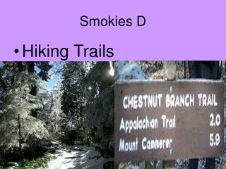
Smokies D • Hiking Trails
Hiking Trails • 850 miles-some old roads, some Indian trails, etc, some built by CCC. • Some trails are foot travel only & some both horse/foot.
Trails • Trail Maps cost $1.00 (Honor system at Park) • Trail distances are measured between junctions.
Campsites # 1-98 • Those in bold or pink require a reservation(865-436-1231) • H means horse. • Campsite elevation is listed on the back. • Permits are required. Free !
Areas • Cades Cove • Elkmont/Tremont • Greenbrier/Cosby • Cataloochee/Big Creek • Oconaluftee • Deep Creek
Areas • Noland Creek • Forney Creek • Hazel Creek • Twentymile • Fontana Lake
Shelters • 16 shelters are mostly located on the 70+ miles of Appalachian Trail in the park and are mainly intended for thru hikers.
Clockwise: Cosby, Mollies Ridge, Pecks Corner, Mt. Collins-whiteblaze.net
Trail Highlights • Waterfalls-ex. Ramsay Cascades • Virgin Forests-Baxter Creek • Historic-Little Cataloochee • Views-Mt. Cammerer • Wildlife-Cades Cove
Types of Hikes • Day Hikes, Loops, In/Out, Drop Offs, Thru, Overnight • Further info (book)-Hiking Trails of The Smokies
Planning/Considerations • Traffic, Trail distance, points of interest, elevation, danger, availability of campsite, water supply, time of year
Cautions • Hypothermia, Lost, Bears, Injury, Falls, Stream Hazards and crossings, road closure, winter, drinking water
Road access • I-40, US 441, US 129, US 321, US 416, US 19, US 32
Rules • Minimal Impact-Camp only in sites, Max. party size 8, Fires within area and ground wood, Food Storage (bears), Toilet, trash, No collection of defacing, Pollution of streams, firearms, feeding/harassing wildlife.
Mt. Leconte trails • Alum Cave Bluff, Rainbow Falls, Boulevard, Trillium Gap, Bullhead, Brushy Mountain. There is a shelter and a lodge on top.