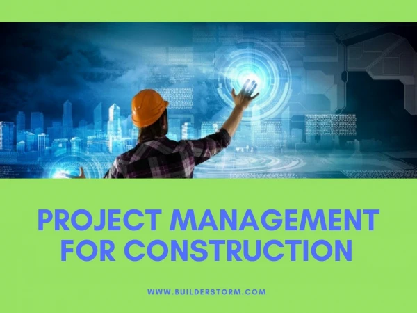
GeoSpatial Technologies: Revolutionizing Construction Project Management
This whitepaper explores how GeoSpatial solutions are transforming the construction industry by enabling better planning, monitoring, and execution of projects. The document examines how technologies like LiDAR, GPS, remote sensing, and enterprise GIS systems help construction companies identify potential issues before breaking ground, monitor progress in real-time, and create comprehensive as-built documentation.<br><br>https://www.ltimindtree.com/wp-content/uploads/2022/09/Geospatial-Solutions-will-transform-the-construction-process.pdf?pdf=download


GeoSpatial Technologies: Revolutionizing Construction Project Management
E N D
Presentation Transcript
CASE STUDY GeoSpatial Solutions will transform the construction process
Unexpected delays and overruns plague the architecture, construction and engineering industries. However, what if they are avoidable? Anticipating and out-planning the unexpected will become not only possible but practical as new GeoSpatial technologies rapidly gain adoption, allowing organizations to spot problems and devise solutions before the first shovel hits the dirt. Site characteristics play a massive role in how a project is designed, bid out and built. However, gaining access to assess geological conditions through dense forest cover and other physical obstacles isn’t easy. In many cases, a project may make it to the point of breaking ground with a full crew before learning of obstacles that could seriously impact or delay construction. Identifying complicated factors early on is critical to planning effectively and staying on schedule and budget. GeoSpatial solutions like Aerial Light Detection and Ranging (LiDAR) can streamline and simplify nearly every step of the design and build process—and increasingly transform how organizations approach large-scale projects. Addressing Pain Points in the Construction Process Carefully evaluating the site is critical to keeping a construction project on schedule and budget. Terrain characteristics, geological features and existing structures must be considered at every stage of the process. Unfortunately, traditional methods for site surveying may be insufficient to anticipate every issue. Ground-level surveillance technologies can be tampered with or disrupted—and private properties can complicate movement. Moreover, there are a variety of survey and measurement types—most of which provide insufficient data for a project. Land surveys can provide an accurate starting point for where abutting property lines begin and end, but they fall short at accounting for the land in between. For example: • Boundary surveys do exactly as the name implies—they simply show property boundaries. This is useful in scoping a project, but it can’t tell you what equipment or timeline to plan for—or what challenges the crew might face. • Topographic surveys analyze the slope and land shape of a given piece of land and document them with contour lines. Architects and engineers use these topographic maps including elevation and other terrain characteristics to tailor-build plans. Ultimately, these surveys only depict one characteristic of the terrain. Complete information is useful not only for planning, but every stage of the construction process. As work progresses on projects initiated without full information, crews will regularly find GeoSpatial surprises. Encountering unexpected soil characteristics, mineral deposits or other obstacles can bring work to a standstill while workarounds are devised. And after work is complete, comprehensive as-built documents must be filed with municipalities, lenders and other parties. Here, once again, GeoSpatial solutions can provide a distinct advantage. © LTIMindtree | Privileged and Confidential 2
Defining GeoSpatial Solutions GeoSpatial solutions describe an umbrella of planning and site-mapping tools that fall within three primary groups: global positioning systems (GPS), remote sensing and enterprise geographic information systems (GIS). • GPS uses triangulation to give an exact position. Modern GPS uses four satellite sources for increased accuracy, and can also be be used for the land survey process. • Remote sensing uses a variety of techniques to infer information about what’s at and below the surface. • Aerial imagery can be captured from piloted fixed-wing aircraft, piloted rotary-wing aircraft and unmanned aircraft (drones). • Satellite imagery can provide increased details about wide swathes of land and can typically be obtained quickly. • Ground penetrating radar technology (GPR) uses radar pulses to image the subsurface with a GPS sensor for 2D positioning. GPR requires increased scrutiny for heterogenous soil types. • Ground-based radar (GBR) technology is the ideal tool for monitoring and measuring very small displacements at high frequency. This technology is limited to only targets directly in the line-of-sight. • Oblique imagery is collected at angles oblique to features of interest via various platforms, such as low altitude aircraft, mobile or terrestrial platforms. 2D images can be perceived in 3D using photogrammetry techniques. • Electromagnetic mapping is based on the response of the ground to the propagation of electromagnetic fields composed of an alternating electric intensity and magnetizing force. A primary or inducing field is generated by passing an alternating current through a coil (loop of wire called a transmitter coil) placed over the ground. Commonly used in mining, it can also be used to detect changes such as landfill seepage. © LTIMindtree | Privileged and Confidential 3
• Light detection and ranging (LiDAR) measures the variability (or ranges) in the distance to Earth’s surface to generate precise, 3D maps depicting surface characteristics in great detail. A LiDAR instrument principally consists of a laser, a scanner, and a specialized GPS receiver. • GIS ties remote sensing data to a precise location data point. GIS is the thread that integrates these two solutions by merging spatial and non-spatial data, remote sensing imagery, and GPS data points to create a single, complete system. When deployed enterprise-wide, every team can use a centralized source of on-site and precisely collected data throughout every stage of planning, construction and post-project communications. That’s what makes GIS a powerful technology/platform to overcome common architecture, engineering and construction challenges. Use GeoSpatial technology to design and build with increased accuracy Many project slowdowns and budget overruns stem from workers finding surprises below ground when they start digging and drilling. For instance, obstacles such as a low- hanging power transmission line crossing the right of way can delay construction till it is cleared. In some cases, large scale revisions to the entire site plan may need to be made, which may require zoning and government approvals. Remote sensing technologies can be used in an iterative fashion as the architecture and engineering process evolves. Cursory evaluations such as satellite/ aerial imagery and LiDAR can be used to identify potential issues with grading and a project’s orientation on the site. Then, ground-penetrating radar and electromagnetic mapping can be employed as plans are finalized for pilings, footings and foundations. By having a wealth of site data at the outset of the construction process, architects can make better decisions by altering plans to adhere to a budget or any other constraint. Or, in extreme cases, GIS data can help stakeholders make the decision that a piece of land is ill-suited for construction before it is purchased or cleared. © LTIMindtree | Privileged and Confidential 4
Use GeoSpatial Technology to Account for Changing Site Conditions A job site isn’t static. Everything from small environmental changes to large-scale environmental disasters can cause the land that a project will be built on to change from the time of first concept to first shovel. Once work begins, slope stability and other site evolutions can arise. Solutions like aerial imagery and LiDAR can be used in real time to account for these changes—and maintain worker safety and structural integrity in the process. For instance, repeat LiDAR scans as construction progresses can spot obstacles that could affect the longevity and long-term stability of the project. Or, highway construction teams may use aerial imagery from a drone to evaluate slope stability as crews dig to create bridge footings. Enterprise GIS can also be used as a high-tech alternative to the conventional means of capturing and quantifying project progress information. Moreover, physical progress monitoring aids in visualizing terrain and geography as construction progresses. GeoSpatial solutions hold the potential to not only increase efficiency, but also better the safety—both for crews working on a project and future occupants over the lifetime of a structure. Use GeoSpatial Technology to Account for Changing Site Conditions GeoSpatial processes help organizations save time and money in monitoring construction progress and post-construction processes—including generating as-built records and conducting inspections. It can be difficult to monitor the progress of large construction projects that cover vast geographic areas. A delay in one region or zone can cause a cascading effect across the entire project. However, with drone-enabled aerial imagery, project managers and other stakeholders can keep tabs on project progress and potential delays through interactive dashboards. By merging enterprise GIS data with project progress data, stakeholders can visualize large projects that cover vast geographic areas in real-time. © LTIMindtree | Privileged and Confidential 5
Use GeoSpatial Technology for As-Built Records As-built records are necessary for formal documentation of how a project was actually built and to identify variances from the building plans. Documenting these subtle changes can however be time- intensive. Digital twinning can communicate these discrepancies to stakeholders in visual terms they can understand. And should you need to create post-construction claims, digitized models can streamline the legal process. Pilot GeoSpatial Solutions with LTIMindtree GeoSpatial solutions are rapidly redefining what’s possible in the construction industry—enhancing intelligent planning and preparation, accelerating essential construction processes, and streamlining inspections to make projects smarter, safer, more efficient and successful. But these are not simple technologies. Moreover, their true value lies in bringing them together to drive intelligent workflows. This is where LTIMindtree’s NxT solutions add value. Instead of patching together disparate, one-off solutions and pilot projects, organizations can merge their GeoSpatial data from digital geography, LMNoP, FAMeVol, GISSOM and more into a powerful analytics engine with LTIMindtree. This incorporates the physical technology layer with applications, platforms, connectivity and integration to provide greater value for your organization. Ready to bring the future to your organization’s architecture, engineering and construction processes? Let’s talk. © LTIMindtree | Privileged and Confidential 6
LTIMindtree is a global technology consulting and digital solutions company that enables enterprises across industries to reimagine business models, accelerate innovation, and maximize growth by harnessing digital technologies. As a digital transformation partner to more than 700+ clients, LTIMindtree brings extensive domain and technology expertise to help drive superior competitive differentiation, customer experiences, and business outcomes in a converging world. Powered by nearly 90,000 talented and entrepreneurial professionals across more than 30 countries, LTIMindtree—a Larsen & Toubro Group company—combines the industry-acclaimed strengths of erstwhile Larsen and Toubro Infotech and Mindtree in solving the most complex business challenges and delivering transformation at scale. For more information, please visit www.ltimindtree.com.