Download
1 / 12
120 likes | 283 Vues
Winter Weather Seminar Nov 3, 2006. Fog and Stratus. CUSTOMERS. Past survey of customers indicated that we scored well on the “Satisfaction Index”. The lowest part of the score was the accuracy of forecast.

E N D
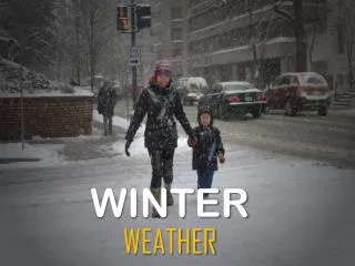
Winter Weather SeminarNov 3, 2006 Fog and Stratus
CUSTOMERS • Past survey of customers indicated that we scored well on the “Satisfaction Index”. The lowest part of the score was the accuracy of forecast. • Southwest Airlines relies on our terminals for operations planning. Their fleet is category 1 which means minimums are 200 ft, 3/8 mile vsby and RVR of 1800 feet. • Southwest Airlines uses just the first 9 hours of our TAF with the most important time frame of 2 to 6 hours. • MCI tower is in the clouds when ceilings are 200 feet, therefore vsby will be reported at ¼ mile. However, sfc vsby will be usually much better. What to forecast? • General Aviation – These customers are usually VFR rated. They must have an alternate when the forecast is at or below 2000 feet and the vsby is at or below 3 miles. Since they have light aircraft, they are sensitive to wind errors more than 5 to 10 knots..
FOG • Thin layer of air near the surface cools forming a stable layer • A layer of air above the very thin stable layer cool with condensation occuring. • The fog layer continues to expand horizontally and vertically. • Radiational cooling at the top of the fog layer allows continuous growth of the fog droplets. • Fog layer causes warming at the surface, however condensation balances the evaporation caused by the warming. (Fog droplet settling) • The inversion associated with the fog layer – base is typically 50 meters below fog top with the top of the inversion just above the fog layer.
FOG/STRATUSSynoptic events(Pre-warm frontal) • There are two types of low pressure systems associate with pre-warm frontal events which we deal with locally • The first type we will consider is a slow moving, non-intensifying low or open wave with a flat orientation to the isobars. • The fog forms in the cold wedge north of the warm front and near the low. • Fog and stratus especially likely if precipitation occurs. This allows the underlying cool air to become saturated through a combination of evaporative cooling and moisture advection into the layer. • Ceilings and visibilities can be reduced to below minimums especially is the soil is and and wet or there is snow cover. • There are two types of low pressure systems associate with pre-warm frontal events which we deal with locally. • The first type we will consider is a slow moving, non-intensifying low or open wave with a flat orientation to the isobars. • The fog forms in the cold wedge north of the warm front and near the low. • Fog and stratus especially likely if precipitation occurs. This allows the underlying cool air to become saturated through a combination of evaporative cooling and moisture advection into the layer. • Ceilings and visibilities can be reduced to below minimums especially is the soil is and and wet or there is snow cover.
FOG/STRATUSFilling Lows • Fog and/or low stratus tends to form north of the occluded or warm front as gradients weaken and evaporative cooling allow saturation (light precipitation still occurring within this region) • These features also produce fog in and around the filling low center as winds weaken and convergence occurs. • Note – Lows that are intensifying do not usually produce much pre-warm frontal fog. In fact, with a low which is intensifying, any existing fog tends to dissipate due to increasing pressure gradient, vertical motion and subsequent mixing.
FOG/STRATUSPost Cold Front • Cold air advection into a region which is overrun by warm and moist air aloft. • Cold front displays anabatic characteristics whereas there is upward vertical motion behind the front, resulting in extensive clouds and some precipitation behind the front. • Similar to pre-warm frontal events where precipitation falls into a cold layer causing saturation. • Environment may also be pre-conditioned by pre-frontal precipitation. • Ceilings and visibilities may fall below minimums closely behind the front.
FOG/STRATUSStationary front • Provide focus for fog and/or stratus especially if it is east-west oriented. • Warm advection aloft with a cold underlying air mass. • Flow parallel to the front which means advection is weak or neutral through the frontal layer. • However, above the frontal layer, warm advection can occur with precipitation, sometimes equally north and south of the boundary. As a result, fog and stratus can occur north and south of the boundary.
FOG/STRATUSFCST CONSIDERATIONS FOR FRONTAL EVENTS • Increasing static stability within the boundary layer will promote fog development. • Amount of turbulent mixing. Increased and deeper mixing will help dissipate fog/stratus. • Depth of cold air inversion – shallow cold air less likely to produce fog/stratus • Cold and dry air advection will dissipate fog/stratus. • Strong or deep forcing will prevent or dissipate fog. • Pre-frontal precipitation conditioning the environment. • Wet soil will aid in fog development. • Climatology
FOG/STRATUSRETURN FLOW EVENTS (COLD SEASON) • As a cold front moves into the Gulf of Mexico, the surface high will move east with the air mass in the Gulf to modify. • As this occurs, fog and stratus forms in the Gulf due to low level mixing and radiational cooling. • This process enhances the low level stability with the return flow dependent upon the initial offshore cold air advection, speed of movement of the surface high, the pressure gradient and the synoptic pattern. • Moist layer is usually through 850 mb with the return flow warmer than the land temperature. • In cases where there is a weak front, the fog and stratus will tend to focus or first appear along the front.
FOG/STRATUSLOCAL RULES OF THUMB (MCI) • Especially vulnerable to weak, stationary or slow moving boundaries. If the environment is sufficiently moist, VLIFR or LIFR conditions occurs, mainly during the late night or early morning hours. • Due to elevation, ceiling 200 feet lower than MKC. • A wind direction from 130-210 with wind speeds from 5 to 8 knots will enhance radiational cooling by 1 to 3 hours. • The reverse applies for a 320 to 070 wind. Delays development from 1 to 3 hours. • With calm winds, there are large and rapid fluctuations of temperature. Usually best not to introduce fog until after midnight. Exception is when the temp-dwpt spread is small during the early evening hours and the ground is wet. • Tower is near cloud base when the ceilings are around 200 feet. It is common for the vsby to be reported at ¼ mile or less. Sfc vsby is ususually better. Forecast the sfc vsby. Also verify sfc vsby with RVR.
FOG/STRATUSLOCAL RULES OF THUMB (MKC & STJ) • MKC – Visibilities will generally be 1 to 3 miles better than MCI due to the urban effect. The exception is advection fog. If fog event is more than 3 hours, the difference between the two stations will decrease. • When the visibilities are below a mile at MCI, MKC will commonly be ¼ to ½ mile better. • STJ – Airport sits in the Missouri river bottoms to the west of Saint Joseph. The airport is almost an island. • STJ – Light north to northwest wind is a cold drainage wind down the valley. • STJ – Winds tend to go calm. If the very light gradient wind is north to northwest, temperatures will get 4 to 10 degrees colder than MCI. If the gradient wind is from the east, temperatures will only be 2 to 4 degrees colder. • STJ – Fog is especially a problem during the fall when the river is still warm.