Download
1 / 27
290 likes | 1.49k Vues
Topics of Interest. Glacial Lake Agassiz Background InformationClassification of BeachesSouthern Outlet Beach DescriptionsCampbell

E N D
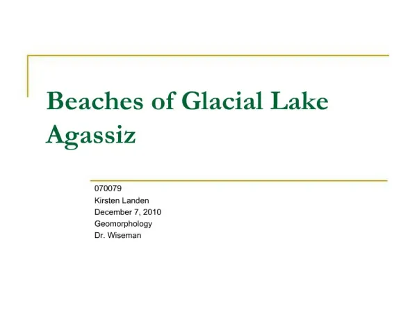
1. Beaches of Glacial Lake Agassiz 070079
Kirsten Landen
December 7, 2010
Geomorphology
Dr. Wiseman
2. Topics of Interest Glacial Lake Agassiz Background Information
Classification of Beaches
Southern Outlet Beach Descriptions
Campbell & Lower Campbell Beaches
Formation of Beaches
Significance of Agassiz Beaches
3. Background Information Formed 11,700 year BP
Red River-Des Moines ice lobe retreated north of the Hudson Bay/Gulf of Mexico drainage divide
First named by Warren Upham in 1880
Lake & drainage basin covered 2million km2
Rocky Mountains to the Lake Superior Basin
South Dakota to Hudson Bay
4. Background Information Total water area was 950,000km2
Maximum water extent covered 350,000km2
During a glacier advance between 9900-9500 years BP
50+ documented beaches
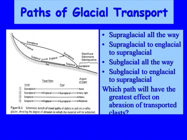
6. Classification of Beaches Typical beach ridge:
3-10ft above the surrounding land on the side away from the lake
10-20ft above the surrounding land on the side of the lake
165-412 feet wide
Stratified sand and gravel (largest material 2-6in)
Surrounding area composed of till, unstratified clay, larger boulders
7. Classification of Beaches
8. Southern Outlet Beaches Classified by four series of closely-spaced beaches
Herman, Norcross, Tintah & Campbell
? ? Decreasing elevation ? ?
9. Southern Outlet Beaches
10. Southern Outlet Beaches
11. Southern Outlet Beaches: Herman Splits into 12-13 individual strands
Poorly developed
Especially east of the Riding & Duck Mountains
Splitting occurred at 3 hinge lines
Highest elevation of the southern beaches
12. Southern Outlet Beaches: Norcross Classified by four extensive closely-spaced shorelines
Sometimes grouped into two main areas
Northernmost area is well-developed
Slight divergence
Approx. 20 ft lower than the Herman Beach
13. Southern Outlet Beaches: Tintah Two pairs of beaches
No definite split
Wide divergence
Medium elevation of the southern beaches
14. Southern Outlet Beaches: Campbell Divided into Campbell and Lower Campbell beaches
Campbell is the most well-developed beach of Lake Agassiz
Lower Campbell is well-developed in the north but poorer in the south
No split but some slight divergence
15. Campbell Beach Most well-developed beach of Lake Agassiz
Composed of gravel and sand deposits
�-1mile wide and 25-30ft deep
Classified by offshore barriers, berms or erosional escarpments
16. Campbell Beach Formation indicates a return of drainage to its southern outlet
Lake Agassiz had temporarily been draining east
Stopped with the re-advancement of an ice sheet
17. Lower Campbell Beach Well developed in the northern reaches, less so in the southern extent
Classified by barrier beaches, berms and erosional escarpments
Only 1.5 miles apart from the Campbell beach in the south
18. Lower Campbell Beach Formed after a 60ft drop in lake level
Due to a retreat of an ice sheet which opened up a lower outlet
Differential uplift started during formation
Indicated by the convergence of the beaches in the south
19. Campbell & Lower Campbell Beaches
20. Formation of Beaches Unlikely that an extensive, well-developed beach can form with high levels of differential isostatic rebound
Relationship of Agassiz outlets, fluctuations in ice-margins & differential rebound provided the mechanism for deepening (transgressing)& lowering (regressing) the lake
And in turn, forming the beaches
21. Formation of Beaches Regression can deposit a uniform layer of sediment
Often abrupt change that can interrupt accumulation
Poor berms & barrier beaches
Transgression creates waves that work coarse-grained sediment upslope
Forms larger/extensive beaches
22. Formation of Beaches Four (Five) southern outlet beaches formed through transgression
Tintah�s formation sped up by re-advancing ice at the NW outlet
Campbell�s transgression controlled by isostatic rebound of the NW outlet
Campbell experienced longest transgression
23. Formation of Beaches
24. Formation of Beaches
25. Significance of Agassiz Beaches Silt & clay deposits form fertile soils
Agriculture
Sand & gravel deposits are important sources of structural supplies
Gravel pits
Cultural significance
Archaeological sites, First Nations burial grounds
26. Text References Fisher. (2005). Strandline analysis in the southern basin of glacial Lake Agassiz, Minnesota and North and South Dakota, USA. Geological Society of America. 117(11), 1481-1496.
Johnston. Glacial Lake Agassiz. Ottawa: Geological Society of Canada, 1946.
Lepper, et al. (2007). Ages for the Big Stone Moraine and the oldest beaches of glacial Lake Agassiz: Implications for deglaciation chronology. Geological Society of America, 35(7), 667-670.
Neilsen. (1987). Origin & Palaeoecology of post-Lake Agassiz raised beaches in Manitoba. Canadian Journal of Earth Sciences, 24(7), 1478-1485.
Rayburn & Teller. (2007). Isostatic rebound in the north-western part of the Lake Agassiz basin: Isobase changes and overflow. Paleogeography, Palaeoclimatology, Palaeoecology, 246(1), 23-30.
Teller. (2001). Formation of large beaches in an area of rapid differential isostatic rebound: the three-outlet control of Lake Agassiz. Quaternary Science Reviews, 20(15), 1649-1659.
Teller, Glacial Lake Agassiz. Canada: Geological Society of Canada, 1983.
Upham. Upper Beaches & Deltas of Glacier Lake Agassiz. Washington: Government Printing Office, 1887.
27. Image/Diagram References Sl. 5: Maximum Extent & Major Features of Lake Agassiz
Teller, Glacial Lake Agassiz. Canada: Geological Society of Canada, 1983.
Sl. 7: Typical Section Across a Beach Ridge at Lake Agassiz
Warren Upham, Upper Beaches & Deltas of Glacier Lake Agassiz (Washington: Government Printing Office, 1887), page 11.
Sl. 9: Relative Elevations of Lake Agassiz Beaches
Teller. (2001). Formation of large beaches in an area of rapid differential isostatic rebound: the three-outlet control of Lake Agassiz. Quaternary Science Reviews, 20(15).
Sl. 10: Southern Extent of Lake Agassiz
Fisher. (2005). Strandline analysis in the southern basin of glacial Lake Agassiz, Minnesota and North and South Dakota, USA. Geological Society of America. 117(11).
Sl. 19: Aerial Photography of Campbell Beaches
Rayburn & Teller. (2007). Isostatic rebound in the north-western part of the Lake Agassiz basin: Isobase changes and overflow. Paleogeography, Palaeoclimatology, Palaeoecology, 246(1).
Sl. 23: Shoreline Development in a Basin Undergoing Isostatic Rebound
Teller. (2001). Formation of large beaches in an area of rapid differential isostatic rebound: the three-outlet control of Lake Agassiz. Quaternary Science Reviews, 20(15).
Sl. 24: Relative Changes in Lake Level & Overflow Outlets Used
Teller. (2001). Formation of large beaches in an area of rapid differential isostatic rebound: the three-outlet control of Lake Agassiz. Quaternary Science Reviews, 20(15).
28. Questions?