Spatial Analyses in Wilderness Search and Rescue
350 likes | 565 Vues
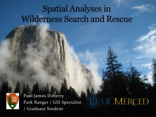
Spatial Analyses in Wilderness Search and Rescue. Paul James Doherty Park Ranger / GIS Specialist / Graduate Student. What will be researched?. Objective 1: Describe where Search and Rescue incidents (SARs) occur and predict future events

Spatial Analyses in Wilderness Search and Rescue
E N D
Presentation Transcript
Spatial Analyses in Wilderness Search and Rescue Paul James Doherty Park Ranger / GIS Specialist / Graduate Student
What will be researched? • Objective 1: Describe where Search and Rescue incidents (SARs) occur and predict future events • Objective 2: Increase the “probability of area” (POA -predicting where a lost person is or is going to be) • Objective 3: Increase the “probability of detection” (POD -detecting a lost person if in the search area)
Intellectual Contribution – Objective 1 • Use geo-referencing techniques to compute uncertainty measurements for incident location with a large unique (n = approx 4,000) dataset (Guo et al 2007) • Test and evaluate spatial-temporal risk modeling procedures to describe where incidents have occurred and predict where they will occur (Kelly et al 2006)
Intellectual Contribution- Objective 2/3 • Finding a missing person/object is the classic mystery • Probability of Success (POS) • Probability of Area (POA) • Probability of Detection (POD) • POA x POD = POS • How can integrating GISystems and GIScience increase overall POS? • Human foot-travel modeling (work with Liz Sarow Fall 2009) • Dynamic vector design (how do vector inputs improve predictive model accuracy?) • More objective approach to finding missing persons
Case Study: Yosemite National Park • Sierra Nevada, CA • Size • 1,200 sq. miles • 95% wilderness • 800 trail miles • Annually • +3.5 million people • Search and Rescues: 200
The Search for A Missing Person • Search Theory • Simplified • POA x POD = POS • Overall POS = [(POA1 x POD1) +(POA2 x POD2)….] • Where 1,2,3,…. are search segments Basically, where is the person most likely to be (based off of search model) and how are we most likely to find them (based off of search technique)
Objective 1 Georeference SAR data
Spatialdistribution • Majority of SARs described are referenced by distance from placenames • Data is in report format, needs to be compiled • What causes clustering?
Objective 1 - Methods • Geo-reference points from text (occasional GPS) • Classify incidents by type (trauma vs. medical etc.) • Evaluate uncertainty of geo-reference • Characteristics of where incidents have occurred • Ecological Niche Factor Analysis? • Develop new protocols to plot incident locations
Objective 2 Probability of Area
Objective 2: Increase the probability of area • What is the current Search Model for determining POA? • POA = Theoretical + Statistical + Subjective + Reasoning • How can we use Spatial Analyses to increase accuracy of POA?
Objective 2: Increase the probability of area • Establishing Probability of Area (POA) • Theoretical • Distance subject could have traveled in the amount of time elapsed (objective, geography) • Statistical • Data which reflects the distance other subjects have traveled under similar conditions (objective, human behavior) • Subjective • Evaluation of limiting factors (objective, geography) • Reasoning • Systematic analysis of circumstances surrounding the disappearance of missing person (subjective, human behavior)
Objective 2 - Methods • Construct and evaluate speed models for missing hikers • Cost-distance modeling • Generate areas of high probability • Refine data for distance from PLS (CALEMA data?) • Hazards from Objective 1 (20 year dataset) • Attractions from viewshed analyses • Dynamic probability mapping when clues are detected
Cost-Distance modeling • A function of: • Terrain • Behavioral Profile (Koester and Stooksbury 1995) • Time
Objective 3 Probability of Detection
Objective 3: Increase the probability of detection • What is the current Search Model for determining POD? • [Effective Sweep Width]1 + [Clue Detection]1 + [Coverage of Assignment]1 POD1a • *Extremely subjective process • POD1a + POD1b + POD1c = cumPOD1 • * Law of diminishing returns applies
Objective 3 - Methods • How can we use Spatial Analyses to increase accuracy of POD? • Search assignment generation (unified cartography) • Identifying “holes” in search (using GPS) • Determine optimal sweep width (ground-truth) • How do we know when we have reached our point of diminishing return? • When to stop searching? • Search Area vs. Rest of World (ROW)
Challenges… • Objective 1: Georeference SAR data • Geo-referencing 4,000 points will require significant effort, difficult to do with accuracy/ high resolution • Data quality? N = ~4000 points n = ~2,000 points • Concentration of points around popular hiking areas • Factor significance may vary across the type of incident • Objective 2: Probability of Area • Terrain model will need ground-truth and will not apply in other habitats • Objective 3: Probability of Detection • Balancing GIS Application vs. GIScience
Broader Impact • Novel research topic • Increase overall preparedness for incident occurrence • Preventative Search and Rescue initiatives • Help find missing persons (Searches are emergencies!) • Allow GIS students and Search and Rescue personnel to collaborate and elevate collective knowledge • Technique testing • Geo-referencing/ spatial uncertainty • Ecological Niche Factor Analysis • Predictive models
Potential Collaborators • National Park Service • ESRI • California Emergency Management Agency • National Association for Search and Rescue • Wilderness Medical Society • Yosemite Leadership Program at UC Merced • Yosemite Fund • Yosemite Search and Rescue
ESRI • Feature article in ArcUser Magazine • YOSAR wins Special Achievement in GIS award