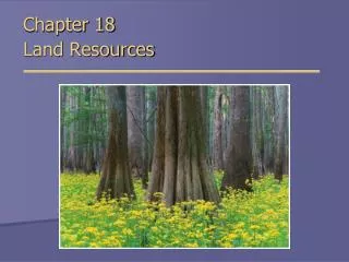
Environmental Science Chapter 14 “Land”
Environmental Science Chapter 14 “Land”. Section 1: How We Use Land. Land Use and Land Cover. Urban Land :. Rural Land : . Land that contains relatively few people and large open space. Land that is covered mainly with buildings, homes, industry, and roads (6 % of US land)


Environmental Science Chapter 14 “Land”
E N D
Presentation Transcript
Land Use and Land Cover Urban Land: Rural Land: Land that contains relatively few people and large open space • Land that is covered mainly with buildings, homes, industry, and roads (6 % of US land) • Area that contains 2,500 or more people and usually has a governing body
Land Use and Land Cover Rangeland: Forestland: Land used for harvesting wood, wildlife, fish, nuts, and other resources (Oconee, Ga) 28 % of US land • Land used to graze livestock and wildlife • 26% of US land
Land Use and Land Cover Cropland: Parks and Reserves: Land used for recreation and scenic enjoyment and for preserving native animal and plant communities. 13 % of US land • Land used to grow plants for food and fiber. • 20 % of US land
Where We Live • Until 1850 – most people lived in rural areas. They were dependant on the land for crops and livestock (food /clothes). • The Industrial Revolution changed this drastically. Cars and machinery meant you didn’t have to live where food/goods were produced. • People are still dependent on the resources produced in rural areas: clean drinking water, fertile soil, land for crops, trees
The Urban-Rural Connection • The resources that are produced by natural and artificial ecosystems are called ecosystem services. Examples: • purification of air and water • preservation of soil and renewal of soil fertility • prevention of flood and drought • regulation of climate • maintenance of biodiversity
Supporting Urban Areas • Rural land needed to support 1 person depends on many factors: *Climate *Standard of living *How efficiently resources are used Ecosystem Services per person: • (Earth total: 12.4 billion hectares) • Most developed countries: about 8 hectares of land and water • US: 12 hectares • Germany: 6 hectares
Urbanization: Urban Sprawl: • The movement of people from rural areas to cities. • Usually for more jobs/better pay. • In 1960 - 70 % of US – urban • By 1980 – only increased to 75 %. • Rapid expansion of a city into the countryside around a city. • Usually built on land previously used for food production • In 2000 – more Americans lived in suburbs than in cities and countryside combined
Infrastructure: Urban Crisis: • All the things society builds for public use. • Include: railroads, sewers, roads, bridges, canals, fire and police stations, schools, hospitals, power lines, water mains. • When more people live in a city than its infrastructure can support. • Living conditions deteriorate. • Developed countries can suffer from urban sprawl. • Ex – Japan
Land-use Planning: Geographic information system (GIS): • Is determining in advance how land will be used: • Ex: where houses, businesses, and factories will be built, also where land will be protected for recreation. • Computerized system for storing, manipulating, and viewing geographic data. • GIS software allows a user to enter different types of data about an area. • Such as: location of sewer, roads, and parks, and then create maps.
Farmland: • Is land that is used to grow crops and fruit. • Provides an important oxygen source for urban areas. • Moderates the temperature of urban areas.
Rangelands:Overgrazing: • Land that supports different vegetation types like grasslands, shrublands, and deserts. • Is not used for farming or timber production. • Allowing more animals to graze in an area than the range can support. • Too many of the plants are eaten and the land becomes degraded.
Maintaining the Range To sustain the productivity of rangeland: • Reduce overgrazing by limiting the herds to sizes that do not degrade the land. • Leave the land unused for periods of time so that the vegetation can recover. • Use methods such as killing invasive plants, planting native vegetation, and fencing areas to let them recover .
Forest Land Harvesting trees: • People use enormous amounts of wood. • Worldwide average: 1,800 cm3 of wood per person per day. • US: uses 3.5 times this amount • About 1.5 billion people in developing countries depend on firewood as their main source of fuel. • Clearcutting: the process of removing all the trees from an area of land.
Deforestation: Reforestation: • The clearing of trees from an area without replacing them. Consequences: • reduction of wildlife habitat • soil erosion (no tree roots to hold the soil in place) • loss of topsoil • Theprocess by which trees are planted to re-establish trees that have been cut down in a forest land. • In some places - is happening at a faster rate than trees are being cut down. • Ex. New England – now contains more forest than it did a century ago.
Parks and Preserves: Wilderness: • Established in 1870s • After explorers brought news to congress of magnificent land in Wyoming and Montana. • This became the first national park: Yellowstone • Today - the US has about 50 national parks. • An area in which the land and the ecosystems it supports are protected from all exploitation. • So far, 474 regions covering almost 32 million acres have been designated as wilderness in US. • Open to hiking, fishing, boating (w/out motors), and camping.
Threats to Protected Areas: Conservation Corridor: • Litter • Traffic jams • Rangelands, mining and logging sites, oil and gas drilling operations, factories, power plants and urban areas are close enough to affect parks. • Strips of protected land that connect one preserve to another preserve.