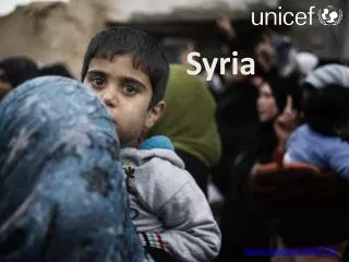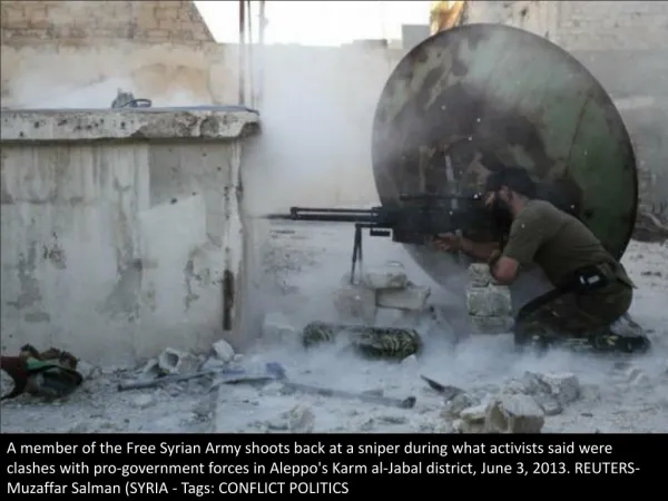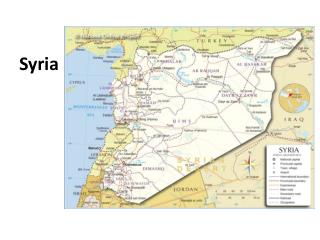
Easy Map for Syria
Easy Map for Syria. Prepared on: 7 May 2014 Feedback: ochaturkey@un.org. Easy Map. What is Easy Map ? A tool for creating basic maps for reports and presentations. Uses predefined base maps and map elements to enable quick and easy construction of user tailored maps. Instructions

Easy Map for Syria
E N D
Presentation Transcript
EasyMapforSyria Prepared on: 7 May 2014 Feedback: ochaturkey@un.org
EasyMap What is EasyMap? • A tool for creating basic maps for reports and presentations. • Uses predefined base maps and map elements to enable quick and easy construction of user tailored maps. Instructions • Select the slide with the base map of the area you want to create. • Adjust the colour/weight of the outline and/or fill of the district/governorates. • By selecting the boundary • You can select desired polygon using area name (Format->Select->Select Pane • In the selection pane, expand District_fill & SubDistrict_fill layers and change fill color of the selected SubDistrict/or District. • Copy and paste the preset symbols or graphic elements onto the map. • Update Date, source fields in the map. • Save the slide as an image (Office Button -> Save As -> Other Formats. Select the *.jpg file type, and when prompted select “Current Slide Only”). • If the same map is to be used in future, save a copy of the PowerPoint file. • When inserting into a report or presentation be sure to maintain the aspect ratio.
AL-HASAKEH ALEPPO AR-RAQQA IDLEB LATTAKIA HAMA DEIR-EZ-ZOR TARTOUS HOMS DAMASCUS RURAL DAMASCUS QUNEITRA DAR'A AS-SWEIDA 0 50 100 Km Syrian Arab Republic: Map Title Date: Data Source: COD/FOD Disclaimer: The boundaries, areas, and names shown and the designations used on this map do not imply official endorsement or acceptance.
AL-HASAKEH ALEPPO AR-RAQQA IDLEB LATTAKIA HAMA DEIR-EZ-ZOR TARTOUS HOMS DAMASCUS RURAL DAMASCUS QUNEITRA DAR'A AS-SWEIDA 0 50 100 Km Syrian Arab Republic: Map Title TURKEY • Mediterranean • sea IRAQ LEBANON JORDAN ISRAEL Date: Data Source: COD/FOD Disclaimer: The boundaries, areas, and names shown and the designations used on this map do not imply official endorsement or acceptance.
Al-Malikeyyeh Quamishli Jarablus Ain Al Arab Ras Al AL-HASAKEH Afrin Tell Ain A'zaz Abiad Al Bab Al-Hasakeh Harim Jebel AR-RAQQA Saman ALEPPO Menbij Idleb Jisr-Ash-Shugur Ar-Raqqa LATTAKIA Lattakia As-Safira Ariha Ath-Thawrah IDLEB Al-Haffa Al Ma'ra As-Suqaylabiyah Al-Qardaha Deir-ez-Zor Jablah DEIR-EZ-ZOR Muhradah As-Salamiyeh Banyas HAMA Masyaf Hama Sheikh Badr Dreikish TARTOUS Al Mayadin Ar-Rastan Safita Tall Al Makhrim Tartous Kalakh Abu Al-Qusayr Kamal HOMS Tadmor Homs An Nabk Yabroud Al Qutayfah At Tall Az-Zabdani RURAL Rural DAMASCUS DAMASCUS Damascus Darayya Duma Qatana Rural Damascus Quneitra As-Sanamayn QUNEITRA Shahba Izra' Al Fiq As-Sweida DAR'A AS-SWEIDA Dar'a Salkhad 0 0 50 50 100 100 Km Km Syrian Arab Republic: Map Title Date: Data Source: COD/FOD Disclaimer: The boundaries, areas, and names shown and the designations used on this map do not imply official endorsement or acceptance.
Al-Malikeyyeh Quamishli Jarablus Ain Al Arab Ras Al AL-HASAKEH Afrin Tell Ain A'zaz Abiad Al Bab Al-Hasakeh Harim Jebel AR-RAQQA Saman ALEPPO Menbij Idleb Jisr-Ash-Shugur Ar-Raqqa Lattakia As-Safira Ariha Ath-Thawrah IDLEB LATTAKIA Al-Haffa Al Ma'ra As-Suqaylabiyah Al-Qardaha Deir-ez-Zor Jablah DEIR-EZ-ZOR Muhradah As-Salamiyeh Banyas HAMA Masyaf Hama Sheikh Badr Dreikish TARTOUS Al Mayadin Ar-Rastan Safita Tall Al Makhrim Tartous Kalakh Abu Al-Qusayr Kamal HOMS Tadmor Homs An Nabk Yabroud Al Qutayfah At Tall Az-Zabdani RURAL Rural DAMASCUS DAMASCUS Damascus Darayya Duma Qatana Rural Damascus Quneitra As-Sanamayn QUNEITRA Shahba Izra' Al Fiq As-Sweida DAR'A AS-SWEIDA Dar'a Salkhad 0 0 50 50 100 100 Km Km Syrian Arab Republic: Map Title TURKEY IRAQ • Mediterranean • sea LEBANON JORDAN ISRAEL Date: Data Source: COD/FOD Disclaimer: The boundaries, areas, and names shown and the designations used on this map do not imply official endorsement or acceptance.
Al-Malikeyyeh Jawadiyah Al-Malikeyyeh Quamishli Amuda Qahtaniyyeh Darbasiyah Quamishli Ya'robiyah Be'r Al-Hulo Tal Hmis Al-Wardeyyeh Ras Al Ain Tal Ras Al Tamer Ain Al-Hasakeh Hole Al-Hasakeh Areesheh Shadadah Markada Al-Hasakeh Governorate: Map Title Creation Date: dd mmm 2014 Data Source: COD/FOD Disclaimer: The boundaries, areas, and names shown and the designations used on this map do not imply official endorsement or acceptance.
Ain al Arab Lower Shyookh Bulbul Jarablus Jarablus Raju Ghandorah Sharan Ar-Ra'ee Suran Ain Al A’zaz Ma'btali Arab Afrin Menbij Aghtrin A'zaz Sheikh El-Hadid Tall A'rima Refaat Afrin Abu Sarin Mare’ Al Bab Al Bab Jandairis Qalqal Nabul Tadaf Haritan Daret Azza Rasm Haram El-Imam Jebel Saman Eastern Kwaires Dayr Hafir Atareb As-Safira Jebel Hadher Saman Zarbah Banan Maskana Menbij Hajeb As-Safira Al-Khafsa Tall Ed-daman Khanaser Aleppo Governorate: Map Title Creation Date: dd mmm 2014 Data Source: COD/FOD Disclaimer: The boundaries, areas, and names shown and the designations used on this map do not imply official endorsement or acceptance.
Tell Abiad Suluk Tell EinIssa Abiad Ar-Raqqa Jurneyyeh Karama Ar-Raqqa Al-Thawrah Maadan Ath-Thawrah Sabka Mansura Ar-RaqqaGovernorate: Map Title Creation Date: dd mmm 2014 Data Source: COD/FOD Disclaimer: The boundaries, areas, and names shown and the designations used on this map do not imply official endorsement or acceptance.
Kisreh Tabni Deir-ez-Zor Sur Khasham Basira Deir-ez-Zor Muhasan Thiban Al Mayadin Al Mayadin Hajin Ashara Jalaa Abu Susat Kamal Abu Kamal Deir-ez-Zor Governorate: Map Title Creation Date: dd mmm 2014 Data Source: COD/FOD Disclaimer: The boundaries, areas, and names shown and the designations used on this map do not imply official endorsement or acceptance.
Ziyara Shat-ha Madiq Castle Hamra As-Suqaylabiyah Kafr Zeita As-Suqaylabiyah Karnaz As-Saan Suran Muhradah Tell Salhib Muhradah As-Salamiyeh Jeb Ramleh Hama Saboura Oqeirbat As-Salamiyeh Hama Masyaf Masyaf Eastern Wadi El-oyoun Bari Harbanifse Ein Halaqim Oj Hama Governorate: Map Title Creation Date: dd mmm 2014 Data Source: COD/FOD Disclaimer: The boundaries, areas, and names shown and the designations used on this map do not imply official endorsement or acceptance.
Ar-Rastan Ar-Rastan Tall Kalakh Talbiseh Jeb Qabu Taldu Ein ElNisar Nasra Sokhneh Al Makhrim Ej-Jarrah Shin Hawash Kherbet Tin Noor Al Makhrim Hadideh Tall Kalakh Homs Al-Qusayr Farqalas Tadmor Al Quasir Raqama Hasyaa Tadmor Homs Sadad Mahin Qaryatein Homs Governorate: Map Title Creation Date: dd mmm 2014 Data Source: COD/FOD Disclaimer: The boundaries, areas, and names shown and the designations used on this map do not imply official endorsement or acceptance.
Dana Harim Qourqeena Salqin Harim Kafr Takharim Maaret Tamsrin Armanaz Teftnaz Darkosh Bennsh Idleb Janudiyeh Sarmin Idleb Jisr-Ash-Shugur Saraqab Jisr-Ash-Shugur Badama Mhambal Ariha Ariha Abul Thohur Ehsem Ma'arrat An Nu'man Kafr Sanjar Nobol Al Ma'ra Heish Tamanaah Khan Shaykun Idleb Governorate: Map Title Creation Date: dd mmm 2014 Data Source: COD/FOD Disclaimer: The boundaries, areas, and names shown and the designations used on this map do not imply official endorsement or acceptance.
Kiseb Rabee'a Qastal Maaf Kansaba Lattakia Ein El-Bayda Al-Haffa Bahlawaniyeh Salanfa Al-Haffa Ein Lattakia Et-teeneh Mzair'a Hanadi Jobet Fakhura Berghal Al-Qardaha Al-Qardaha Ein Shaqaq Harf Elmseitra Ein Elshaqiyeh Jablah Jablah Beit Yashout Dalyeh Qteilbiyyeh Lattakia Governorate: Map Title Creation Date: dd mmm 2014 Data Source: COD/FOD Disclaimer: The boundaries, areas, and names shown and the designations used on this map do not imply official endorsement or acceptance.
Inset Map Aleppo Al-Hasakeh Ar-Raqqa Deir-ez-Zor Idleb Hama Lattakia Homs
Color Palette Pantone 279 RGB 81/145/205 Pantone 229 RGB 122/0/60 Pantone 279 (50% opacity) RGB 164/190/227 Pantone 378 RGB 86/108/17 Reflex Blue RGB 0/85/164 Pantone Cool Gray 9 RGB 145/145/149 Pantone 660 RGB 5/108/182 Pantone Cool Gray 4 RGB 205/204/204
Insert your text and/ or symbols here Insert your text and/ or symbols here Insert your text and/ or symbols here Insert your text and/ or symbols here Map elements/ suggestions Insert your text and/ or symbols here Try to keep the map as simple as possible. The angles of the lines and arrows should be 45 or 90 degrees. Use the color from Color Palette. Use symbols from the humanitarian symbol catalogues Insert your text and/ or symbols here Alternatively or additionally to text explanations, you can insert photos, charts and diagrams. Arrows can help illustrate movements, e.g., population movements: Insert your text and/ or symbols here Insert your text and/ or symbols here Insert your text and/ or symbols here
CLUSTERS/SECTORS Camp Coordination and Camp Management (CCCM) Logistics Early Recovery Nutrition To change background color, select symbol and change Shape fill color Education Protection Shelter Emergency Telecommunications Food Security Water, Sanitation and Hygiene Health OTHERS Agriculture Multi-cluster/sector Rule of law and justice Coordination Safety and security Environment Fishery
PEOPLE Affected population Infant Missing Children Dead Man Injured Woman Drowned Elderly National army Pregnant Rebel People with physical impairments Child combatant Peacekeeping force
DISASTERS/HAZARDS AND CRISES Cold wave Landslide/mudslide Cyclone Locust infestation Drought Snow avalanche Earthquake Storm Conflict Epidemic Storm surge Humanitarian access Fire Snowfall Population displacement Flash flood Technological disaster Population return Flood Tornado Heatwave Tsunami Heavy rain Violent wind Insect infestation Volcano
SOCIOECONOMIC AND DEVELOPMENT Debris management Rural Livelihood Rural exodus Livestock Trade and market Population growth Urban Reconstruction Urban/rural
ACTIVITIES/STRATEGY Advocacy Leadership Information technology Analysis Learning Innovation Assessment Meeting Services and tools Civil-military coordination Needs assessment Staff management Coordinated assessment Partnership Training Deployment Policy Financing Preparedness Fund Public information Gap analysis Reporting Humanitarian programme cycle Response Information management Scale up/down operation
PRODUCT TYPE Calendar Map Chart Photo Data Report Document T able Film
Food and Non-Food items Blanket Non-food items Bottled water Oil Medical supply Bucket/jerry can Plastic sheeting Mosquito net Clothing Relief goods V accine Detergent Rice Flour Salt Food Soap Infant formula Stove Kitchen set Sugar Mattress T arpaulin Medicine T ent
W A TER, SANI TA TION AND HYGIENE Borehole Solid waste Communal latrine Spring water Latrine cabin Submersible pump Potable water T oilet Potable water source W ater source Sanitation W ater trucking Shower W ell CAM P IDP/refugee camp Registration Permanent camp Spontaneous site T emporary camp Transition site
SECURITY INCIDETNS Abduction/kidnapping Forced recruitment Harassment/intimidation Arrest/detention Assault House burned Attack Mine Carjacking Murder Dangerous area Robbery Forced entry PHYSICAL BARRIER Border crossing Observation tower Checkpoint Physical closure Earthmound Road barrier Military gate Roadblock
DAMAGE Building not a fected Damaged/A f fected House a f fected School not a fected Destroyed House destroyed Not a f fected House not a f fected Airport a f fected Port a f fected Airport destroyed Port destroyed Airport not a f fected Port not a f fected Bridge a f fected Road a f fected Bridge destroyed Road destroyed Bridge not a f fected Road not a f fected Building a f fected School a f fected Building destroyed School destroyed
GENERAL INFRASTRUCTURE o Government f fice Assembly point House Health facility Buddhist temple Infrastructure Health post Building Mobile clinic Hindu temple Church Mosque Hospital Clinic NGO Office Hotel Community building Police station Diplomatic mission School Distribution site UN compound/office Food warehouse University
Airport Helicopter Airport military Helipad Boat Port Bridge Ship Bus Road T rain Ferry T ruck Gas station T unnel
Computer Mobile phone E-mail Radio Fax W alkie talkie Internet
SY0803 Al-Malikeyyeh SY0802 Quamishli Jarablus SY0208 Ain Al SY0206 Arab SY0804 Ras Al AL-HASAKEH Afrin SY0204 Tell Ain SY0203 SY1102 A'zaz Abiad SY0202 Al Bab SY0800 Al-Hasakeh SY0703 Harim Jebel AR-RAQQA Saman ALEPPO SY0200 SY0700 SY0205 Menbij SY1101 Idleb SY0704 Jisr-Ash-Shugur Ar-Raqqa SY0600 Lattakia SY0207 As-Safira Ariha SY0705 Ath-Thawrah IDLEB LATTAKIA SY1103 SY0901 Al-Haffa SY0702 Al Ma'ra SY0603 SY0502 As-Suqaylabiyah SY0604 Al-Qardaha Deir-ez-Zor SY0602 Jablah DEIR-EZ-ZOR Muhradah SY0505 SY0503 As-Salamiyeh Banyas SY1002 HAMA SY0504 SY0501 Masyaf Hama Sheikh SY1005 Badr Dreikish SY0903 SY0404 TARTOUS SY1004 Al Mayadin Ar-Rastan Safita SY0406 SY1003 Tall Al Makhrim Tartous SY0403 Kalakh SY1000 SY0902 Abu Al-Qusayr SY0402 Kamal HOMS Tadmor SY0405 SY0401 Homs SY0306 An Nabk Yabroud SY0305 SY0303 Al Qutayfah At Tall SY0304 Az-Zabdani SY0307 RURAL Rural DAMASCUS DAMASCUS Damascus SY0301 SY0100 SY0302 Darayya Duma SY0309 Qatana SY0308 Rural SY0301 Damascus SY1400 Quneitra As-Sanamayn SY1202 QUNEITRA SY1303 Shahba Izra' SY1203 SY1402 Al Fiq As-Sweida DAR'A SY1300 AS-SWEIDA SY1200 Dar'a SY1302 Salkhad 0 0 50 50 100 100 Km Km Syrian Arab Republic: Who, What, Where (as of 10 August 2010) TURKEY IRAQ • Mediterranean • sea 2 2 LEBANON JORDAN ISRAEL Date: Data Source: COD/FOD Disclaimer: The boundaries, areas, and names shown and the designations used on this map do not imply official endorsement or acceptance.
Ain al Arab Lower Shyookh Bulbul Jarablus Jarablus Raju Ghandorah Sharan Ar-Ra'ee Suran Ain Al A’zaz Ma'btali Arab Afrin Menbij Aghtrin A'zaz Sheikh El-Hadid Tall A'rima Refaat Afrin Abu Insert your text and/ or symbols here Sarin Mare’ Al Bab Al Bab Jandairis Qalqal Nabul Tadaf Haritan Daret Azza Rasm Haram El-Imam Jebel Saman Eastern Kwaires Dayr Hafir Atareb As-Safira Jebel Hadher Saman Zarbah Banan Maskana Menbij Hajeb As-Safira Al-Khafsa Tall Ed-daman Khanaser Aleppo Governorate: Map Title 2 2 Creation Date: dd mmm 2014 Data Source: COD/FOD Disclaimer: The boundaries, areas, and names shown and the designations used on this map do not imply official endorsement or acceptance.