Download
1 / 34
380 likes | 686 Vues
PREDICTION OF THE BEHAVIOUR OF LANDSLIDE DAMS USING A GEOMORPHOLOGICAL DIMENSIONLESS INDEX. L. ERMINI AND N. CASAGLI. 陳奕愷 莊凱翔. 2010.12.31. OUTLINE. INTRODUCTION DATASET GEOGAPHICAL DISTRIBUTION AND RELATED INFORRMATION DAM STABILITY ASSESSMENT

E N D
PREDICTION OF THE BEHAVIOUR OF LANDSLIDE DAMS USINGA GEOMORPHOLOGICAL DIMENSIONLESS INDEX L. ERMINI AND N. CASAGLI 陳奕愷 莊凱翔 2010.12.31
OUTLINE • INTRODUCTION • DATASET • GEOGAPHICAL DISTRIBUTION AND RELATED INFORRMATION • DAM STABILITY ASSESSMENT • POSSIBLE IMPROVEMENT TO THE MODEL AND CONCLUSION
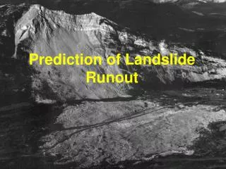
INTRODUCTION Landslide dams are natural dams that form when the body of a landslide partially or completely blocks a river channel. In all cases an impoundment of water is created. This causes a serious hazard with respect to the dammed river section. The hazard is highest when it is not possible to set up promptly a control system for water drainage. As a result of a breach of a landslide dam an anomalous flood wave may propagate downstream. The higher the peak discharge originated by the dam failure, the more devastating the effects.
DATASET The dataset used in this paper results from the collection of data of more than 500 phenomena distributed worldwide. Data are derived from the cases inventoried by the authors themselves, most of which are located in the Northern Apennines, Italy and the western USA and from cases collected by review work.
GEOGAPHICAL DISTRIBUTION AND RELATED INFORRMATION GEOGRAPHICAL DISTRIBUTION
GEOGAPHICAL DISTRIBUTION AND RELATED INFORRMATION LANDSLIDE DAM LONGEVITY
GEOGAPHICAL DISTRIBUTION AND RELATED INFORRMATION • the hydrological balance in the watershed area upstream from the dammed section allows the lake to fill up over and above its capacity. • the loss due to both seepage through the debris dam and evapotranspiration from the lake surface is lower than the lake inflow discharge. 滲流 + 表面蒸散 + 流出 < 流入 The dam longevity is fundamentally controlled by the capacity of the lake which formsupstream and the discharge of the inflowing stream.
GEOGAPHICAL DISTRIBUTION AND RELATED INFORRMATION LANDSLIDE TYPE • As underlined in previous investigations landslide dams may form in different geographical environments and can result from of various kinds of mass movements.
GEOGAPHICAL DISTRIBUTION AND RELATED INFORRMATION From the diagram, landslide type is not considered to exert any control over dam evolution, and therefore this parameter cannot be used to forecast the degree of dam stability.
GEOGAPHICAL DISTRIBUTION AND RELATED INFORRMATION TRIGGERING CAUSES(rainfall) Most of the inventoried dams are a direct consequence of rainfall events(47 per cent): this combines both short intense and prolonged precipitation. Difficulties in settinga common boundary for these two terms in the context of a worldwide database, where various countries andclimate conditions are represented.
GEOGAPHICAL DISTRIBUTION AND RELATED INFORRMATION Distinguishing between the two could only be performed by a detailedanalysis of hydrological data, which are not available for a statistically significant number of case histories.
GEOGAPHICAL DISTRIBUTION AND RELATED INFORRMATION TRIGGERING CAUSES(Earthquakesare and Volcanoes) Earthquakesare the second most frequent triggering mechanism for landslides that provoke the formation of natural dams. From the available data, it is interesting to note that only earthquakes with M > 7 trigger landslides. Often landslide dams are also consequences of the explosions of caldera volcanoes. Generally, these kinds of landslide dams are prone to collapse because of the erodibility of the materials they are formed in.
GEOGAPHICAL DISTRIBUTION AND RELATED INFORRMATION DAM STABILITY ASSESSMENT BI • The dam volume considered as the main stabilizing factor since it controls the dam self-weight • The watershed area considered as the main destabilizing factor since it controls the channel discharge and stream power and indirectly the dam shape
GEOGAPHICAL DISTRIBUTION AND RELATED INFORRMATION • Canuti et al. (1998) and Casagli and Ermini (1999), starting from the database of cases collected in the Northern Apennines, defined the blockage index (BI ), using this parameter for a preliminary forecast of blockage evolution: Vd is the landslide dam volume and Ab the catchment area. a lower boundary for cases of complete dam formation is given by BI = 3 and an upper boundary for failed dams is given by BI = 5, while a lower boundary for stable dams is given approximately by BI = 4.
GEOGAPHICAL DISTRIBUTION AND RELATED INFORRMATION DBI Carried out on a larger number of landslide dams bysetting up a new index. All the case histories collected were ranked in the two main evolution classes (SD and UD)
GEOGAPHICAL DISTRIBUTION AND RELATED INFORRMATION • From geomorphic analysis, best results were reached through the definition of the dimensionless blockage index (DBI ): • Hd represents dam height, Vd landslide dam volume and Ab catchment area.From a physical point of view, dam height is an important variable in assessing the stability of a landslide dam against both overtopping and piping failure mechanisms.
DAM STABILITY ASSESSMENT In particular a lower boundary for cases of stable dams, defined as the higher DBI value reached for the category of unstable dams, corresponds to values ranging from 3.23 to 2.68; while an upper boundary for failed dams, defined as the higher value reached by the DBI for the category of stable dams, corresponds to values ranging from 2.68 to 2.83.
DAM STABILITY ASSESSMENT An intuitive explanation of this result could be that cases from groups (a), (b) and (c) are located in areas quite similar both from climatic (mainly temperate regions) and geomorphic points of view, while events of group (d) are more heterogeneous. Five events are responsible for the high variability of the DBI for groups (c) and (d) and they have been analysed in detail. They can be interpreted as “exceptions” to a “common” landslide dam behaviour as generalized by the DBI.
DAM STABILITY ASSESSMENT In view of these considerations, three main domains can be separated as follows: (a)DBI < 2.75stability domain (b)2.75 < DBI < 3.08uncertain domain (c)DBI > 3.08instability domain
POSSIBLE IMPROVEMENT TO THE MODEL AND CONCLUSION Possible improvements to this empirical model could be made by considering other variables and setting up a wider database in order to reach conclusions based on a statistical analysis. Mentioned above, a stability analysis should take into account grain size distribution of debris materials. However, in most cases understanding the role played by the grain size distribution of the debris material is difficult, because this parameter has to be compared with other variables that control the damming process.
CONCLUSIONS Landslide dams remain a physical process which is not well understood, because they are the result ofthe complex interaction between river and slope dynamics. The prevailing factor out of these two is often fundamental in controlling the fate of the landslide dam. By merging the already published inventories on landslide dams it is possible to increase the knowledge concerning these processes, thereby allowing more reliable forecasting analyses.
CONCLUSIONS A preliminary study of the newly set up database shows that landslide dams triggered by rainfall are more unstable than those mobilized by earthquakes. The reason suggested is that, usually, landslides triggered by earthquakes are capable of carrying a greater amount of material to the river channel, thus forming a more substantial landslide dam. Better results have been obtained by the definition of geomorphological indexes and particularly by the dimensionless blockage index (DBI ), based on the comparison between the basin area of the blocked river (Ab), dam volume (Vd) and dam height (Hd).
現存堰塞湖 九份二山堰塞湖 誘發事件:921大地震、水保局 備註:已趨於穩定 陶塞溪 (梅園) 堰塞湖 誘發事件:2009/12/31 邊坡崩塌 和社溪 (神木村) 堰塞湖 誘發事件:莫拉克颱風、臺大實驗林 備註:已淤滿 荖濃溪 (梅山村) 堰塞湖 誘發事件:莫拉克颱風 備註:地處偏遠,保全聚落距離較遠 旗山溪 (那瑪夏鄉) 堰塞湖 誘發事件:莫拉克颱風 備註:工程整治進行中 龍泉溪堰塞湖 誘發事件:2006/07/16 地震 備註:整坡工程進行中 拉克斯溪 (梅蘭村) 堰塞湖 誘發事件:莫拉克颱風 備註:地處偏遠,保全聚落距離較遠 寶來溪 (寶山村) 堰塞湖 誘發事件:莫拉克颱風 備註:地處偏遠,保全聚落距離較遠 士文溪 (春日鄉) 堰塞湖 誘發事件:莫拉克颱風 備註:工程整治進行中 太麻里溪 (包盛社) 堰塞湖 誘發事件:莫拉克颱風 備註:溢流河道穩定工程進行中
THANK YOU FOR YOUR ATTENTION