Opening Slide
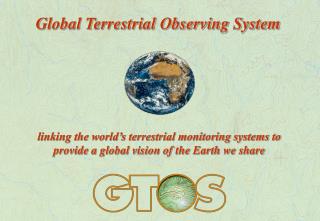
Opening Slide. Global Terrestrial Observing System. linking the world’s terrestrial monitoring systems to provide a global vision of the Earth we share. Mission statement. GTOS Mission Statement.

Opening Slide
E N D
Presentation Transcript
Opening Slide Global Terrestrial Observing System linking the world’s terrestrial monitoring systems to provide a global vision of the Earth we share
Mission statement GTOS Mission Statement To provide policy makers, resource managers and researchers with access to the data they need to detect, quantify, locate, understand and warn of changes (especially reductions) in the capacity of terrestrial ecosystems to support sustainable development.
Key areas Focuses on five issues of global concern: 1. changes in land quality (cover, use) 2. availability of freshwater resources 3. loss of biodiversity 4. climate change 5. pollution and toxicity
GTOS promotes GTOS promotes: integrated analysis bio-physical and socio-economic data interaction between monitoring networks, research programmes, and policy makers data exchange and application quality assurance and protocols to harmonize measurements ... and provides guidance in data analysis
GTOS is not... GTOS is NOT: NOT a source of funding (but does assist others in seeking funds for scientifically sound work consistent with its objectives) NOT a source of primary data NOT a research programme
Structure Secretariat Steering Committee Sponsors Roster of Experts GT-Net Panel Country Activities Data users and providers GCOS & GOOS GTOS Structure
Sponsors GTOS Sponsors Food and Agriculture Organization (FAO) International Council for Science (ICSU) United Nations Environment Programme (UNEP) United Nations Educational, Scientific and Cultural Organization (UNESCO) World Meteorological Organization (WMO)
Steering Committee GTOS Steering Committee Advises the Sponsors and the Secretariat on the scientific and technical content and direction of the programme. It can create subsidiary bodies, such as Working Groups and Panels, for specific purposes as required. It is composed of about 10 experts, invited by the Sponsors to participate in their personal capacities and on a voluntary basis, augmented by one representative of each of the sponsoring organizations.
Secretariat GTOS Secretariat ProgrammeDirector GTOS Secretariat c/o FAO, SDRN viale delle Terme di Caracalla Rome 00100 Italy Tel: (+39-06) 5705 3450 Fax: (+39-06) 5705 3369 E-mail: gtos@fao.org Internet: http://www.fao.org/gtos
Global observing systems - convergence of interest IOC of UNESCO UNEP FAO WMO ICSU UNESCO Ocean services Atmosphere Biodiversity Land surface/ hydrology Pollution/ coastal zone Ocean & climate Pollution, toxicity Terrestrial ecosystem structure & function Cryosphere Marine living sources GTOS GCOS GOOS
Joint Panels TOPC GTOS GCOS JDIMP GOSSP Coastal OOPC GOOS Joint Panels
Users/providers of data GTOS users and providers of data Scientific programmes Governments UN Organizations GCOS & GOOS NGOs & Private sector International agreements
GTOS and the Conventions • Ramsar Convention on Wetlands - 1971 • World Cultural and Natural Heritage Convention - 1972 • Convention on Trade in Endangered Species - 1973 (CITES) • Conservation of Migratory Species Convention - 1979 (CMS) • Basel Convention on Hazardous Wastes - 1989 • Climate Change Convention (UNFCCC) - 1992 • Convention on Biological Diversity (CBD) - 1993 • Convention to Combat Desertification (CCD) - 1994 • Convention on Prior Informed Consent - 1998 (Hazardous chemicals and pesticides)
Origins of GTOS Origins of GTOS Rio Declaration & Agenda 21 (1992) Fontainebleau Workshop (1993) Scientific and Technical Planning Group (1993-95) GTOS Secretariat, FAO HQ - Rome (March 1996) GTOS Steering Committee (December 1996) Implementation Plan (1997)
Value-added of GTOS Value-added Common framework for databases, sites, networks Harmonization of measurements & terminology Improved access to environmental data & information Deeper understanding of terrestrial ecosystems & global change processes Better collaboration between ecological networks Stronger links between science and policy
GT-Net Panel Operational activities • Global system of terrestrial observation networks (GT-Net) • Terrestrial carbon observation initiative (TCO) • Global observations of forest cover project (GOFC) • Net primary productivity project (NPP) • Central and eastern European programme • EU NoLimits project • Southern and eastern Africa programme • Terrestrial ecosystem monitoring sites meta database (TEMS)
GT-Net (scope) GT-Net: A global system of networks • Objective: • to better understand global and regional change by linking • existing terrestrial monitoring networks. • Key activities: • to share and exchange environmental data; • to define clear policies on data and information access; • to develop standards for metadata & local, regional and global • in situ data sets; • to undertake demonstration projects • (e.g. Net primary productivity, Terrestrial carbon).
GT-Net Structure GT-Net Structure GTOS Secretariat Steering Committee (GTSC) GT-Net GT-Net Panel Thematic Networks Regional / National Networks Biodiversity Permafrost Glaciers Hydrology Southern Africa Central Europe Southern Asia
GT-Net Members Networks participating in NPP project • Arab Centre for the Studies of Arid Zones and Dry Lands (ACSAD) • Arctic Monitoring and Assessment Programme (AMAP) • Chinese Ecosystem Research Network (CERN) • Consultative Group on International Agricultural Research (CGIAR) • Fluxnet • International Cooperative Programme on Integrated Monitoring of Air Pollution Effects on Ecosystem (ICP IM) • Organismo Autonomo Parques Nationales • Réseau d’Observatoires de Surveillance Ecologique à Long Terme (ROSELT) • UK Environmental Change Network (ECN) • US Long-term Ecological Research Networks (LTER) • Worldwide Network of Biosphere Reserves (MAB-BR)
GT-Net Panel GT-Net Panel The GT-Net Panel will provide the GTOS Steering Committee with scientific and technical guidance on matters relating to the implementation and operation of GTOS observation programmes, including practical advice on means to facilitate their on-going operation. It will be composed mainly of scientists designated by the regional networks participating in GTOS and some members of the GTOS Steering Committee. A few independent scientists of distinction, who may have no direct role in GTOS and its network, will also be invited as members. In this way, active terrestrial and aquatic scientists of the forefront of their fields can keep GTOS abreast of current scientific findings and applications.
GT-Net (demonstration project) GT-Net demonstration project GT-Net will undertake projects which demonstrate the effectiveness of linking existing terrestrial networks to generate data sets which are useful in studying global change. This will serve as a test bed for collaboration among networks and sites, including data sharing and exchange, and obtaining the experience needed for further network development. The first project concentrates on improving estimates of global terrestrial primary productivity. It adopts a hierarchical approach and uses models which combine satellite data with in situ observations. A set of output products, which have Net Primary Production (NPP) as their common foundation, will be produced. The NPP project has two primary goals: (1) to distribute a standard global NPP product to regional networks for evaluation; and (2) to derive regionally specific crop, range and forest yield maps for land management applications.
GT-Net (demonstration project) Net Primary Productivity The calculation of NPP requires input data which are valuable long-term observations in their own right: Leaf Area Index (LAI) Land cover Soil water holding capacity and nitrogen content Temperature Rainfall
TEMS meta-database Terrestrial Ecosystem Monitoring Sites (TEMS) TEMS Meta- database • A directory of meta-data on monitoring stations • Its objective is to register information about long-term terrestrial monitoring sites around the world • It contains information on more than 700 sites • It can be searched on the Web • http://www.fao.org/gtos/
GT-Net (demonstration project) Constraints & Opportunities • Constraints Terrestrial data and information is: - highly fragmented; - has a variety of owners; - and numerous gaps in coverage. Financial support for making in situ terrestial observations is limited at all levels. Most monitoring and assessment is targeted at specific issues (e.g. food security, deforestation) and is of a limited duration. • Opportunities Technology advances are allowing more investment in and use of decision-support tools. Some policy bodies are recognizing the value of science and investing in environmental data and information. Scientists are interested to collaborate among themselves and, to some extent, with policymakers (e.g. IGOS).