Introduction to eziLink Training
760 likes | 901 Vues
This comprehensive training session introduces participants to eziLink, focusing on the creation and submission of XML/GML files for various forestry activities under the Ministry of Forests and Sustainable Resource Management. The training encompasses fundamental concepts, hands-on exercises, and troubleshooting techniques, empowering attendees to navigate eziLink effectively. By the end of the session, participants will master the submission process, including checking for results and resolving any rejected submissions, thereby enhancing their proficiency in managing forestry data submissions.

Introduction to eziLink Training
E N D
Presentation Transcript
Introduction to eziLink Training For the Ministry of Forests and Sustainable Resource Management
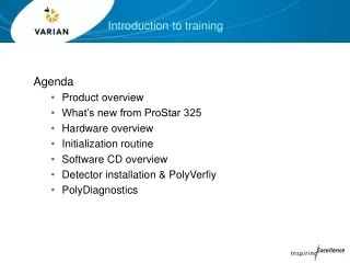
Overview of Session • Instruction on concepts • Hands-on exercises and examples • Troubleshooting • Questions and Answers
Training Objectives • At the end of the training, participants will be able to: • Use eziLink to create XML/GML files for Opening Definition, Disturbance, Silviculture Activity, Forest Cover Polygon and Milestone reporting, • Submit the XML/GML files through the ESF Submission System; and • Check for results of ESF submission and know where in eziLink to address any rejected submissions.
Agenda • Introduction of Instructors and Students • Introduction to e-Submission Concepts • Introduction to the Basic Navigation in eziLink • Opening, Changing and Saving Submissions • Practice Exercises • Creating a New Submission • Practice Exercises • Quality Assurance and Cartography
Overview Amendments FTA / ECAS RESULTS SILVICULTURE HARVEST PLANNING DEVELOPMENT Free to Grow Met Harvest Complete RegenMet Approval to Harvest (Government) Block is Engineered/Costs (Licensee) Forest Stewardship Plan (FSP) Forest Development Plan (FDP) Submit* 3, 4, 5 Submit* 1, 2, 3, 4, 5 FRPA – Current Forest Range and Practices Act Submit* 3, 4, 5 Electronic - ECAS (Appraisal) FTA (Cut Permit) Site Plan (SP) NO NEED TO AMEND Free to Grow Survey Regen Survey RESULTS 1 – Opening Definition 2 - Disturbance 3 - Milestone 4 – Silviculture Activity 5 – Forest Cover Polygon Submit* 4, 5 Submit* 4, 5 FPC – Legacy Forest Practices Code Hardcopy - ECAS (Appraisal) FTA (Cut Permit) Silviculture Prescription (SP) MUST BE AMENDED FORM GROUP - FS708 FORM A = (Opening Definition-1) FORM B = (Disturbance - 2, Silviculture Activity – 4) FORM C = (Milestone 3, Forest Cover Polygon – 5)
Attribute Information RESULTS Validation Verification FTA Submission Document (XML/GML) Electronic Submission Framework LRDW Spatial Information Conversion or direct capture of data Upload of data to website Information into operational systems Conceptual View of ESF
Attribute Information RESULTS Validation Verification FTA Submission Document (XML/GML) Electronic Submission Framework LRDW Spatial Information Conversion or direct capture of data Upload of data to website Information into operational systems eziLink in the ESF World
What eziLink does... • Creates submission documents • Support for spatial and attributes • Entry or loading data for submission • Performs quality assurance of submissions • Provides Tools to support e-submission process • Uploading and status checking • Printing submission contents • FTA, RESULTS and ABR submissions
What eziLink Does Not Do... • Perform data management • Understand business rules associated with the submission • Replace mapping and business management systems
District Use of eziLink • Districts will use eziLink to create the submission documents • add clean spatial information to a submission • add attribute information to a submission • Quality assure and troubleshoot submissions
Create a new RESULTS submission Add attribute data Choose type of Submission Load spatial data into eziLink Copy spatial data into submission Upload the submission Save the submission Review and validate the submission Successful upload Verification Errors, correct submission Automated Verification by Business Agents Approvals by MOF Repeat until accepted or rejected RESULTS Submission Process
RESULTS Submissions Supported • Opening Definition • Disturbance Reporting • Silviculture Activity Reporting • Forest Cover Polygon Reporting • Milestone Reporting
Terminology • Feature • A real world thing represented in eziLink that can include spatial and non-spatial attributes • Item • Something that can be manipulated in eziLink (copied, pasted, edited) • Layer • a collection of spatial features that have a common theme and style
Initial Options on Start • Create A New Submission • Creates a new submission • Open An Existing Submission • Opens a FTA, RESULTS or ABR submission • Does not have to be created in eziLink • Load A Submission From a Database • Loads and links spatial data for management system • Search ESF for Previous Submissions • Searches bases on user criteria
Menus • File • File management and e-submission utilities • Edit • Selection and copy functions • View • Change spatial display • Change what is visible to the user
Menus • Layer • Functions for creating and working with spatial layers • Tools • Quality assurance tools • Tools to manipulate information • eziLink preferences • Window • Help
Warning/Errors Editing Toolbox Undo/Redo Attributes Styles Measure Feature Info Zoom/Pan Select Zoom/Pan File Management Create PDF Toolbar
Main Submission Node Collapsible Node Main Submission Node Icon Sub - Components Spatial Data Icon Submission Item Node Warning Icon eziLink Category eziLink Internal Check box for Layers (for RESULTS ) visible and selectabl e layer Submission Window - Overview
Submission Content • Internal eziLink Layers Category • Working Category • QA Category Submission Window - Categories
Submission Window - Menus • Right Click on Submission Component • Add components • Zoom and select feature • Paste Geometry • Change Styles
Submission Window - Menus • Right Click on Layers • Edit and modify Attributes • Save to new dataset • Move up/down in layer order • Cut, copy and remove layers
Key Items for New Submissions • Things to have • Client number and contact information • Details about the submission to be made • Spatial data • Format • Projection of the source data • Clearly identifies what spatial feature belongs with what attributes
Overview • eziLink support reading from Shapefile, IGDS, GML and WKT • Shapefile format is recommended • Structure more similar to that required by submissions • The better the data coming in, the less work you have to do
Projections • eziLink Supports the standard projections used in BC • Albers (BC Standard) • UTM • Geographics (lat/long) • Data is re-projected as data is loaded • when loading data be sure to select the projection of the source data
Select Format Select Projection Loading Spatial Data • Loading any spatial file requires user to specify • Format (IGDS, Shape) • Source Projection • Some formats require additional information
Create polygons from graphic group • Check to have eziLink to create polygons from lines with a common graphic group number Loading IGDS Data
Loading IGDS Data • Global Orgins • In Units of Resolution • MOF Standard • X: 4,000,000 UOR • Y: -5,296,000,000 UOR
Scale • Converts units to proper projected units (ie metres) • Units of resolution per ground unit • MOF Standard • 1000 mm per Meter for a UTM or Albers projection Loading IGDS Data
Ability to Query • Level • Colour • Type • and more… • Use a SQL where clause • “WHERE LEVEL = 43” to select level 43 features Loading IGDS Data
IGDS Data Recommendations • Simple geometry is better - limit use of complex shapes • Geometry should be ‘cleaned’ through Maps 3D to resolve issues • Use the standard global origins and units of measure • Text is loaded into points and labeled
Adding Spatial Data • Adding spatial data to the submission is a ‘cut and paste’ operation
Adding Spatial Data • Only one geometry can be pasted into a single submission component. • i.e. a single polygon or multi-part polygon can be pasted into an Opening Definition in the submission window
Exercises • Practice with • loading shapefile • copying geometry into submission • Exercise 10 & 11 from the Training Manual
Area BLK CP Polygon 15 ha 1 A 101 40 ha 2 101 B 25 ha 2 C 101 What is a Multipart Feature? Polygon A Polygon B Polygon C
What is a Multipart Feature? Polygon A Representation of Cutblocks Area BLK CP Polygon 15 ha 1 A 101 65 ha 2 101 B • Single set of attributes • Provides a way of aggregating spatial information Multi-part Polygon B
What is a Multipart Feature? Representation of Cutting Permit Area CP Polygon 80 ha A 101 • Applies to all types of Geometries Multi-part Polygon A
How Do Spatial Geometries Relate Point Point Linestring Linestring Polygon Polygon
Multi-Point Multi-Linestring Multi-Polygon How Do Spatial Geometries Relate Point Point Linestring Linestring Polygon Polygon
Multi-Point Geometry Collection Geometry Collection Multi-Linestring Geometry Collection Multi-Polygon How Do Spatial Geometries Relate Point Point Linestring Linestring Polygon Polygon
Widely Used Spatial Functions • Used with to interact selected features • Operates on features not entire layers
Union • Creates a seamless feature by merging adjacent selected features Widely Used Spatial Functions
Combine • Creates a multi-part geometry Widely Used Spatial Functions
Separate Features • Simplifies multi-part geometry Widely Used Spatial Functions
Polygonize • Creats a polygon from selected lines • No gaps or undershoots in lines Widely Used Spatial Functions
Widely Used Spatial Functions • Calculate area/lengths from geometry • ESF compares net areas to gross areas of the geometry • Available from Tools Menu