Download
1 / 10
100 likes | 118 Vues
The National Integrated Land System (NILS) provides business solutions for managing cadastral records and land parcel information in a GIS environment. It offers modules for survey management, measurement management, parcel management, and a web portal for data distribution. NILS supports various business lines and integrates with other systems like PRIS, FAMS, and AFMSS.

E N D
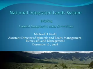
National Integrated Lands SystemBriefing Federal Geographic Data Committee Michael D. Nedd Assistant Director of Minerals and Realty Management, Bureau of Land Management December 16 , 2008
National Integrated Land System • Provides business solutions for the management of cadastral records and land parcel information in a GIS environment • Provides a process to collect, maintain, and store parcel-based land and survey information • Developed in modules. Slide No. 2
What is NILS? • The National Integrated Lands System (NILS) has been under development for 10 years: • Survey Management (SM) – to manage survey data collected in the field (now combined with MM) • Measurement Management (MM) – to analyze and adjust surveyed data from the field • Parcel Management (PM) – to create and manage parcel features and their legal area descriptions • GeoCommunicator (Geo) – Internet Web site for the distribution and viewing of NILS data
Core Functions Support BLM Business BLM / FS Business Data Steward = Program Leads NILS Core Functionality Current Land Status Data Steward = Title and Land Status Tools = Parcel Management (PM) Cadastral Framework Data Steward = Cadastral Survey Tools = Measurement Management (MM)
Support of business lines Business Driven: Custom Views PRIS AFMSS FAMS OTHERS Specific Business Oriented Data NILS Core Functionality Spatially Enabled Land Records (GCBD, Land Ownership, Authorizations, …) Data Warehouse: All data available
BLM NILS Service Oriented Architecture(Enterprise GIS Evolution) NILS Core Functionality: (Automated Geo-Centric Workflows) Spatially Enabling Other Business Systems… Examples: FAMS, PRIS, etc NILS
BLM NILS Service-Oriented Architecture Protection and Response Information System (PRIS) FAMS (Maximo) Automated Fluid Minerals Support System (AFMSS) National Lease Sales System LR2000 National Integrated Land System (NILS) Well Information System (WIS)
GeoCommunicator is the publication site for the Bureau of Land Management's National Integrated Land System (NILS). WH&B AFMSS FAMS OTHERS INTERNAL Specific Business Oriented Data Authoritative Data Spatially Enabled Land Records EXTERNAL
GAP Analysis – NILS Release 5 • Purpose - Interagency team to examine the latest release of NILS and evaluate the project’s scope. • To ensure business needs and users expectation are being meet • To address the changes in technology • To work with other bureaus and agencies to move toward a common system with common standards Slide No. 9
Conclusions and Questions ? NILS National Integrated Land System