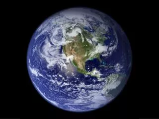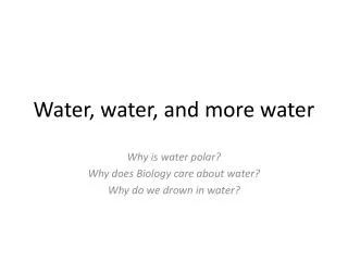
Water
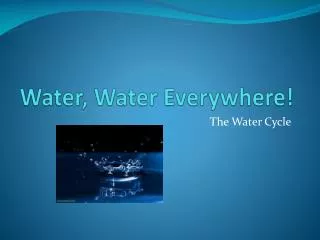
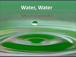
Water. Water Cycle. Evaporation is the process in which liquid bodies of water, such as ponds, lakes, rivers, and oceans, change into water vapor. Transpiration is the evaporation of water from plant leaves.

Water
E N D
Presentation Transcript
Water Cycle • Evaporation is the process in which liquid bodies of water, such as ponds, lakes, rivers, and oceans, change into water vapor. • Transpiration is the evaporation of water from plant leaves. • Condensation is the next process. In condensation the water vapor changes to liquid water or ice. The clouds are formed due to condensation. • Precipitation is when the water condenses so much that it falls to the ground in the form of rain, snow, or hail. • Once the precipitation falls to the ground, the water may infiltrate (infiltration) into the ground OR • Once the precipitation falls to the ground, the water may flow onto the ground (runoff) into lakes, streams, rivers oceans, or ponds. • Once in these bodies of water, evaporation occurs and the process starts all over again.
Distribution of Groundwater Groundwater: Belt of soil moisture Zone of aeration • Unsaturated zone • Pore spaces in the material are filled mainly with air Zone of saturation • All pore spaces in the material are filled with water • Water within the pores is groundwater Water table – the upper limit of the zone of saturation
Porosity vs Permeability Porosity • Amount of pore space available • Determines how much groundwater can be stored • Depends on: • Shape, packing and arrangement of grains • Well-sorted: all grains are the same size (high porosity), examples: sand, poorly cemented coquina. • Poorly-sorted: finer grains fill spaces between larger grains (low porosity), examples: well-cemented sandstone, shale, mudstone, and limestone.
Porosity vs Permeability Permeability • Ability to transmit water through connected pore spaces • How easily water can flow through a rock or sediment • Depends on: • Grain size (Coarser-grained sediments are more permeable than fine-grained sediments because the pores between the grains are larger) • Grain shape and packing (sorting)
Groundwater Features • Wells • Pumping can cause a drawdown (lowering) of the water table • Pumping can form a cone of depression in the water table • Artesian wells • Water in the well rises higher than the initial groundwater level
Aquifers • Aquitard – formed by impermeable materials that create a zone of saturation above it • Aquifer – permeable layers that allow water to flow freely through • The source of most water wells
Two Types of Aquifers • Unconfined: water level rises freely as the aquifer recharges • Confined: rising water reaches impermeable layer, becomes pressurized • Use aquifer coloring sheet for pictures
Groundwater Overuse • Groundwater is replenished mostly by rain • If there is less rain than use of the water, the water level will decrease
Groundwater Overuse • Cone of depression – lowering of the water table around a well due to large amounts of water being pumped out
Groundwater Overuse • Ground subsidence (sinking) can occur if water is used faster than it is replenished • Creates depressions or sinkholes
Sources of Groundwater Contamination • Sewage from septic tanks, farm wastes, inadequate or broken sewers • Fertilizers and pesticides from agriculture • Residential runoff • Highway salts • Chemical and industrial materials that leak from pipelines, storage tanks, landfills, or holding tanks • Saltwater in coastal areas • Minerals and nutrients from dissolved rock and other natural materials
Groundwater Pollution • Point Source Pollution – contaminants have an identifiable source • Smokestacks, car tailpipe • Nonpoint Source Pollution – contaminant source cannot be found • Several farmlands in the same area • Flow downhill – contaminants leaked into the ground at the top of a hill will flow downhill • Rainwater – runs through the contaminant, absorbs it, and transfers it to another area
Groundwater Cleaning • If water travels slowly through sand or permeable sandstone, the water is purified • Sometimes contaminated water is pumped out of an aquifer and treated; the aquifer is replenished naturally or with the treated water
River Basins • Encompasses all the land surface that drains surface water from many finger-like streams and creeks which flow downhill into one another and eventually into one large river which takes the water to the ocean.
River Basins • Watersheds (river basins) are separated from each other by areas of higher elevation (ridge lines/divides). • Water channels at ridge lines will be narrow with fast-moving water. • As channels combine, the width of the stream will increase. • Watersheds have a branching appearance due to the tributaries (small streams branching from larger streams and rivers)
Wetlands • Land that is covered by water all or part of the year. • Includes swamps, marshes and bogs
Wetlands 3 Functions: • Provide flood protection during storms • Filter pollution and urban runoff • Habitat for many animals
Wetlands Swamp Mostly trees and bushes Marsh Tall grasses, some trees and bushes Carolina Bays Unique to East Coast Oval-shaped lakes that often fill with plants and sediment