Download
1 / 14
270 likes | 1.05k Vues
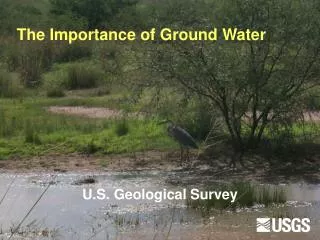
The Importance of Ground Water. U.S. Geological Survey. Groundwater Systems. 14% of total fresh water is contained in groundwater systems Average rate of recharge is ~280yrs Zone of saturation depth where all pore space is filled with water Water table Top of saturation zone

E N D
The Importance of Ground Water U.S. Geological Survey
Groundwater Systems • 14% of total fresh water is contained in groundwater systems • Average rate of recharge is ~280yrs • Zone of saturation • depth where all pore space is filled with water • Water table • Top of saturation zone • perched water tables • Movement • Always downhill • Hydraulic gradient
Aquifer Systems • Aquifer – a rock or unconsolidated sediment unit that is saturated with water (gas/oil) • Porosity – the volume of pore space between grains in a rock • Permeability – the measure of connectedness of pore spaces • Aquatard – a rock unit that traps or retards groundwater movement • Potentiometric surface – the level of equilibrium of an aquifer defined by its hydrostatic head • Confined – artesian wells • Unconfined • Perched
Scale of Ground-Water Flow Systems Up to tens of kilometers Relatively small systems Recharge quickly Discharge quickly Up to hundreds of kilometers Relatively large systems Usually recharge slowly Discharge slowly
Amount and Nature of Recharge High, diffuse recharge(typical in humid climates) Low, focused recharge(typical in the arid Southwest)
Factors affecting locations of GW discharge Topography Basins with through-flowing streams WETLANDS STREAM Internally drained basins ET Aquifer ends at sloping land surface SPRINGS SPRINGS
Factors affecting locations of GW discharge Positive pressure and conduit WETLANDS Potentiometric surface Confining rocks Aquifer zone Fault or fracture
Cone of depression or drawdown is lowering of water table around a a pumping well RECHARGE RECHARGE PUMPING RECHARGE ET ET WETLANDS STREAM INFLOW FROM SURFACE WATER BEDROCK AQUIFER OUTFLOW TO SURFACE WATER
Generalized stratigraphic section of rock units near Flagstaff
Flow system conceptual model: Colorado Plateau SPRINGS SPRINGS Low- permeability rocks
Colorado Plateau/Northern Arizona • Extensive aquifer system • Navajo SS • Dakota Fm. • Coconino SS • Localized springs • Canyon walls • Structural trends • Few natural lakes • Mormon Lake • Through flowing stream/river systems • Colorado River vs LCR
Colorado Plateau/City of Flagstaff • Groundwater well fields • Inner Basin • Lake Mary • Continental • Woody Mtn. Road • Surface water catchments • Lake Mary system • Lake Powell? • River system recharge • LCR • Rio de Flag • Perched water tables • Thin alluvium • Non-permeable volcanic rocks • Quick recharge/discharge • Baderville