Download
1 / 15
150 likes | 268 Vues
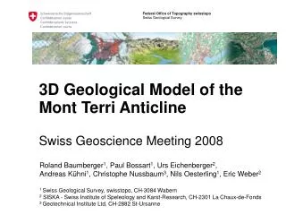
This document discusses the creation and significance of a 3D geological model for the Mont Terri anticline, aiming to enhance geological understanding and applications. It outlines the methodologies involved, from data acquisition and modeling to the iterative refinement of geological structures. The model serves not only as a valuable resource for geological research but also helps ensure the consistency of 2D data through verification and quality standards. The project demonstrates the complexities and iterative nature of 3D geology, highlighting future prospects for regional models and software integration.

E N D
Content • Introduction • The 3D geological model of the Mont Terri anticline • Outlook Definition of 3D Geology * “3D geology is the interaction of 3D modelling, 3D visualization, data handling and analysis” * by the Swiss Geological Survey
Introduction - Background Why working in the domain of 3D geology? • Geology is 3D • Key technology • Great importance Supply models for further applications First step • 3D model of the Mont Terri anticline
Introduction – The Mont Terri model • Aims • To develop a 3D model of the Mont Terri anticline • To describe the necessary steps in a “cook-book” • To present the 3D model as movie & VRML-scene • Side-effect • To check the consistency of 2D profiles • Methodology • Using maps, measurements etc. as input data • Deriving a “simplified model” of the tectonic setting • Iterative refinement of the model
Introduction – The Mont Terri model Team Modelling • ISSKA, La-Chaux-de-Fonds • Geotechnisches Institut, St. Ursanne Project owner & reviewing • swisstopo, Swiss Geological Survey
Introduction – Tectonic interpretation of the Mont Terri region Based on the Geologic Atlas of Switzerland 1:25’000; sheet ”St.Ursanne”; Laubscher (1963); modified by C. Nussbaum
Introduction – 3D simplified block diagrams of the Mont Terri anticline Position of Mont Terri rock laboratory Nussbaum & Bossart (2008), in Bossart and Thury, swisstopo report
3D model – Basic data aquisition Geological data • Geologic Atlas of Switzerland 1:25‘000, sheet „St. Ursanne“ • Azimuth & dip measurements • Geological cross-sections and reports supplied by science (Uni Basel), industry and SBB • Geological maps along Mont Terri galleries Other data • DEM 25 • Aerial photos • Construction data of the Mont Terri rock laboratory • Layouts of highway and railway tunnels as well as abandoned limestone quarry of St. Ursanne
1b 1a Data preparation Create structural model Transfer to modelling software 2 Inter-/extrapolation modelling process Check geological consistency 4a 4b Modify structural model 3 Create new data no no OK? yes 5 Complete final model 3D model – Applied methodology Basic data aquisition
3D model – Challenges Difficulties appeared during model construction due to: • Data density • heterogenous spatial distribution • Data resolution • tunnel cross-sections vs. geological profiles • Ages of samples • e.g. 1873-1875 tunnel cross-sections provided by the SBB • Diverging conceptual models of the geological structure • publishing ages of basic data
3D model – Results • 3D model • Software: Cinema 4D • 3D scene • VRML-format • Movie presenting the model • .avi-format (see movie at swisstopo booth) • Project report
3D model – Conclusions • 3D geology can help to assure quality standards of 2D data • Identification of contradictions of 2D cross-sections • Verification of „plain strain hypothesis“ • 3D geology is time consuming • 500-800h modelling work • 3D geology does not provide one stop results, it is an iterative approach • Construction of detailed models by passing through several loops • 3D geology is always interpretation (like conventional geological cross-sections and maps • Results represent only an approximation to the real settings
Outlook – Mont Terri • Combination of the existing Borehole Information System and 3D model • Finite element modelling (hydrodynamic, stress field etc.)
Outlook – General Short-term • Development of a conceptual background for the setup and application of the 3D geology • Implementation of geological 3D modelling software • Development of 3D models of selected regions Mid-term • Integration of 3D data into swisstopo Data Management Systems • Establishing of partnerships and networks • Definition of interfaces to other domains Long-term • Development of nationwide 3D geological models
The end - Questions & answers Thank you for your attention. 3D model available at: http://www.isska.ch/SwissTopo3D/index.html Contact: roland.baumberger@swisstopo.ch