Overview
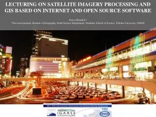
LECTURING ON SATELLITE IMAGERY PROCESSING AND GIS BASED ON INTERNET AND OPEN SOURCE SOFTWARE Fatwa Ramdani * * Geo-environment, Institute of Geography, Earth Science Department, Graduate School of Science, Tohoku University , JAPAN. Overview. Background Objective and motivation

Overview
E N D
Presentation Transcript
LECTURING ON SATELLITE IMAGERY PROCESSING AND GIS BASED ON INTERNET AND OPEN SOURCE SOFTWARE Fatwa Ramdani**Geo-environment, Institute of Geography, Earth Science Department, Graduate School of Science, Tohoku University, JAPAN
Overview • Background • Objective and motivation • Trial of instruction • Result • Another case studies • Conclusions
Background • Map • window • INTERNET CONNECTION • dot-COM bust • ILWIS • Google earth • Web-gis Usersof remote sensing and GIS recently have spread from professional users to non-professional users.
General Research Framework and Analytical Structure in Geographical Study • Social System • macroeconomic change • population growth • change in policy • biofuel market demand • technological transformation • etc. GIS Impact to human-environment Environmental Management • Ecological System • Deforestation • Turbidity • Drought • Vegetation characteristics • etc. Dynamic of land system Environmental Sustainability Driving forces Changes in environment RS
ILWIS • ILWIS is a user friendly open source Geographic Information System. ILWIS is acronym from Integrated Land and Water Information System. The system was developed and distributed by ITC Enschede (International Institute for Geo-Information Science and Earth Observation) in the Netherlands for use by its researchers and students. Since 1 July 2007 it has been distributed and became free software. ILWIS supports numerous vector, raster, and database formats and functionalities, we can visualize, manage, edit, analyze data, and compose printable maps, integrated raster and vector approach. Therefore, it is evaluated as a convenient and suitable system for natural resources management.
Map Window GIS • MapWindow , a GIS software, is free to use and redistribute to clients and other end users. Unlike other free tools, MapWindow is more than just a data viewer, it is an extensible geographic information system. This means that we can write plug-in, add additional functionality (models, special viewers, hot-link handlers, data editors, etc.) and pass these along to clients and end users. MapWindow includes standard GIS data visualization features as well as input database attribute table editing, shapefile editing, and grid importing and conversion.
Google Earth • we can use freely Google Earth which is the easiest and accessible geographic information on the internet. We can access to it from computer, mobile phone, tablet or browsing the web. Most of user, using Google Earth as navigator to find their way, after all they can drawing, measuring, and geo-tagging photos as they want to. Google Earth
Objectives and Motivation • The objectives of this paper is to optimize open source software like ILWIS and MapWindow GIS in education and to introduce a case study of teaching on remote sensing (imagery processing) and GIS based on internet connection. • Introduce students with open source software beside the commercial software • To prevent students from piracy activity which is criminal action in Indonesia
Result • Optimum duration is the length of course in this study, we used three types of length duration: 45 minutes course, 60 minutes course and 90 minutes course. • Subject matter is subject that was delivered in this class. It was about development of access transportation and expansion of urban land uses. Illustration and description is about how students feel satisfied with description and illustration given. • Feedback is how many students asking after following the class. • Planning the lesson and material is how students feel satisfied with lecturer. Was the lecturer planning well and ready to deliver the material in good explanation. And repeating the lesson from quiz is how many students can answer the question in correctly. • Statistical data showed in figure above. The optimum satisfaction from students in receive the lesson using this method is in 90 minutes duration, with the highest feedback, repeating the lesson from quiz, planning the lesson and material, and giving illustration and descriptions. Therefore, we recommended to choose 90 minutes course than two type others. Because it is too short to practice all subject or materials in this class.
Another case study (1) NDVI Extraction of Urban Vegetation in High Dense Urban Environment to measure Inhabitants Satisfaction of Urban Green Space Urban vegetation Satellite imagery: WorldView 2 Acquisition date: November 19, 2010 Location: Depok City, West Java, Indonesia
Another case study (1a) Decision Tree Classification using NDVI value as threshold
Another case study (2) July, 2010; wet season Sixteen years time interval monitoring of large seasonal-tropical lake with low accessibility September, 2004; rainy season June, 1990; wet season Satellite imagery: Landsat TM and ETM+ Location: Sentarum Lake, West Kalimantan, Indonesia
Another case study (2a) Year 2009; 2,274 ha and located only 420 m from National Park (green color) Monitoring remarkable expansion of oil palm plantation Year 2011, 9,919 ha and now located less than100 m from National Park (green color)
Another case study (3) Urban development monitoring in eastern Indonesia; Satellite imagery: Landsat TM and ETM+, Location: Wandama Gulf, West Papua, Indonesia 9/24/2003 4/2/1989 8/26/2010
Another case study (3a) Urban development monitoring in western Indonesia; Satellite imagery: Landsat ETM+, Location: Palembang, South Sumatera, Indonesia 2001 2010
Another case study (5) Land use land cover classification for urban planning and development Satellite imagery: SPOT5 Acquisition date: August 5, 2006 Location: Indragiri Hulu Regency, Riau, Indonesia
Conclusions • The necessity and utility of instruction on using this free software is strongly recommended in 90 minutes length duration course. • The benefit using open source software are low-cost even free of charge, easily to convert and doing geospatial analysis (union, clip, dissolve, etc), export to .JPG format file and/or PDF, and very friendly user interface, make it easier to use even for a new comer in RS/GIS. • Extensive application in order to environmental monitoring in developing country like Indonesia; many island and remote area with low accessability • The difficulties of ILWIS and MapWindow GIS are in cartographic rules and design and unstable software in computer with minimum specification. We suggest minimum 2GB of RAM and good processor with high performance graphic card. • We strongly recommended this method to apply in the class of remote sensing and GIS for undergraduate students with basic knowledge of geospatial science for optimum result.
どうもありがとうございました Thank you for your attention