Download
1 / 19
190 likes | 296 Vues
Explore the SWOT satellite mission launching in 2019 for hydrology modeling and simulation. Learn about the simulator principles, residual height errors, assimilation methodology, and results with a focus on water surface elevation. Enhance your understanding of how the simulator can be used for assimilation studies and future improvements.

E N D
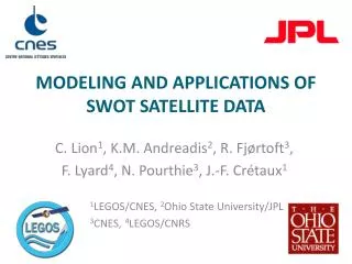
modeling and applications OF swot satellite data C. Lion1, K.M. Andreadis2, R. Fjørtoft3, F. Lyard4, N. Pourthie3, J.-F. Crétaux1 1LEGOS/CNES, 2Ohio State University/JPL 3CNES, 4LEGOS/CNRS
1 SWOT mission • NASA and CNES, launch in 2019 • 970km orbit, 78°inclination, 22 days repeat • KaRIN: InSAR Ka band • Wide swath altimeter • Ocean: “Low resolution” meso-scale and submeso-scale phenomena (10km and greater) • Hydrology: “High resolution” surface area above (250m)² rivers above 100m 970 km
2 Preparing the mission for hydrology Modelisation and simulation for technical use 1. Radar cross section CNES/ CAP Gemini simulator 2. SAR amplitude image: Rhone river, France CNES/ Altamira information simulator
3 Goals • Need for a simulator for scientific users (hydrology) • “Fast”: 3 months 3min • Easy to use: no need for heavy preparation of input data • Portable • Relatively realistic errors • Targets: deltas, rivers, lakes… • Output: water elevation Simulator output: water height The Amazon river, Brazil
4 Simulator principle • Based on works of: S. Biancamaria and M. Durand: swath calculation, principle V. Enjolras: residual error calculation
5 Simulator principle • Based on works of: S. Biancamaria and M. Durand: swath calculation, principle V. Enjolras: residual error calculation
6 Simulator principle • Based on works of: S. Biancamaria and M. Durand: swath calculation, principle V. Enjolras: residual error calculation
7 Residual height errors Taken into account • Roll • Baseline variation • Thermal noise • Geometric decorrelation • BAQ noise • Satellite position Not taken into account yet • Troposphere • Layover • Shadow • Processing (classification…) • ….
8 Residual height errors: Roll B a • Roll i R r1 r2 H h
9 Residual height errors E_b B • Baseline i R r1 r2 H h
10 Residual height errors • Coherence loss g = gSNR + gSQRN + gg N number of looks B i R r1 r2 H h
11 Simulator principle • Based on works of: S. Biancamaria and M. Durand: swath calculation, principle V. Enjolras: residual error calculation
12 Simulator principle • Based on works of: S. Biancamaria and M. Durand: swath calculation, principle V. Enjolras: residual error calculation m
13 Simulator principle • Based on works of: S. Biancamaria and M. Durand: swath calculation, principle V. Enjolras: residual error calculation
14 Simulation: Ohio River 3 months modelizationcourtesy: K. Andreadis 40.5 40.5 40 40 Latitude Latitude 39.5 39.5 39 39 38.5 38.5 275 276 277 278 279 275 276 277 278 279 Longitude Longitude Input: Model LisFLOOD Reference water height (m) Output: Water height observed by SWOT (m)
15 Assimilation methodology • Assimilating SWOT observations in a identical twin synthetic experiment • Ohio River study domain (only main stem) • LISFLOOD hydraulic model • Ensemble Kalman filter • Errors introduced to boundary inflows, channel width, depth and roughness • Observation errors from a Gaussian distribution N(0,5cm) courtesy: K. Andreadis
16 Assimilation results • Water surface elevation along the river channel at two SWOT overpass times 208 Hours 280 Hours • Information is not always propagated down/up stream • Small ensemble size could partly be the reason courtesy: K. Andreadis
17 Conclusions • Simulation of SWOT data with more representative errors • The simulator is more user friendly: output format as input format, GUI, can be used with several models • Can be used for assimilations studies (estimate indirect valuables) • Need to improve the simulator: layover, decorrelation due to vegetation, troposphere …
![Data Modeling [Comparison of data modeling techniques ]](https://cdn0.slideserve.com/205866/data-modeling-comparison-of-data-modeling-techniques-dt.jpg)


![Data Modeling [Comparison of data modeling techniques ]](https://cdn3.slideserve.com/6795343/data-modeling-comparison-of-data-modeling-techniques-dt.jpg)