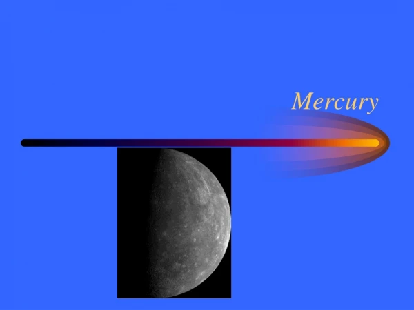
Imaging Mercury surface
Imaging Mercury surface. The SIMBIO-SYS Experiment for the BepiColombo Mission. Enrico Flamini – Roma 27-2-07. SIMBIO-SYS.


Imaging Mercury surface
E N D
Presentation Transcript
Imaging Mercury surface The SIMBIO-SYS Experiment for the BepiColombo Mission Enrico Flamini – Roma 27-2-07
SIMBIO-SYS • SIMBIO-SYS is an integrated package for the imaging and spectroscopic investigation of the Hermean surface selected by ESA as part of the European mission to Mercury BepiColombo .
100 km 15 km Upper crust evolution and surface processes SCIENCE: Geology and Geomorphology • Geomorphological characterization of the highly cratered units (3D) • Origin, limit and areal extension of intracrater, hummocky and smooth plains; • Stratigraphic relationships between highlands and plains (3D) • Presence of layered units (HR) • Characterization of polar deposits; • Identification of aeolian deposits; • Impact crater morphologies and degradation level (3D) • Ejecta distribution and modification
Interior dynamics and crustal differentiation processes SCIENCE: Volcanism Styles and Deposits • Origin of the smooth plain materials (volcanic or lobate crater ejecta?); (3D + HR + IR) • Identification of volcanic edifices; (3D) • Identification of volcanic deposits (i.e. lava flow vs. ejecta blanket); (3D + HR + IR) • Definition of the type of volcanism (i.e. fissural, explosive)
Crustal dynamics 40 km Discovery Scarp Tectonics Evolution • Morphological characterization of mercurian large lobate scarps; (3D) • Identification and classification of smaller tectonic features; (3D) • Observation of cross-cutting relationships to infer the relative age of tectonic events; (HR) • Mapping the distribution of tectonic features
30 km Surface Age • Observation of impact craters with diameter > 0.5 km; • Mapping the different crater distribution; • Comparison between age and the main geological units of highlands and plains • This would led to the definition of the impact flux in the inner Solar System Temporal occurrence of geologic processes
Surface Composition and Weathering • Characterization of the bulk surface composition; • Measure the FeO and TiO2 abundances; • Identification of recent volcanic deposits • Different composition of hermean plains respect to highlands • Identification of weathering products • Effect of surface weathering as function of the surface exposure (age) Interior differentiation, alteration processes
Radar bright spots Water in coldest sites Characterisation of Polar deposits • Characterization of the polar deposits composition; • Search for similar deposits in permanently shadowed areas of large impact crater.
SIMBIO-SYS ScienceSummary • Surface geology: stratigraphy, geomorphology • Volcanism: lava plain emplacement, volcanoes identification • Global tectonics: structural geology, mechanical properties of lithosphere • Surface age: crater population and morphometry, degradation processes • Surface composition: maturity and crustal differentiation, weathering,rock forming minerals abundance determination • Geophysics: libration measurements, internal planet dynamics
SIMBIO-SYS Configuration • SYMBIO-SYS, realised for the Italian Space Agency by Galileo Avionica with the partnership of France and Suisse, incorporates capabilities to perform: • medium space resolution global mapping in stereo and colour imaging using two pan-chromatic and 3 broad-band filters Stereo Channel STC; • high spatial resolution imaging in a pan-chromatic and 3 broad-band filters High Resolution Imaging Channel HRIC; • imaging spectroscopy in the spectral range 400 2000 nm Visible Infrared Hyperspectral Imager VIHI. HRIC STC VIHI
High spatial Resolution Imaging Channel(HRIC) • Main Objectives • to provide images at ground pixel size of 5 m /pxl @ 400 km* • to provide high spatial coverage if about 20% Mercury surface • to provide high spatial resolution images in up to 4 different bands *The proposed thermal design of interfaces with the S/C could lead to the reduction of the optics aperture and to a resolution of 10 m @ 400 km.
Ground track and Coverage: HRIC Peri-Herm HRIC FOV tracks for two consecutive (red and blue) orbits of the spacecraft. Peri-herm side (adjacent tracks do not overlap at equator).
Ground track and Coverage: HRIC Apo-Herm HRIC FOV tracks for two consecutive (red and blue) orbits of the spacecraft. Apo-herm side (adjacent tracks overlap).
Stereo Channel (STC) • Main Objectives • Global mapping in stereo mode at spatial resolution of < 110 m • Global mapping in three colours at spatial resolution of < 110 m
Visible Infrared Hyperspectral Imager channel (VIHI) • Main Objectives • To produce global mineralogical mapping at spatial resolution <400 m • To identify mineralogical species at a 5-10% confidence level • To correlate surface composition and surface features at a scale of 400m globally and up to 100m in selected places (> 5% surfacecoverage)
Optics Thermoelastic stability Still under study: optomechanical tollerances not yet fixed. The following values present have to be considered as reference. APE Absolute Pointing error; The in flight calibration it is of paramount importance for the removal of thermomechanical biases!