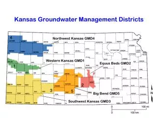
Kansas Groundwater Management Districts
140 likes | 377 Vues
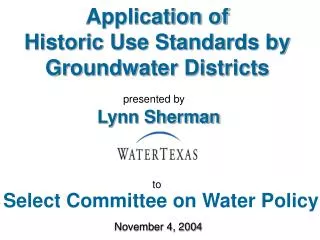
Kansas Groundwater Management Districts. Northwest Kansas GMD4. Western Kansas GMD1. Equus Beds GMD2. Big Bend GMD5. Southwest Kansas GMD3. EQUUS BEDS GROUNDWATER MANAGEMENT DISTRICT NO. 2 Total Reported Groundwater Use, 1992-2012. Average Water-Level Decline Jan 2011-Jan 2012 : 3.2 feet.

Kansas Groundwater Management Districts
E N D
Presentation Transcript
Kansas Groundwater Management Districts Northwest Kansas GMD4 Western Kansas GMD1 Equus Beds GMD2 Big Bend GMD5 Southwest Kansas GMD3
EQUUS BEDS GROUNDWATER MANAGEMENT DISTRICT NO. 2Total Reported Groundwater Use, 1992-2012
Average Water-Level Decline Jan 2011-Jan 2012 : 3.2 feet Average Water-Level Decline Jan 2012-Jan 2013 : 1.8 feet
Enhanced Well Spacing & Application Review Suspension Area Applications filed on or after October 10, 2012 suspended for processing until October 12, 2014. Change in PD applications moving more than 300 feet or increasing number of wells also suspended
Drought Impacts Cheney Reservoir
LITTLE ARKANSAS RIVER – JULY 30, 2013 ~7,500 CFS
LITTLE ARKANSAS RIVER – JULY 30, 2013 ~7,500 CFS Flow Rate equal to 4,200 center pivots operating at 800 GPM!
District ActivitiesSpecial Projects • AGRICULTURE WATER ENHANCEMENT PROGRAM - AWEP • AWEP Proposal approved in 2010 • Five year program – Partnership with NRCS • $3.71 Million obligated in 2010 -2013 • ~2955 acres converted from flood to center pivot • ~3664 acres converted to sub-surface drip irrigation
WATER METERING • WATER METERING • Modifications to the District’s water metering regulations approved by the Chief Engineer, DWR in 2011 • Modifications require all non-domestic wells not equipped with a water meter as of December 31, 2010, to be equipped with a water meter according to the following schedule:
WATER METERING • WATER METERING • All non-domestic wells in the Northeast quarter of every section in the District by December 31, 2012 • All non-domestic wells in the Southeast quarter of every section in the District by December 31, 2013 • All non-domestic wells in the Southwest quarter of every section in the District by December 31, 2014 • All non-domestic wells in the Northwest quarter of every section in the District by December 31, 2015
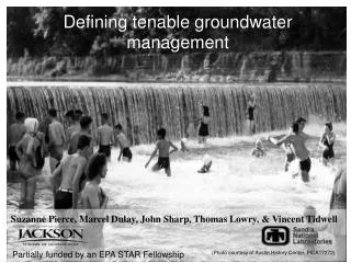
GMD2 PROPOSED EXPANSION AREAS Area 2 Area 1 Area 4 Area 3