Muddy Brook vs. Alder Brook
200 likes | 393 Vues
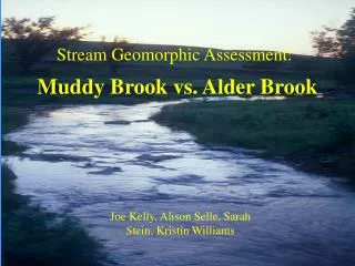
Muddy Brook vs. Alder Brook. Stream Geomorphic Assessment:. Joe Kelly, Alison Selle, Sarah Stein, Kristin Williams. Project Description. Chose Alder Brook as attainment stream Similar watershed characteristics Similar land use history Paired outlet, middle, and upstream reaches

Muddy Brook vs. Alder Brook
E N D
Presentation Transcript
Muddy Brook vs. Alder Brook Stream Geomorphic Assessment: Joe Kelly, Alison Selle, Sarah Stein, Kristin Williams
Project Description • Chose Alder Brook as attainment stream • Similar watershed characteristics • Similar land use history • Paired outlet, middle, and upstream reaches • Evaluate stream condition within the stream and between paired reaches
Site Description Muddy Brook Alder Brook
Muddy Starts at Shelburne Pond Unconfined land Relatively undeveloped Agriculture on adjacent land Wetlands Grass/shrub buffer, one forested area Reach 3 • Alder Brook • Spring fed • Unconfined land • Relatively undeveloped • Narrow grass/shrub buffer on right bank, forested on left bank
Muddy Brook Wide riparian buffer, dense shrub area, also forest area High beaver activity Relatively high residential development in watershed Alder Brook Some beaver activity Pasture land and some residential development Grass/shrub buffer Reach 2
Muddy Brook Enters into Allen Brook Relatively high urban development in watershed Agriculture on adjacent land Grass buffer, with forested area near airport Alder Brook Enters into Winooski River Agriculture on adjacent land Route 117: culvert, highly trafficked Grass buffer near road, shrub/forested buffer upstream Reach 1
Methods • Study of site through orthophotos and Terrain Navigator • Windshield survey for both streams conducted • Further on site field surveys conducted for both streams • Data compiled into the ACCESS database • Conversations with Dr. Breck Bowden • Data compiled and resulting graphs analyzed
Conclusions • Alder Brook scored as “Good” for Phase 1, RGA and RHA • Muddy Brook scored as “Fair” for Phase 1, RGA and RHA • High correlation between RGA and RHA • Reach-to-reach comparisons showed varying conditions - Both impacted by urban and agricultural development in the lower reach, though Alder actually scored lower • Impairment in Muddy Brook could be partially caused by development adjacent to reaches not included in the study • Flow alteration is likely occurring in the middle and lower reach of Muddy Brook as well as the lower reach of Alder Brook
Recommendations for Improvement • Larger riparian buffers with higher quality vegetation • Storm water management practices • Zoning regulations • Enforcement of BMPs: agriculture, golf course, residential areas
Limitations to the Study • Need more clearly defined buffer vegetation categories • Utility of Phase 1: windshield survey needed to complete ‘remote sensing’ • Historic range of variability - Muddy Brook originates from Shelburne Pond, Alder Brook originates from a spring • Applicability of Protocol with different original ‘reference’ conditions - Observations suggested that Alder would not support healthy benthic macroinvertebrates
Thank You! Source: http://www.anr.state.vt.us/dec/waterq/rivers/docs/assessmenthandbooks/rv_apxbphase1-2databaseinstr.pdf We would like to acknowledge: Dr. Breck Bowden, Alex Hackman, Carl Cappelletti, Bill Gill, Mike Kline Questions?