Download

1 / 28
280 likes | 409 Vues
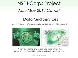
The JKL Aviation Program, led by Brian Schoettmer and supported by Dustin Garbage, specializes in advanced aviation meteorology. Utilizing the Gridded Forecast Editors (GFE) and the National Digital Forecast Database (NDFD), our team integrates various meteorological parameters tailored for Eastern Kentucky's complex topography. We ensure accurate forecasts by employing smart tools that adapt to local terrain factors, providing comprehensive aviation data like ceiling heights and visibility. Explore our services at www.weather.gov/jkl for graphical and easy-to-understand aviation forecasts.

E N D
JKL Aviation Grid Services Dusty Harbage – Aviation Program Leader Brian Schoettmer – Asst. Aviation Program Leader
NWS Grid Methodology • Various meteorological parameters are forecast by entering quantifiable values into a gridded database and shipped to the National Digital Forecast Database (NDFD)
JKL Aviation Grids • Edited using Graphical Forecast Editor (GFE) in AWIPS. • Finished product is sent to National Digital Forecast Database (NDFD) and to our website. (www.weather.gov/jkl)
Aviation Grid Editing • Edits are made using certain “smart” tools to fit the meteorological setup. Also, certain edit areas are used to define east Kentucky’s complex topography. -Ridges, Mountains, Valleys, Extreme Valleys, River Valleys, etc. • Forecast values are entered into 2.5 km X 2.5 km grid boxes.
Aviation Forecast vs. Public Forecast • Public forecast parameters include - T, Td, RH, MaxT, MinT, Wind, Wind Gust, Sky, POP, POP12, WX, QPF, Snow Amount. • Extra aviation forecast parameters include - Ceiling Height, Predominant Height, and Visibility • Public forecast parameters are populated into the aviation grids. - For example, sky cover from the public forecast is imported into the aviation grids and used to derive ceilings.
East Kentucky Terrain • How do we depict terrain differences? A common view from WFO JKL!
Visibility Grids River Valley Fog
Valley Fog… Ridges 10 SM Valleys 5 SM River Valleys 3 SM
Predominant and Ceiling Height Derivation • Consider an approaching weather system with clear skies in place. • Generally, you will have upper level clouds stream in first and slowly saturate the column. How is this depicted?
Predominant and Ceiling Height Derivation • Sky cover at a given hour.
Predominant and Ceiling Height Derivation • What the sounding might look like for an approaching system. Notice saturation of the upper levels first. SCT – BKN Clouds around 20,000 feet.
Predominant and Ceiling Height Derivation • Use model data and upstream observations to forecast predominant height of the clouds. Rain Notice the lowering cloud heights (saturating the atmospheric column) Virga
Smart Tools Used • PredHgt_fm_Sky_Lowering - great for incoming systems where cigs are gradually lowering as atmospheric column saturates.
Predominant and Ceiling Height Derivation • Once your sky cover and predominant height are determined, ceiling height can be derived using a “smart” tool that combines the two parameters. Smart tool removes sky cover less than 57% since it is not considered a ceiling.
Smart Tool Used • CigHgtFmPredHgtAndSky (ceiling height from predominant height and sky) - used to combine sky cover (cig/no cig) with predominant cloud height to determine cig height.
The Big Picture Sky Cover Grid Ceiling Height Predominant Height
JKL’s Aviation Web Page • www.weather.gov/jkl Click Here
Aviation Web Services • Point and Click TAF’s. -our 3 TAF airports are highlighted in bold. Point and click TAF’s can be obtained for any airport in the CWA with gridded data.
The Final Product • What Do Our Customers See?
The Final Product Scattered Rain Showers Lowering Cigs No Cigs Lowering Vis Due to Light Rain
The Final Product • What Do Our Customers See?
Aviation Grid Pros • More data for pilots to use for supplementing an official weather brief. • Presented in a graphical and easy-to-understand format. - Hourly weather graphs • Point and Click “TAFS” - Airports that do not have TAF’s still have a forecast. • Easy to use information at your fingertips.
Aviation Grid Cons • TEMPO weather conditions are not currently depicted in the grids. Could this be done? • How do we handle varying terrain? - Since CIGS are AGL, a smart tool is used to lower CIGS for higher terrain MSL. (MSL to AGL) - What is the proper conceptual model? How do cloud bases vary over complex terrain? (stratiform or convective)
Cons Continued… • There is concern that the public will use gridded information and not obtain an official weather brief. - NWS liability? • In the end, it is the responsibility of the pilot in command (PIC) to obtain all necessary weather information to plan a flight. - Our gridded data should be used as a supplement to an official weather brief.
Future Plans • A proposal was sent to Central Region Headquarters suggesting ceiling and visibility grids for NDFD across CR. • This will be a possibility once LAMP Guidance is available to populate in NDFD for initialization. • JKL will likely be a test site when this occurs.
Questions?...Comments? • Thank You! • Questions or comments can be e-mailed to Dustin.Harbage@noaa.gov