The Dynamic Ocean Chapter 15
The Dynamic Ocean Chapter 15. Cape Hatteras, NC. Learning Objectives. What is the force that drives the ocean’s currents? What is the basic pattern of surface currents? How do surface ocean currents influence climate? What is thermohaline circulation?


The Dynamic Ocean Chapter 15
E N D
Presentation Transcript
Learning Objectives • What is the force that drives the ocean’s currents? What is the basic pattern of surface currents? • How do surface ocean currents influence climate? • What is thermohaline circulation? • Why is the shoreline considered to be a dynamic interface? • What factors influence the height, length and period of a wave? Can you describe the motion of water within a wave?
Learning Objectives • How do waves erode? • What are some typical features produced by wave erosion and from sediment deposited by beach drift and longshore currents? • What are the local factors that influence shoreline erosion, and what are some basic responses to shoreline erosion problems? • How do emergent and submergent coasts differ in their formation and characteristic features? • How are tides produced?
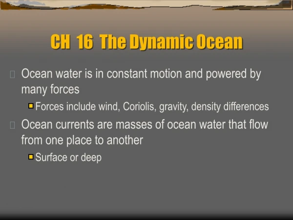
Ocean water movements • Surface circulation • Ocean currents are masses of water that flow from one place to another • Surface currents develop from friction between the ocean and the wind that blows across the surface • Huge, slowly moving gyres
Ocean water movements • Surface circulation • Five main gyres • North Pacific Gyre • South Pacific Gyre • North Atlantic Gyre • South Atlantic Gyre • Indian Ocean Gyre (mostly S. Hemisphere) • Related to atmospheric circulation • Trade winds, westerlies • Also influenced by major landmasses
Ocean water movements • Surface circulation • Deflected by the Coriolis effect • To the right in the Northern Hemisphere • To the left in the Southern Hemisphere • Four main currents generally exist within each gyre • ~6 years to make the loop in Pacific (Box 15.1) • Large central zone w/no well-defined currents • West Wind Drift is the only one that completely circles the Earth
Ocean water movements • Surface circulation • Importance of surface currents • Climate • Currents from low latitudes into higher latitudes (warm currents) transfer heat from warmer to cooler areas • As N. Atlantic Current approaches W. Europe, kit splits; part of it carries warm air to Great Britain, Norway, Iceland • Canary Current - travels south (cool)
Coriolis Effect On a non-rotating Earth, rocket would travel straight to its target. Earth rotates 15/hr so even though rocket travels in a straight line, it follows a curved line that veers to the right of the target.
Gulf Stream ~1769: Benjamin Franklin’s Gulf Stream chart Satellite image of Gulf Stream (warm – orange)
Ocean water movements • Surface circulation • Importance of surface currents • Climate • Influence of cold currents is most pronounced in the tropics or during the summer months in the middle latitudes • Cold currents travel equator, moderate climate • Aridity quite pronounced in w. South America, Africa • Lower atmosphere chilled by cold offshore water • Air is more stable, less likely to move upward and form rain clouds
Ocean water movements • Surface circulation • Importance of surface currents • Upwelling • The rising of cold water from deeper layers • Most characteristic along west coasts of continents • Coastal winds + Coriolis Effect surface water moves away from shore • Brings greater concentrations of dissolved nutrients to the ocean surface
Ocean water movements • Deep-ocean circulation • Significant vertical movement (surface circulation is mostly horizontal) • A response to density differences • Factors creating a dense mass of water • Temperature – cold water is dense • Salinity – density increases with increasing salinity • Called thermohaline circulation
Sea Ice Surrounding Antarctica When seawater freezes, salt doesn’t become part of ice; water becomes denser and sinks
Ocean water movements • Deep-ocean circulation • Most water involved in deep-ocean currents begins in high latitudes at the surface • A simplified model of ocean circulation is similar to a conveyor belt that travels from the Atlantic Ocean, through the Indian and Pacific Oceans and back again • Warm water in ocean’s upper layers flows poleward • Becomes dense and sinks • Returns to equator as cold, deep water • Eventual upwelling
The coastal zone • The land-sea boundary (interface) • Dynamic – topography, geology, climate vary greatly • Shoreline– contact between land and sea • Shore – area between lowest tidal level and highest areas affected by storm waves • Coastline – the seaward edge of the coast • Beach – accumulation of sediment along the landward margin of the ocean
Crystal Beach TX (9/16/08), 3 days after Hurricane Ike. Most of the damage was caused by a storm surge. MAP
Sanibel Island, FL: beach is made of shells, shell fragments
Green Sand Beach at Puu Mahana, Hawaii: green material is olivine sand ((Mg,Fe)2SiO4); dark gray material is basalt lithic sand.
Ocean water movements • Waves • Energy traveling along the interface between ocean and atmosphere • Can transfer energy 1000s of km • Derive their energy and motion from wind • Shape/modify shorelines that must absorb energy • Parts • Crest • Trough
Ocean water movements • Waves • Measurements of a wave • Wave height – the distance between a trough and a crest • Wavelength – the horizontal distance between successive crests (or troughs) • Wave period – the time interval for one full wave to pass a fixed position
Ocean water movements • Waves • Wave height, length, and period depend on • Wind speed • Length of time the wind blows • Fetch – the distance that the wind travels • As the wave travels, the water passes energy along by moving in a circle • Waveform moves forward • At a depth of about one-half the wavelength, the movement of water particles becomes negligible (the wave base)
Ocean water movements • Waves • Swells – waves that have traveled away from area of origination • Sea waves seen from shore are usually a mix of swells from faraway storms and waves created by local winds
Oak Island Pier, NC Pier Camera
Wave erosion • Wave erosion • Caused by • Wave impact and pressure • Breaks down rock material and supplies sand to beaches • Abrasion – sawing and grinding action of water armed with rock fragments
Sand movement on the beach • Beaches are composed of whatever material is available • Some beaches have a significant biological component • Material does not stay in one place • Wave energy moves large quantities of sand parallel and perpendicular to the shoreline
Beaches and shoreline processes • Wave refraction • Bending of a wave • Wave arrives parallel to shore • Results • Wave energy is concentrated against the sides and ends of headland • Wave erosion straightens an irregular shoreline
Beaches and shoreline processes • Longshore transport • Beach drift – sediment moves in a zigzag pattern along the beach face • Longshore current • Current in surf zone • Flows parallel to the shore • Moves substantially more sediment than beach drift
Shoreline features • Erosional features • Wave-cut cliff • Wave-cut platform • Marine terraces • Associated with headlands • Sea arch • Sea stack
Shoreline features • Depositional features • Spit – a ridge of sand extending from the land into the mouth of an adjacent bay with an end that often hooks landward • Baymouth bar – a sand bar that completely crosses a bay • Tombolo – a ridge of sand that connects an island to the mainland
Aerial view of a spit and baymouth bar along the Massachusetts coastline