This week:
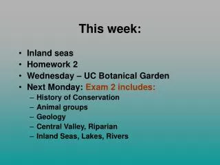
This week:. Inland seas Homework 2 Wednesday – UC Botanical Garden Next Monday: Exam 2 includes: History of Conservation Animal groups Geology Central Valley, Riparian Inland Seas, Lakes, Rivers. Inland Waters. Fresh Water a precious resource. Importance of Fresh Water areas.

This week:
E N D
Presentation Transcript
This week: • Inland seas • Homework 2 • Wednesday – UC Botanical Garden • Next Monday: Exam 2 includes: • History of Conservation • Animal groups • Geology • Central Valley, Riparian • Inland Seas, Lakes, Rivers
Fresh Waters • Surface waters run off, down hill • All area that collects water forms a water shed for a river, delta, bay • Source zone • High oxygen levels, clear water • fast moving head waters, waterfalls • Transition zone • Floodplain zone • Muddy water • Low oxygen levels
Our Watershed • Drains to Carquinez Straits
Lakes - water collects in a catch depression Lake type determine by how it formed: • Glacial • Tectonic • Landslide • Volcanic • Fluviatile • Shoreline • Terminal or Closed basin
Glacial Lakes • Glacial action- Common in Sierras • Tarns (lakes) formed by glacier action leaving low spots in bed rock- • Pater Noster- series of cirques (tarns with high vertical back wall) down a mountain • Moraine lakes- impeded by moraine. • May have a blue color due to suspended rock particles • Common on east side of Sierras • Kettles form as holes in the moraine field
Tectonic process – uplifting, and depressions in dip-slip Faults • Graben (grave) lakes • Lake Tahoe (1). Original lake formed between two blocks of stone as fault slipped down. • Livermore Valley - gravels
Volcanic Lakes • Lava flows blocks water flow • Common along faults, often form in conjunction with tectonic (as in Tahoe) • Clear lake - Dammed by lava. • Two arms fill in grabens. • Current form of Lake Tahoe (2) • Was deepened by lava flow at Truckee end. • Caldera Lake forms when a volcano blows off its summit and leaves the sunken caldera which fills with water. • Crater lake in Oregon, deepest in US. • Small surface area restrict evaporation – stays full with winter rains/snow
Landslide lakes- • Rock, Mud flow traps flow, raises water level • Mirror lake in Yosemite. Several on Kern River. • Often short lived as water digs in new channel. • Often form in narrow river canyons. • Caused by mudslides or earthquakes.
Fluviatile - From in depression formed by flowing water • Ox Bow lakes - cut off from main channel. • River Dam lakes - Sediment flowing down a tributary blocks main channel. • Kings River sediment blocked flow North up San Joaquin valley. • Tulare river flows south, formed lake Tulare.
Shoreline - • impounded by barriers of sand by wind and waves at River mouths. • maybe seasonal • Can break quickly- • a tourist drowned in San Lorenzo River - at Santa Cruz, washed out to sea. • We’ll see a small lake at Salmon Creek beach
Terminal or Closed basin • Watershed with no outlet • Dependent on inflow vs. evaporation rates • Mono Lake-Oldest lake in California • Hypersaline, accumulating solutes for thousands of years • Tufa towers form under water in bubbles in brine solution • One of most productive ecosystems • Water Diversion in Owens River • Level dropped 46 feet since 1946. • 1994 decision mandated rising lake 20 feet.
20th Century Low, January 1982 6,372 ft above sea level Beginning of Diversions, 1941 6,417 ft above sea level 20th Century High, 1919 6,428 ft above sea level Overflow Level, 100,000 years ago 7,200 ft above sea level Mono Lake Currently at 6382.3 ft.Goal: 6391 ft. in 2014
Aral Sea - disappearing • Rivers being diverted for agriculture • From 4th to 8th largest lake • (1960) 68,000 km2; (1998) 28,000 • Salinity increasing, salt blows onto fields
Created Lakes: Reservoirs • All have an estimated life span until sediments fills them in. • Block fish migrations, silt flow to flood plain • Control floods • Clean Power source
Limnology: Study of lakes • Littoral Zones: • near shore, sunlight • marsh, floating plants (macrophytes) • Lots of decomposers – marsh food chain • Limnetic Zone • Open sunlight waters, • main photosynthetic (producers) zone • Profundal Zone • Deep open water, too dark for photosynthesis • Benthic Zone • Bottom of lake inhabited by decomposers, and other animals adapted to cold, oxygen poor water: snails, worms, crayfish, catfish
Dissolved Oxygen (DO) • Oxygen needed for cell activity • Low oxygen levels limit activity of animals. • Can cause massive die offs • BOD- is biological oxygen demand • caused by organic wastes in water (pollution). • Decomposers use up oxygen in the rapid growth. • DO Sensitive to temperature, pH levels in water.
Seasonal changes in Alpine lakes • Water mixes in Fall and Spring, oxygen, nutrient levels uniform • Summer warming stratifies lakes • Water floats over cooler, forming a thermocline • Lower water is nutrient rich • Lack oxygen • Upper warmer water may run out of nutrient for photosynthesis • Winter may have insulating ice layer, forming a stratification
Lake Succession • Lakes fill-in over time. Nearly all the nutrients come from outside the lake. • e.g. Lake Yosemite filled valley after ice melted • Oligotrophic few nutrients. • Clear, bluish water little algae • high dissolved oxygen • Few fish, e.g.. Trout (small gills, easy to get oxygen) • Meso- intermediate • Eutrophic- more and higher nutrient levels • Low oxygen levels. Green color • Senescent- filled in, becoming meadow • Crane Flat in Yosemite
Eutrophic Cultural Eutrophication: human influences cause lakes to become eutrophic due to pollution, erosion. Oligotrophic
Stream / River types: (Indicated on topo maps) • Permanent- year round • Intermittent - seasonal, winter / spring flow, dry summer fall. • Interrupted- parts flow above ground, other parts below (common in Southern California) • Slough - slower moving side channel of larger creek, stream, river
Bends in the Rivers, Streams • Coriolis affect causes water to flow in an arch on a flat plain, • to the right in the Northern hemisphere, • causes streams to meander, as water curves until it reaches an uphill. • Can be seen in rivers in Central Valley • As stream erodes the channel on its outside bend, it deposits new sediments on the inside. New soil is formed. • Heavy rocks only moved in great floods, rivers carry mostly gravel, sand, silt, and clay. Clay moves the farthest.
Meanders have a distinctive structure. On the bend of a river, the water rushes to the outside of a bend. This photograph shows the inside, known as a slip-off slope. This is a small area of deposition and creates a gentle slope.
Rivers transport erosion debris • Deforestation adds to erosion, and sediment loads in rivers • Add to near shore pollution, nutrient loads in oceans
Everglades • Fifty miles (80 km) wide in places, one to three feet (0.3 to 0.9 meters) deep in the slough's center but only 6 inches (15 cm) deep elsewhere, it flowed south 100 feet (30 meters) per day • Water diversion started killing off this vast marsh lands • Largest restoration project ever attempted started in 1996. • National Parks are not islands- they still can be influenced by development outside their boundaries.
Water Diversion in California • “Water wars” • North- most of water • South most of the population • Agriculture uses the most • Cities cut back the most in droughts • Population continues to grow • Recycling water can save millions of gallons • Wildlife loose outdown stream